Good afternoon, everyone. A little bit of light snow and flurry action is set to move into the region for the next few days. This may even put down light accumulations for some, especially across the mountains of southeastern Kentucky. The pattern after this relaxes a bit before cranking up again by the weekend.
Two upper level systems will spin in from the northwest through Tuesday morning. The first arrives tonight and Monday morning and will spit out a bit of rain and snow later this evening. Overnight, we will likely see a period of light snow develop, with the greatest concentration across the southeast. Pockets of light snow and flurries will then show up for the rest of the region and that’s likely to continue into Tuesday morning.
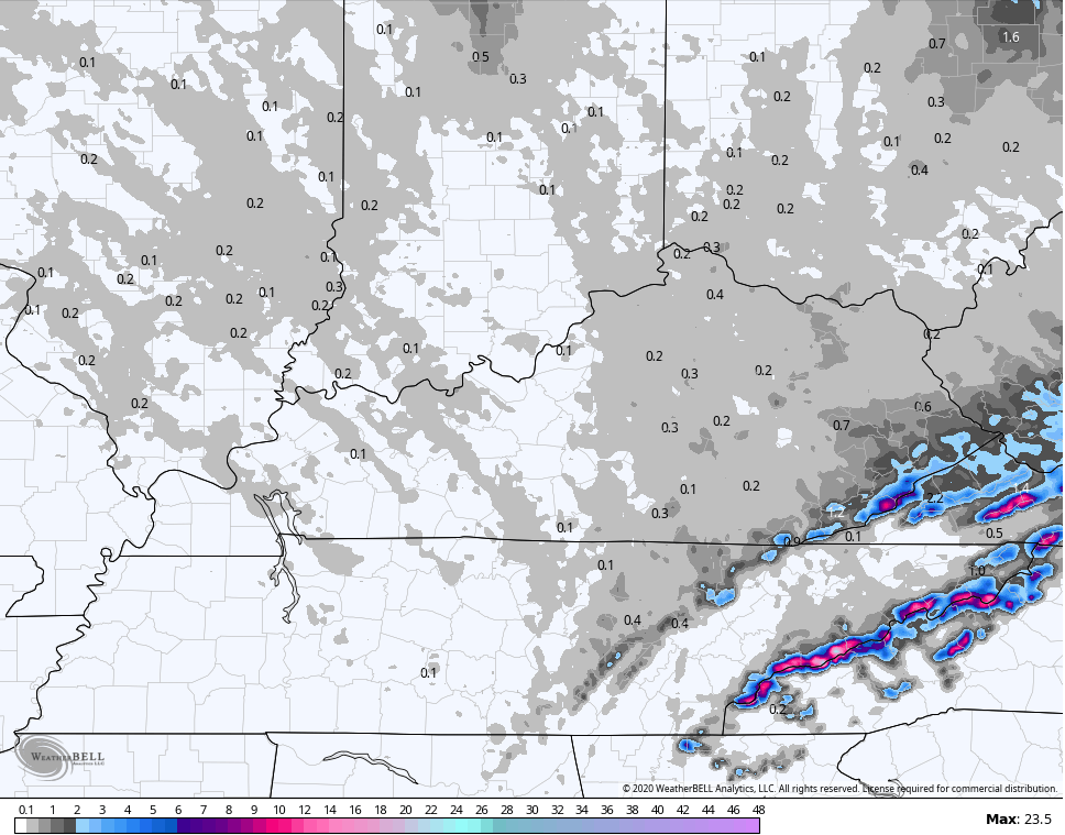
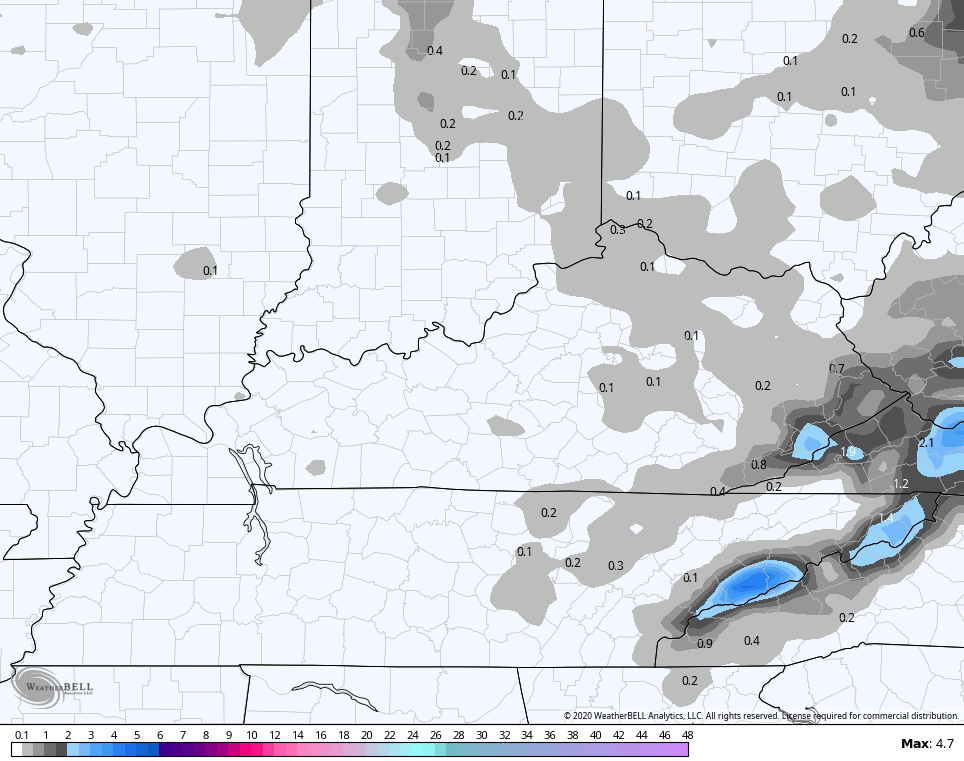
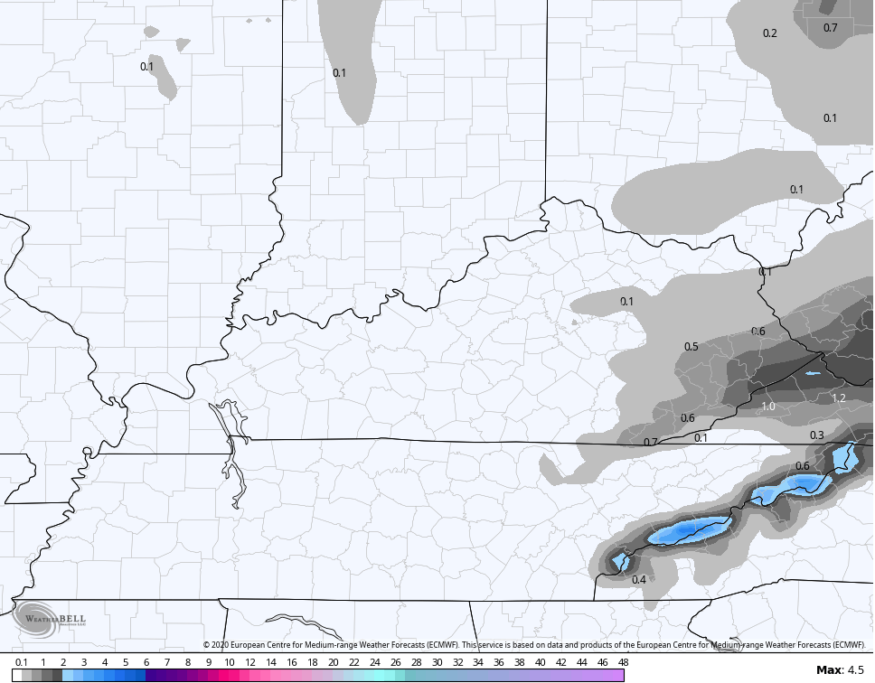
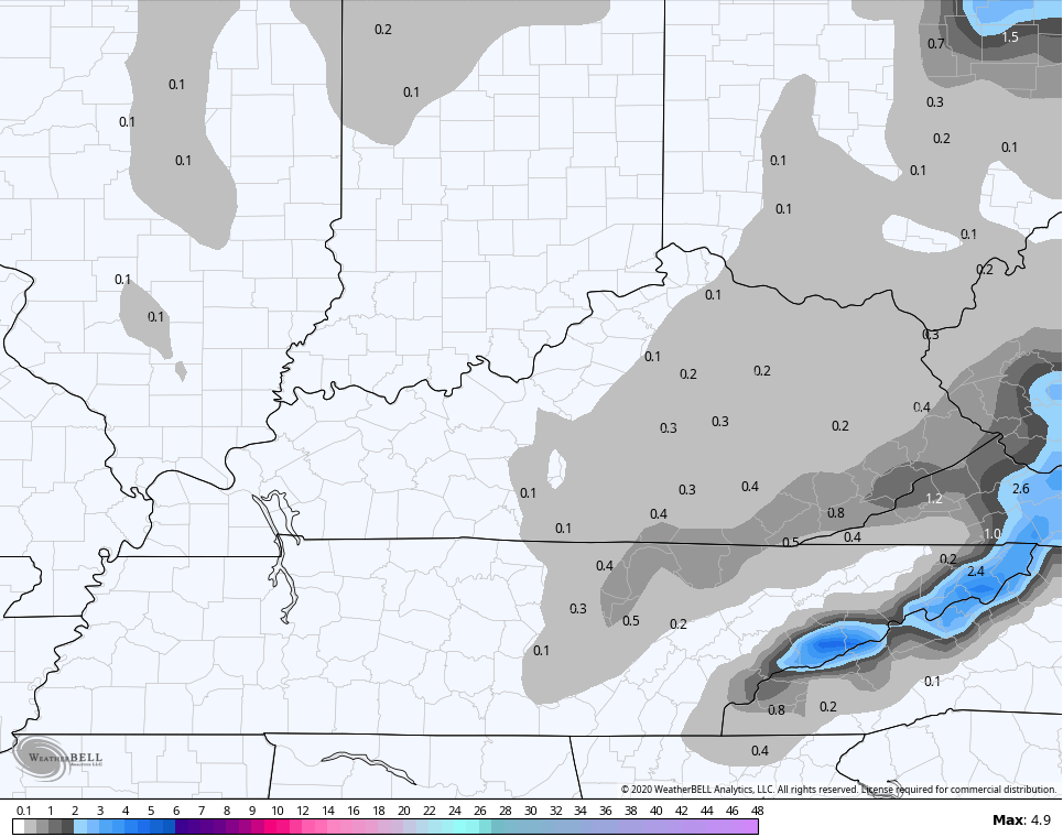
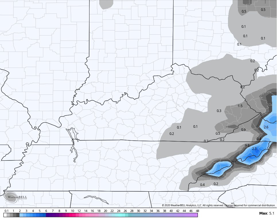
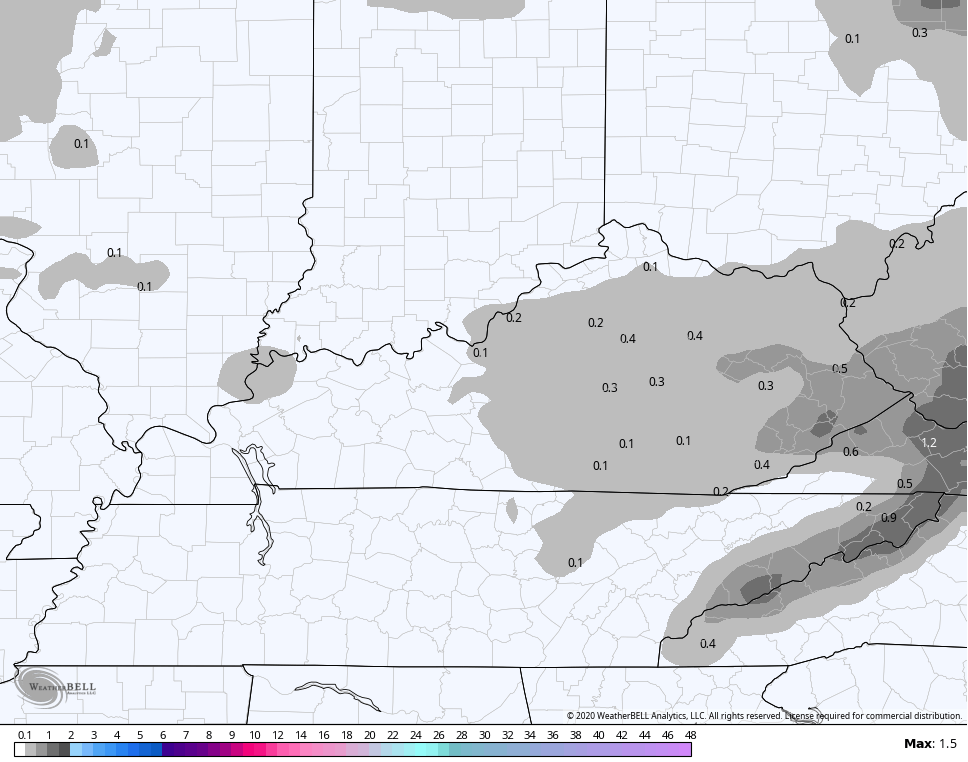
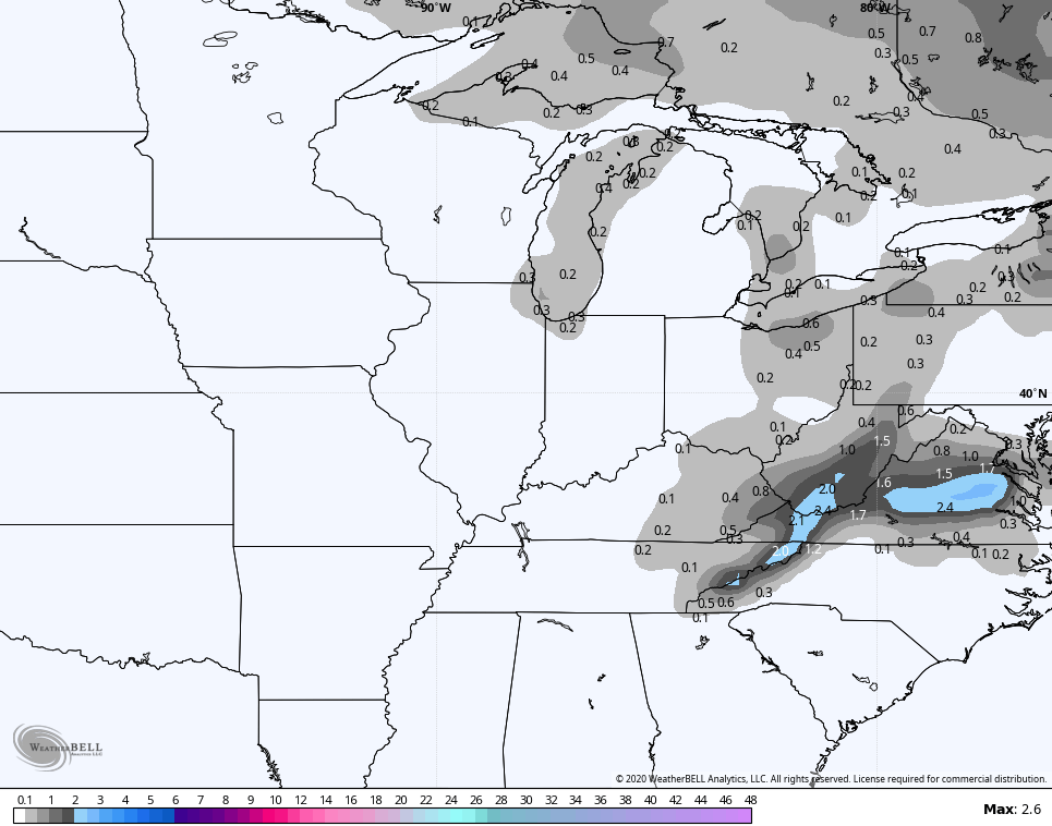
The models like the snow potential in the southeast…
Hi Res NAM
NAM
EURO
CANADIAN
GFS
SREF
GFS ENSEMBLES
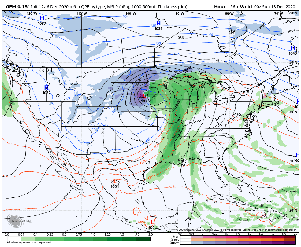
Temps behind this do come up for the second half of the week, but a powerful storm system arrives next weekend with wind and rain ahead of it and winter crashing back in behind it…
I will have another update this evening, so check back. I leave you with your radars to track any drops or flakes that develop…

Have a good one and take care.
