Good Tuesday, everyone. It’s another below normal day, but milder air is ready to surge in here for the rest of the week. If you’re a fan of the cold and winter chances, hang tough, things go back the other day this weekend. That’s when a storm system drags a strong cold front through the region, unleashing another colder, and potentially, wintry pattern.
Before we get into the future, let’s look back at a much colder than normal first week of December…
This is Lexington's coldest first week of December since 2010. The average temp of 33.1 is 6.1 degrees colder than normal for the opening week of the month. #kywx
— Chris Bailey (@Kentuckyweather) December 8, 2020
It was also Lexington’s snowiest first week of December since 2010.
The second week of the month starts with temps below normal again out there today. Clouds and sun will do a little dance and there’s still the chance for a few flakes to show up across the east…

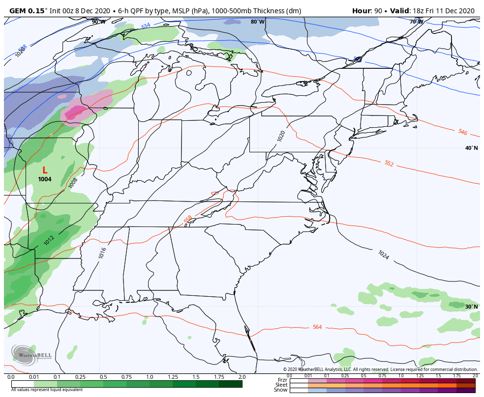
Gusty winds push in later tonight and Wednesday as temps start to climb. Highs will be in the 50s on Wednesday and deep into the 50s to near 60 for Thursday and Friday. That’s when a southwest flow kicks in ahead of our strong storm system and cold front moving in on Saturday.
This storm looks to bring gusty winds and heavy rain ahead of it. Does this front slow down and allow for a wave of low pressure to develop along it and bring an increased threat of winter weather late in the weekend? That’s an idea I’m leaving open and it does have the Canadian rolling with it…
The EURO has the second system, but it’s dragging it to our south and east…
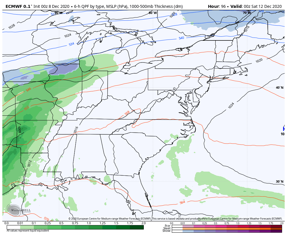
That could be a product of the model holding on to southwestern energy too long.
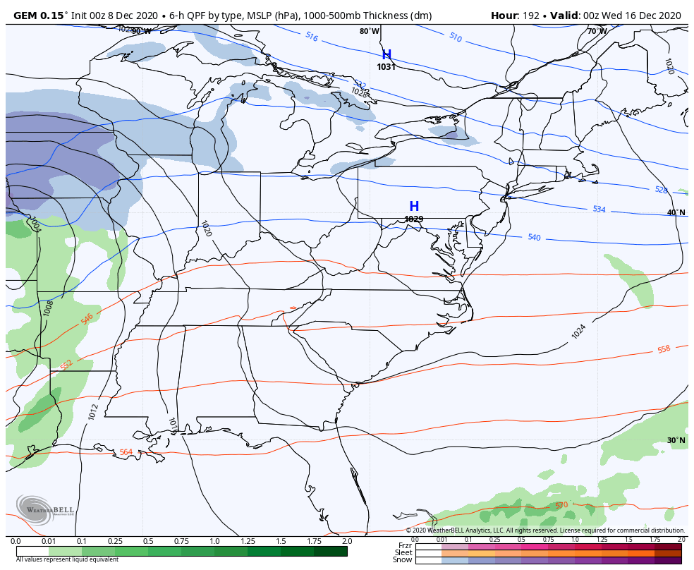
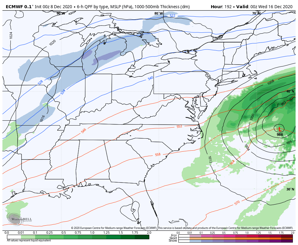
That’s something to watch for and so is the storm system coming behind it by the middle of the week…
CANADIAN
EURO
This is a pattern that’s likely to throw several systems at us from southwest to northeast through the rest of the month. What type of weather they bring will depend on the track, but this pattern continues to be vastly different from last December or the past several Decembers.
Yesterday, I gave you all some thoughts on the upcoming setup and the various indices contradicting one another. I’ve also talked about how the Ensembles have struggled all year and have been biased way, way too warm. They haven’t been catching the colder setups very well at all. The new run of the EURO Weeklies decided to go drastically different from prior runs for Christmas…
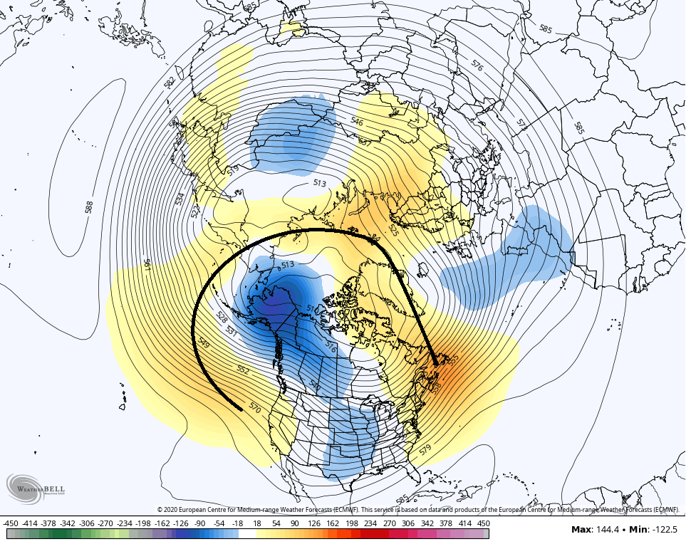
That’s showing a very interesting blocking look which takes some of the trough from near Alaska and sends it into the lower 48.
I will have your normal updates later today. Have a good one and take care.

It’s been even colder in Lexington the first seven days in December than it has been in Chicago! The average temp for Chicago’s O’Hare Airport for the first seven days of this month has been 35.4 degrees (compared to 33.1 degrees in Lexington), which is 3.9 degrees above normal.
That major cold snap that the computer models were predicting last week for much of the middle part of the country during the week of December 14th – 20th now looks like it’s only going to be a modest cool down. According to the 8 to 14 day outlook that was shown Sunday night on a local TV weather segment here, temps are forecast to average above normal for much of the Midwest during that time, including Chicago.
If you want to look for cold and snow check out Siberia and Canada.
Anniversary of a real old fashion Winter, which occurred on this date December 8th,1917 : https://www.weather.gov/lmk/december_1917_january_1918
I remember my Aunt telling me about this Blizzard and had news paper photos of all the 10 to 15 foot snow drifts that occurred on main street in Washington, Indiana.
Euro taking it up a notch.LOL.Middle of the month is looking somewhat intriguing so who knows..
https://www.pivotalweather.com/model.php?m=ecmwf_full&p=sn10_acc&rh=2020120812&fh=168&r=us_ov&dpdt=&mc=
The euro has been horrible so I wouldn’t believe anything it shows beyond 3 to 4 days out.
How can the models be right when the satellites are showing clouds and I guess cold air pouring out of Canada can any one answer that?