Good evening, folks. We continue to watch a fairly interesting situation showing up as heavy rain and winter weather increase from southwest to northeast. The potential continues to be for this to end with a period of heavy, wet snow late tonight and early Monday in parts of the area.
REMINDER: The KWC server gets upgraded Monday, so some slow times and down times will be noted until that’s complete.🖥💰
I’m going to ride my snow forecast until I see the late evening runs then will make any changes if need be (could be upping totals for some)…

The late day runs of the models are more emphatic on a switchover to snow. The EURO is fairly robust and matches my map from above, but it does have higher totals…

The HRRR isn’t as far northwest with the accumulating snow shield, but it continues to go nuts on the southeast…
That’s likely overdone, but that would be a major thumper.
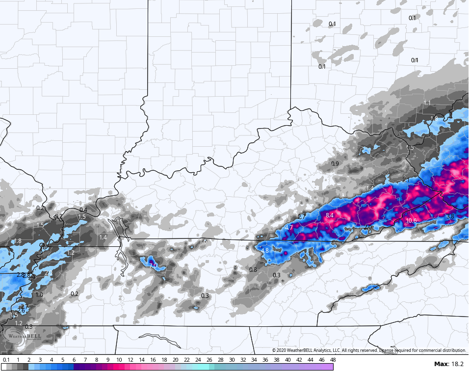
Here are your radars to follow along…

The radar as of this writing has “the look” of this ending with heavy snow for some and wouldn’t take much for this to really ramp up. This will be a long night of nowcasting, so fire up your twitter machines with me. Sleep is for the weather weak and y’all know that ain’t me! 💪😤
The next system rolls in here quickly for Tuesday night and Wednesday. This is likely to become a messy setup with snow, rain, sleet and some freezing rain. This is my very early look at how this may play out…
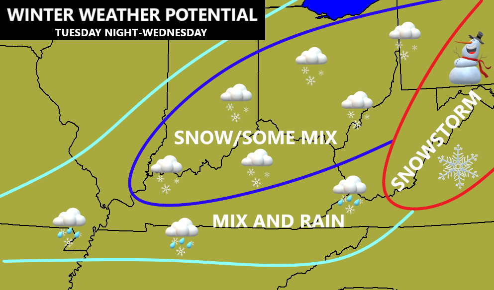
As of now, this looks like a widespread high-end Advisory type event.
In looking much farther down the weather road, the GFS Extended has a nice look for snow and cold lovers. This is the 30 day 500mb height anomalies through the middle of January…
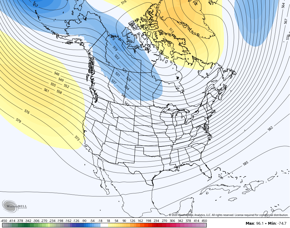
The control run for the same time is more emphatic on a mean trough in our region…
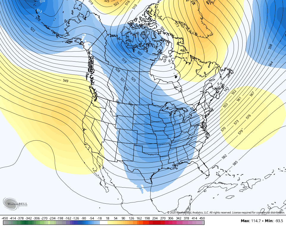
The CFS Seasonal Model for the exact same time period…
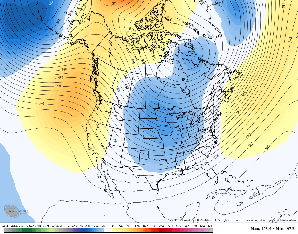
For 30 day averages, those are pretty stout.
I will update KWC as needed through the rest of the evening then have the main overnight update. Have a good one and take care.

drink coffee
This reminds me of a system 20 some odds year’s ago or maybe longer.WYMT had just started up and Jeff Noble was the weatherman.His forecast was for a couple of inches in the higher elevations.Well it started snowing around 9:00 pm that night with snowflakes the size of half dollars.Talkabout a death band.Went to bed and was awakened with flashes of blue and no electric.Had at least 10 inches of hard paste with no electric for over a week.The next day you could tell Jeff was dreading being on the air.Hopefully this system will overachieve like that one.
I think I’m a bit too far north for snow flakes..but then again, one morning in early March a heavy band of rain changed to a nice 7″ of heavy, wet thumping snow right over top of me, so I discount nothing. It’s 2020. 😉
March, a couple years ago. Either 2017 or 2018.