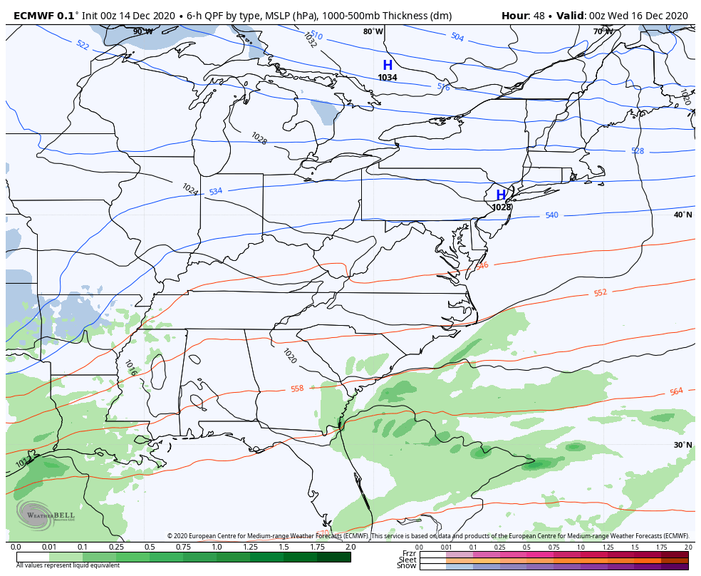
Good afternoon, folks. We continue to track two winter weather makers toward the bluegrass state from tonight through Wednesday. The first is set to bring rain that changes to a swath of wet snow, largely impacting southern and southeastern Kentucky. The next system arriving Tuesday is likely to have a more widespread impact.
KWC servers will be undergoing an upgrade later tonight and Monday, so some slow or down times may show up. Spread the word.
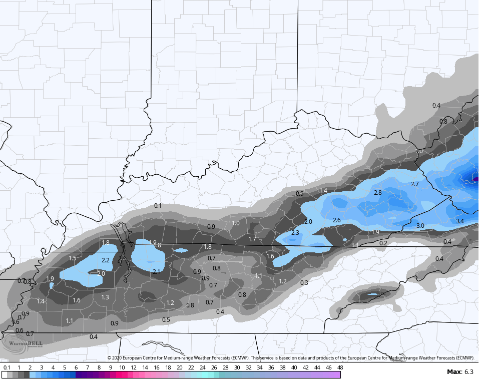
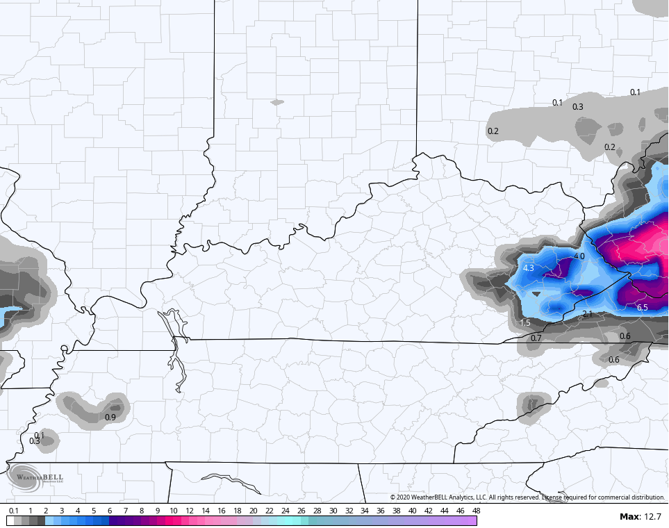
Let’s get this rain and snow party started by saying I really have no changes to my thought process from earlier. If you missed what that is, go back a post an ingest it all. This means I’m sticking with my First Call For Snowfall map…

I will likely freshen that up later today.
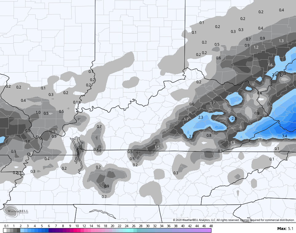
The most consistent forecast model continues to be the European…
The SREF is heading toward the EURO…
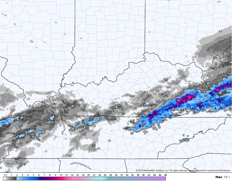
The HRRR only goes through 6am Monday and continues to be the most aggressive…
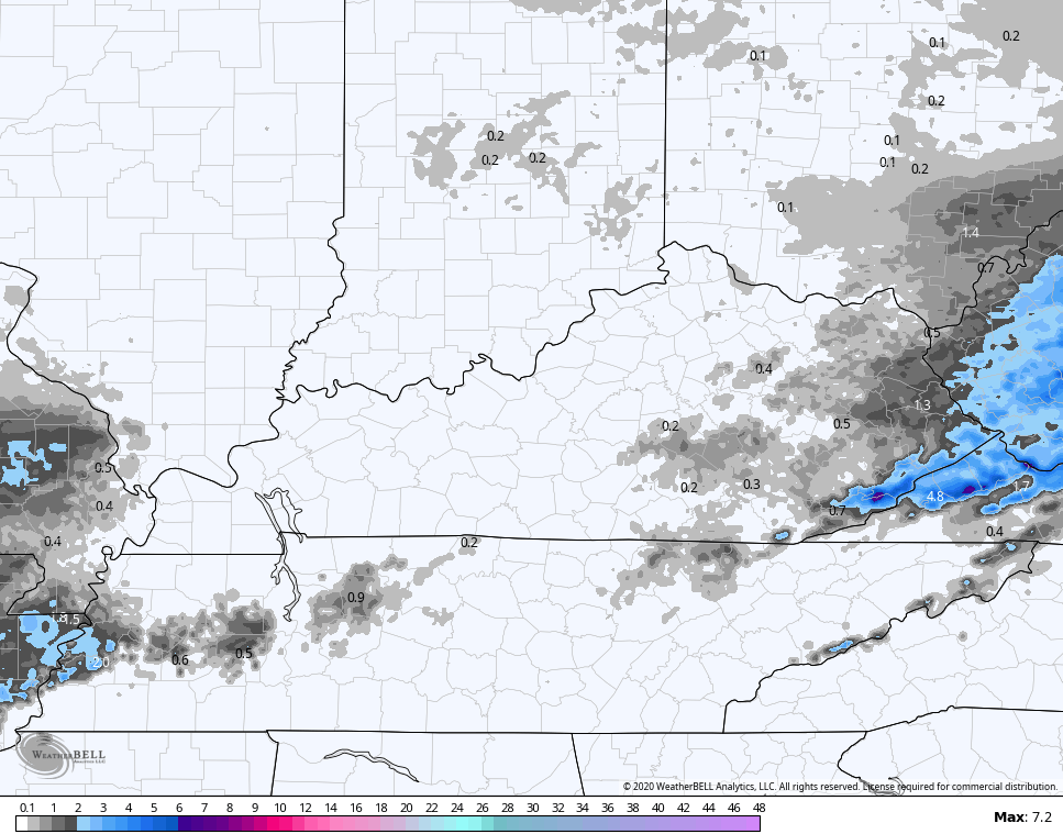
The NAM Fam is showing some wild swings from run to run…
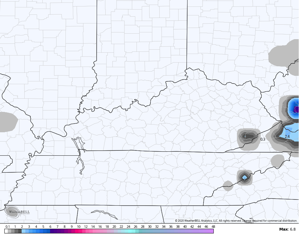
HI RES NAM
NAM
The GFS is consistent in never showing any kind of dynamic cooling…
The Canadian looks weird with all the flake action north of the Ohio River…
Again, this will be interesting to see how it all works out and it will be fun to nowcast the rain as it changes to snow for some.
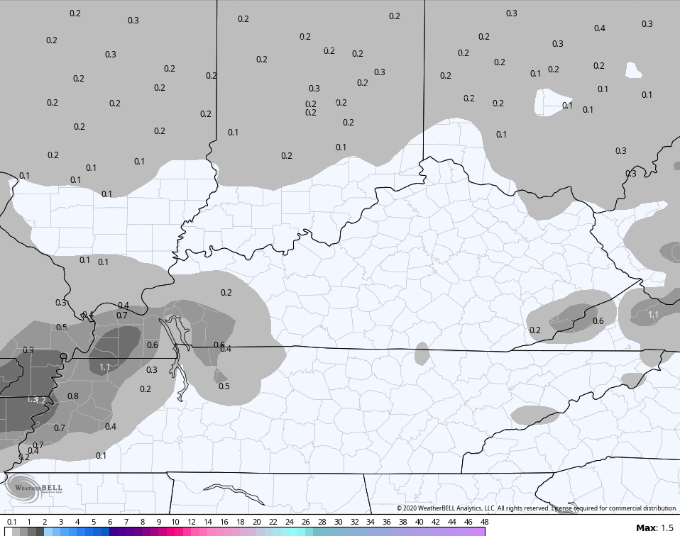
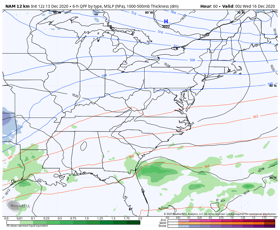
The next system continues to look like a messy one Tuesday night through Thursday morning. Snow, rain and a touch of sleet and freezing rain will be possible. The NAM goes through 7pm Wednesday…
The EURO…
 CANADIAN
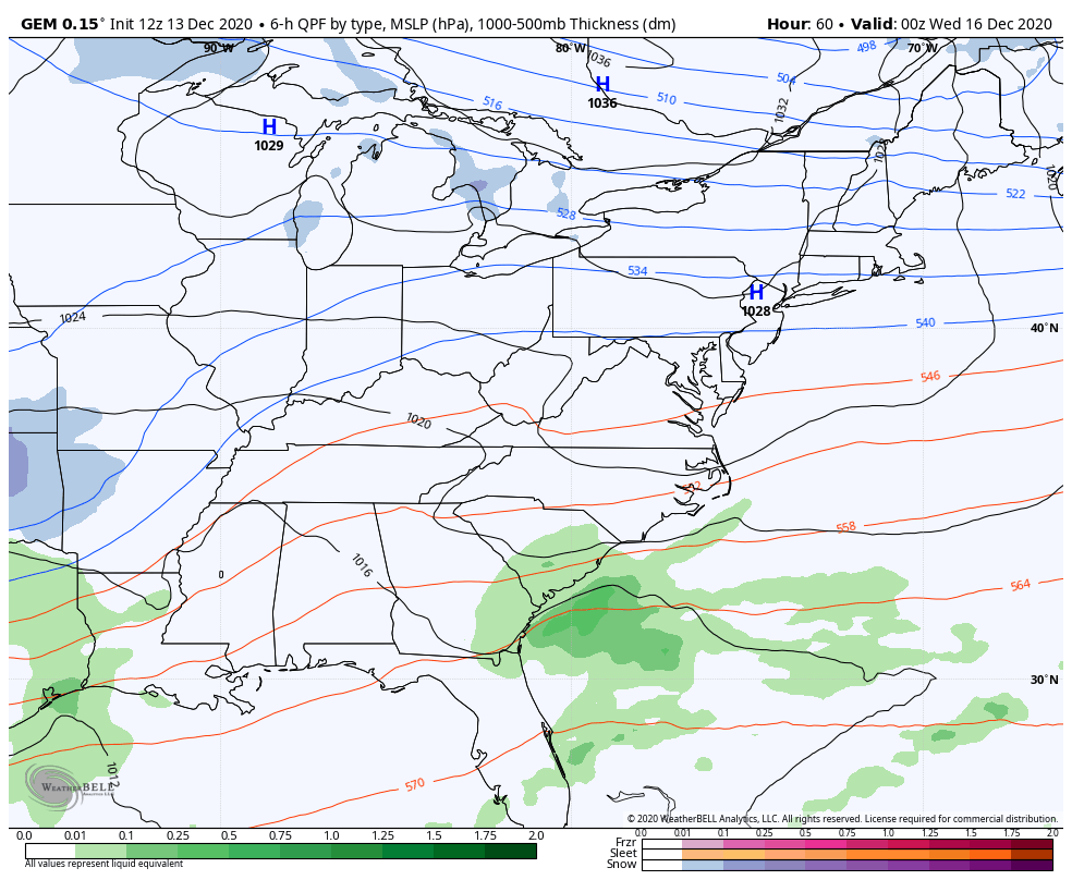
At first blush, this has the look of a 2″-4″ snow for parts of the state, possibly focusing on the northern half of the Commonwealth. Again, that’s a very rough estimate from a few days out, but this is what those kinds of setups typically produce. The final determining factor will be the track and strength of the lead low into the lower Ohio Valley/Tennessee Valley.
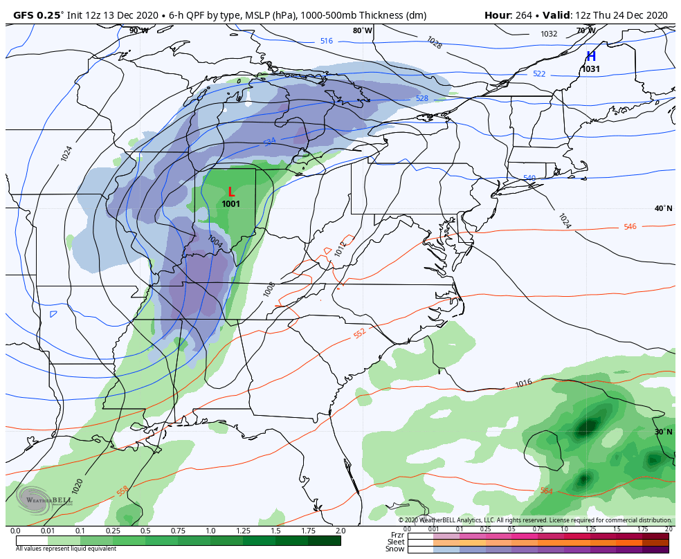
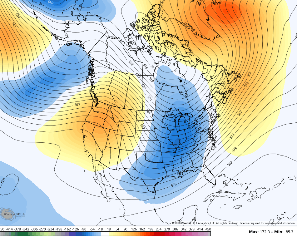
By the way, that’s a monster snowstorm along and east of the Appalachian Mountains. The trolling weather folks in the east who’ve been doing nothing but screaming no snow and torch for December are in for a rude awakening.
Back here in the bluegrass state, another borderline rain/snow system shows up by next weekend.
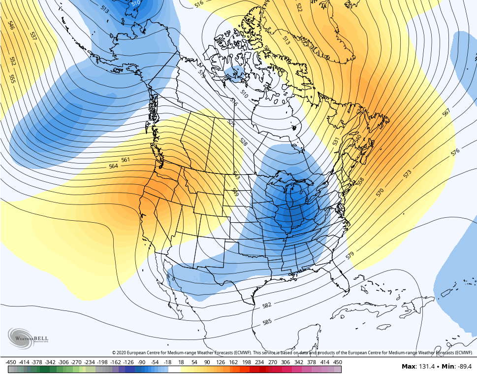
The look for Christmas week continues to be one with a trough digging into the region sometime around Christmas. That could promote a storm system with cold air to work with. If these same weather trolls can show “torch” maps for Christmas, the rest of us can then show Christmas maps like this…
Isn’t that how this works? 🙂
Oh yeah… The GFS Ensembles and EURO Ensembles both agree on a deepening trough right on top of us by Christmas…
I will have another update this evening, so check back. Until then, here are your radars to track the rain and mix toward western Kentucky…

Have a great rest of your Sunday and take care.

Welp, I’m going to go with a little ice storm for my area Wednesday. LOL. Whenever we’re on the fence, everyone around me gets a nice deep snowfall and I’m trying to figure out how to make myself and the dogs stand up on the deck when I let them out! 😀 I’ll hold out big-time for that Christmas one! Wouldn’t that be the most awesome way to end a year like we’ve all had??! 🙂
Not here either Debbie. In the past 12 years, Taylor county has only received two good snows, but they were late.
Worst ice storm was in 2009. No power in my house for 15 days. Hope that doesn’t happen ever again !
I read today that the moderate La Nina is expected to weaken rapidly starting in January and going into spring.
So maybe we will have a back loaded Winter ?
Yes, Shroeder, the ice storm in ’09 was bad for a lot of people, but we never did lose power here in Bardstown(which was odd, because we always did before, since at that time, the main transformer for our street was swallowed up by big trees in my backyard…lol!) Christmas ’04 was awful. IWe had ice while everyone around us had about a foot of snow….Got power back just in time to cook Christmas meal. I really want, need, HAVE TO HAVE some worthwhile snow this year!
The Canadian Model looks like our best hope.
The Louisville & Nelson county area might max out at couple inches.
I’m in Nelson, and nope, I ain’t a-countin’ on it! 🙂 Maybe the mid-week thing might hit just right, but I’m going to be the proverbial “Debbie-Downer” because I’ve been around long enough to see what these things do. Just saying….? But I’m hopeful. I’m always hopeful.
Yes I was speaking about Wed. I have already thrown out the rain bucket for tonight.
Hate to be a negative nancy but WKY has yet to see any accumulating snow at all.
Thanks Chris, I hope the rain to our west is reaching the ground and may we receive at least an inch or better. We need it as soil moisture is getting low for this time of year in my county of Taylor.
Forecasting snowstorms in the Ohio Valley is next to impossible. Most of the snows of the past were surprises.
Christmas 2004 was my best as there was 22 inches of snow on the ground and everyone made it home with no problems.
Guess one can hope or pray it’s right.Really a shame all the moisture and nothing but rain..
https://www.pivotalweather.com/model.php?m=hrrr&p=sn10_acc&rh=2020121318&fh=21&r=us_ov&dpdt=&mc=