Good Sunday, folks. Our developing storm system continues to come in better focus and the trend toward more of a snow look is showing up tonight and early Monday. This fast-moving system may create its own cold air for a period of heavy, wet snow for parts of the state. This is the first of two winter weather makers I’m tracking over the next few days.
Here are some thoughts on what we are dealing with:
- This is a big time moisture producer as it moves quickly across the region.
- Temperatures are marginal for snow, but heavy rain moving in will eventually pull down much colder air overnight. This dynamic cooling process is something we saw very well in central Kentucky a few weeks ago. The heavier the rain, the better the chance for snow. I know that sounds weird, but it’s how these situations work.
- Given the amount of moisture, this could very well be a heavy, wet snow setting up for some. Snowfall rates easily overcome ground temps that are marginal for accumulation.
- How much accumulation any one location gets is tricky as we have a lot of variables to take into consideration. The bust potential actually goes both ways with this one. 🤬
- The main questions in terms of snow fall go like this: Where does the heaviest band set up? How far north and west will the potential for accumulations go? How long does it take for the rain to switch to snow?
Given what I’ve seen from the latest model trends, here’s my First Call For Snowfall…

Keep in mind, this is an initial forecast and not the final product. That may be a work in progress right on through the overnight. Also, this is likely to be a slushy snow that mostly sticks to grassy and elevated surfaces. Still, it can easily accumulate on roads in the heavier bands for a time in the southeast.
If you want to see what dynamic cooling looks like. Check out these future radars. Notice how the heavy rain sets in then all of a sudden… boom… snow takes over…
HI RES NAM
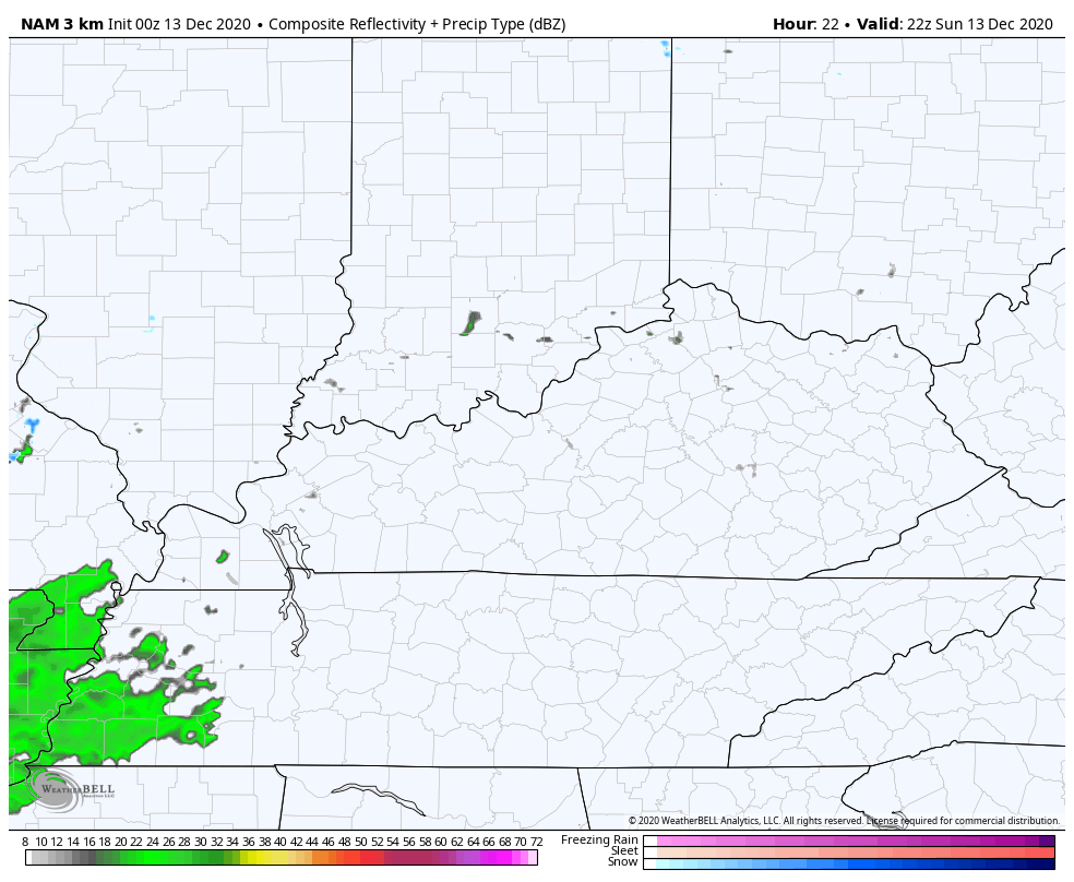
The HRRR is spot on to that…

THE FOLLOWING ARE ONLY COMPUTER MODEL FORECAST MAPS. THESE CHANGE FROM RUN TO RUN.
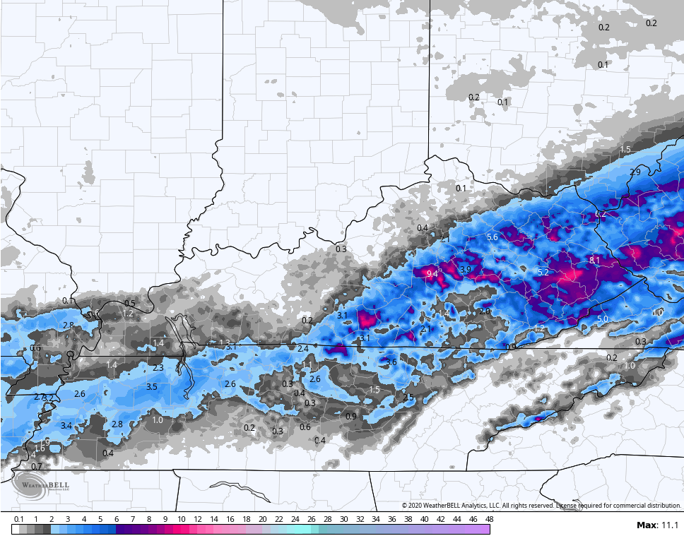
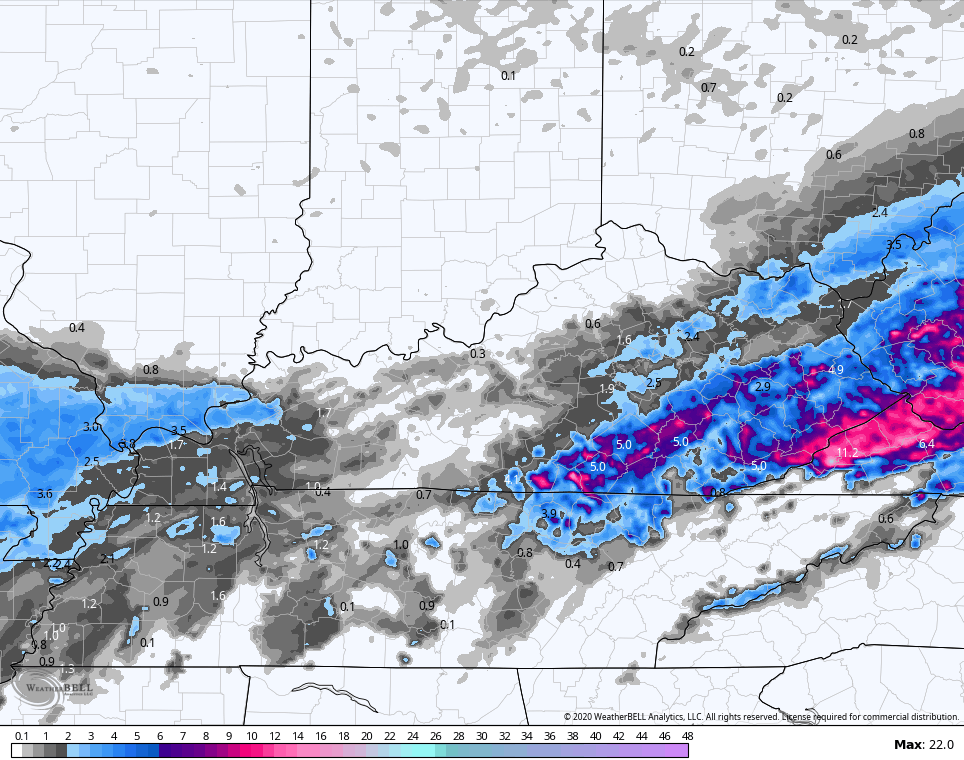
Here are the snow maps from those particular runs…
HI RES NAM
HRRR
The NAM actually is very similar…
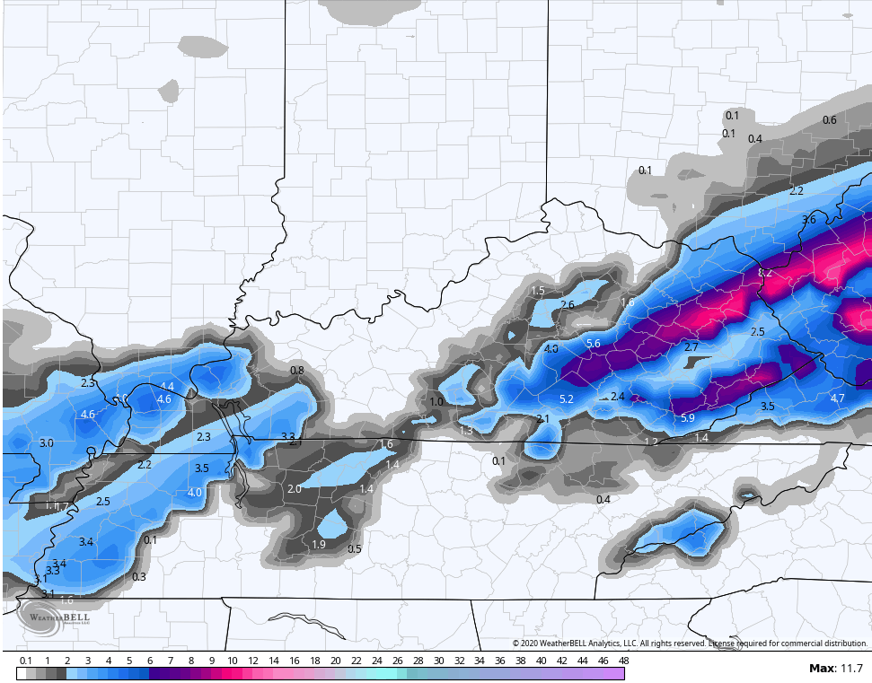
The EURO has been much more consistent and is likely more realistic…

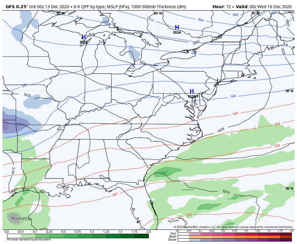
On the opposite end of the spectrum is the GFS. The GFS failed miserably during the last dynamic cooling situation a few weeks back and literally never said it was snowing, even as it was snowing in many areas. Here’s what the GFS shows…

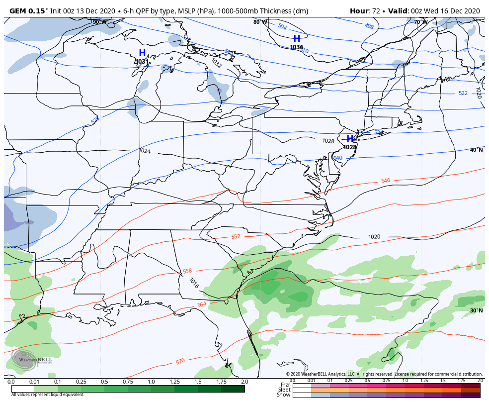
Regardless of what happens with this system, we have no time to waste before the next one is rolling in. This arrives by Tuesday night and may take us through early Thursday. One area of low pressure works into the lower Ohio Valley or Tennessee Valley before a stronger low takes over east of the Appalachian Mountains. Where this first low winds up will be the determining factor between what kind of precipitation any one location gets. As of now, I fully expect our region to be getting snow, rain and a touch of freezing rain/sleet.
The NAM only goes through 7am Wednesday, but shows a healthier lead low that’s actually only gets into east Tennessee, bringing better threat for snow and winter weather…

The EURO continues to bring a little of everything into the region…
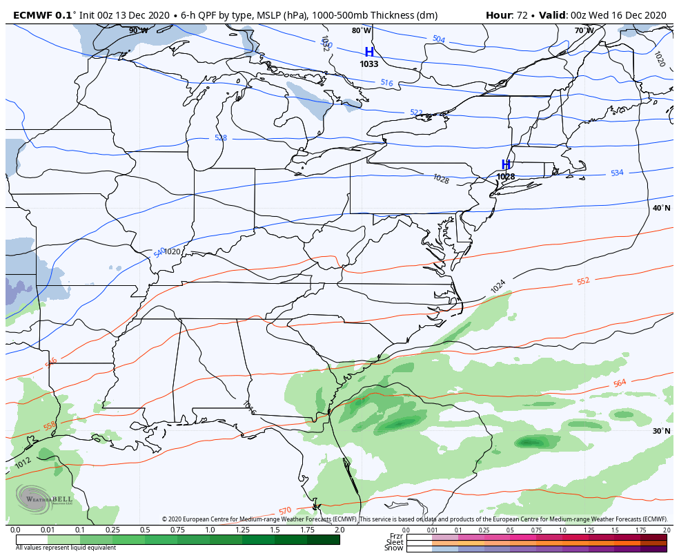
The Canadian…
Just like with every winter system in the east, the GFS has issues. It has way too many lows and is most progressive and flat with the storm in the east. I’m gonna keep pounding this model bias down the throats of weather lovers until the entire weather world notices. 🙂
This is going to be a major snowstorm across areas of the Appalachian Mountains to the big cities of the east coast.
I will have additional updates/upgrades coming your way later today, so check back.
Have a good one and take care.

Looks like Warren County’s snow chances are zilch…as usual!
I have already given up on Sundays system.
After not receiving any measurable precipitation for 16 days in a row, the Chicago area was hit with a deluge Friday afternoon into Saturday morning. The cold, heavy rain produced 1.67 inches of rain at Chicago’s O’Hare Airport and 1.50 inches at the NWS forecast office in the SW suburbs. Only a trace of snow occurred on the backside of the system, as the major snow drought here continues.
We’re going to miss out on the active weather this week, with the two systems staying well to the south of the Chicago area. No measurable snow is predicted for the Chicago area for at least the next week. The temperature so far this month here is averaging 6.6 degrees per day above normal.
So here we are approaching mid-December, and many cities in Kentucky have had more snow this season than the paltry 0.7 inches that has occurred at O’Hare Airport (1.5 inches in the SW suburbs). I would have thought that would be as likely to happen as the Kentucky basketball team starting out 1-4! And it sure looks like you guys will be adding on to your snowfall totals this week.
Mike at least you had a good rain. We are going well below normal here in south central Kentucky, but there is a 90% chance of rain tonight.
Snow will form well east of my area of Kentucky, but I think it will be more of a rain maker than snow ?
So far we only recorded 1 inch of snow for the month, which fell at the beginning of December.
Still waiting for the Polar Low to weaken and the subtropical jet to become stronger and the southeast ridge to move east out into the Atlantic.