Good evening, folks. A light winter weather maker and rain continues to roll at us from the southwest, arriving overnight into early Wednesday. The greatest impact continues to be across the northern half of the state.
I have no changes to the map I put out earlier…
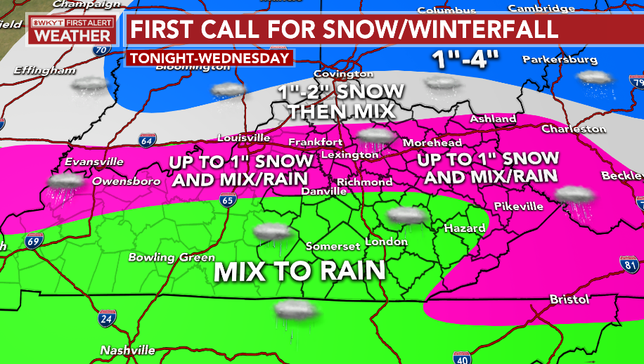
This is a very light event, but the timing on this will cause some travel issues from the Bluegrass region, north and west. The Lexington, Louisville and Cincy metros are included in this. Some pockets of freezing rain will also be noted and some of that will impact the cold valleys in the east.
I’m surprised there isn’t a Winter Weather Advisory for this across the north, especially. The timing will impact the morning commute.
Even the areas getting in on the mix and or snow will likely even see some cold rain as the day wears on with temps inching above freezing.
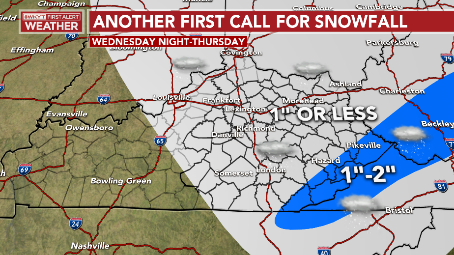
By Wednesday evening, light snow and flurries will take over and this looks to take us through Thursday in central and eastern Kentucky. Light accumulations will be possible…
I’ve got the latest on WKYT tonight at 11 and with the normal full update later tonight. Here are your radars to track the precipitation in from the southwest…

Enjoy the evening and take care.

Real time temperatures are trending 5 degrees or more colder then models– have you notices ??
28 degrees on the Magoffin line in Floyd at David Ky and 29 at Pikeville and Big Sandy Airports
From a standpoint of snow, it looks like Warren County will be on the outside looking in, again. We should be used to it, considering the fact that over the past few years, snowfall amounts in Warren have averaged a trace to fractions of an inch. The ensembles for the 24th & 25th seem to hold promise for Winter weather, but snow will probably stay well to the east of I-65.