Good Thursday, everyone. 2020 isn’t going away quietly as we track a wintry mix and active setup for the final day of the year. 2021 looks to start with more of the same as this pattern stays busy. We have two more systems to impact the region through New Year’s Weekend. Let’s do this.
Our day starts with a wintry mix across parts of western and northern Kentucky. Some light accumulations may show up in this area and we could get this as far south as Interstate 64 for a time this morning. Here are your radars to follow the progress of this…

Temps out there today are MUCH colder than yesterday and stay in the 30s for most areas. Gusty winds make it feel colder and this carries us into a fairly calm New Year’s Eve.
Our big low pressure then ramps up across the lower Mississippi Valley and lifts to the north on New Year’s Day. This causes winds to increase around here and bumps our temps back toward 60-65 for a while. Showers and a few thunderstorms increase and hang tough through the day. There’s even a low-end risk for a few severe storms showing up…

Here’s the future radar from the Hi Res NAM…
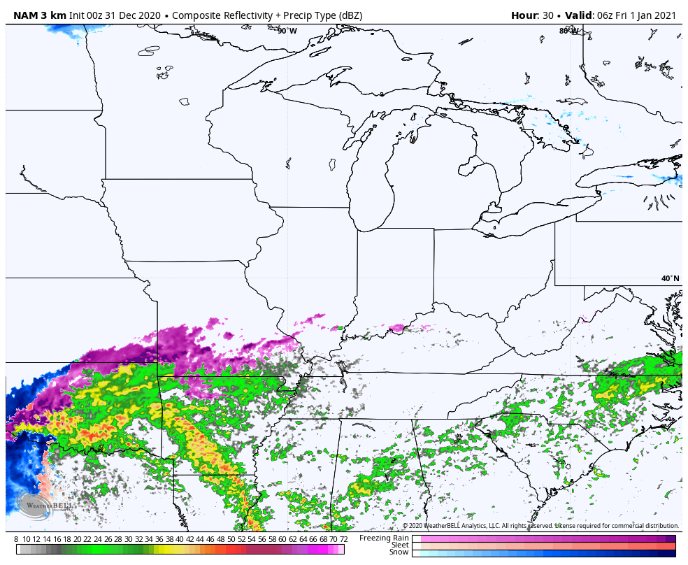
The initial surge of precipitation may start as a touch of freezing rain in the far north early Friday morning.
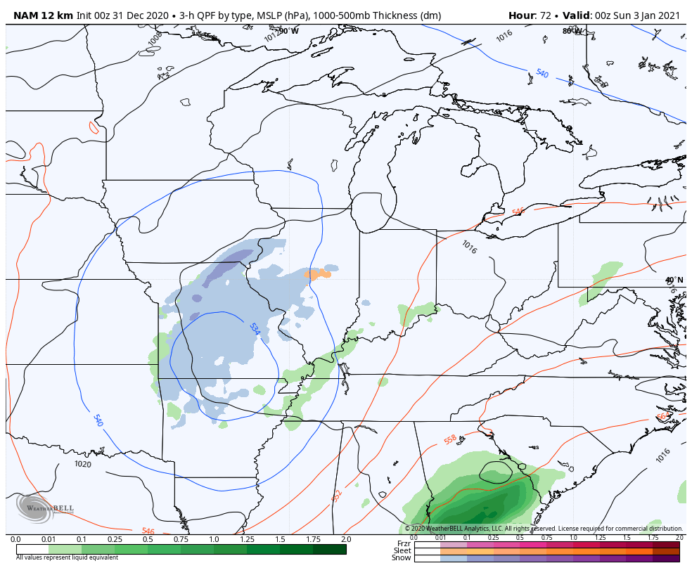
Temps are much colder behind this for Saturday with upper 30s to mid 40s. This is ahead of another storm system rolling in here Saturday night and Sunday. This can bring rain and snow in here during this time. Check out the NAM from 7pm Saturday through 7am Sunday…
The Canadian shows this and a clipper coming in behind it…

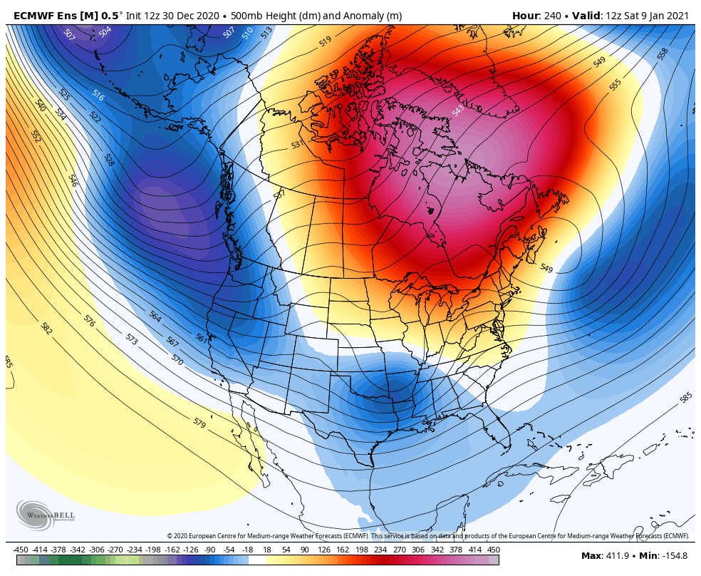
This stormy pattern shows no signs in letting up as we will continue to see storms com at us from the southwest. At the same time, we begin to see a deepening trough get established in our region as the big time blocking shows up…
I will have your updates later today. Have a good one and take care.

wake up america, its going end up a bad winter season!!!!! cold and a couple giraffe huggers left!!!!!
Same active rain pattern.
That looks like one stout -NAO from map above.West base also.Wander if KY benefit’s more from East base or West?
This site will answer your question : http://theweathercentre.blogspot.com/2012/10/east-based-v-west-based-negative-nao.html#:~:text=As%20you%20may%20imagine%2C%20west,all%20of%20the%20East%20US.
All ready read that Schroeder.Really didn’t tell about what favored KY.Guess is East based favors upper Ohio valley.West based favors more of the East coast.So maybe we want a west base -NAO but maybe a tad more East than what models are currently showing..Course this is if models are right.Anyway’s should start seeing some fantasy storms on op models with all the blocking and SSW event showing up.lots of short waves riding south of us.Could get exciting quick.
With a dip over the Easter half of the US we only should be watching low pressure systems riding the Apps…..Eastern rider less Ky snow. West side more Ky snow. Need a low to form and slowly move South or Nashville then up this side or the Mountains. Old skool thumping could bd on the table in the coming weeks. Of course the dreaded ICE word comes into play.
Don’t believe EKY would like that track.Believe the-NAO could also determine the track of the low so it bears watching.-NAO also keep systems from cutting and slows them down for a more wound up system.