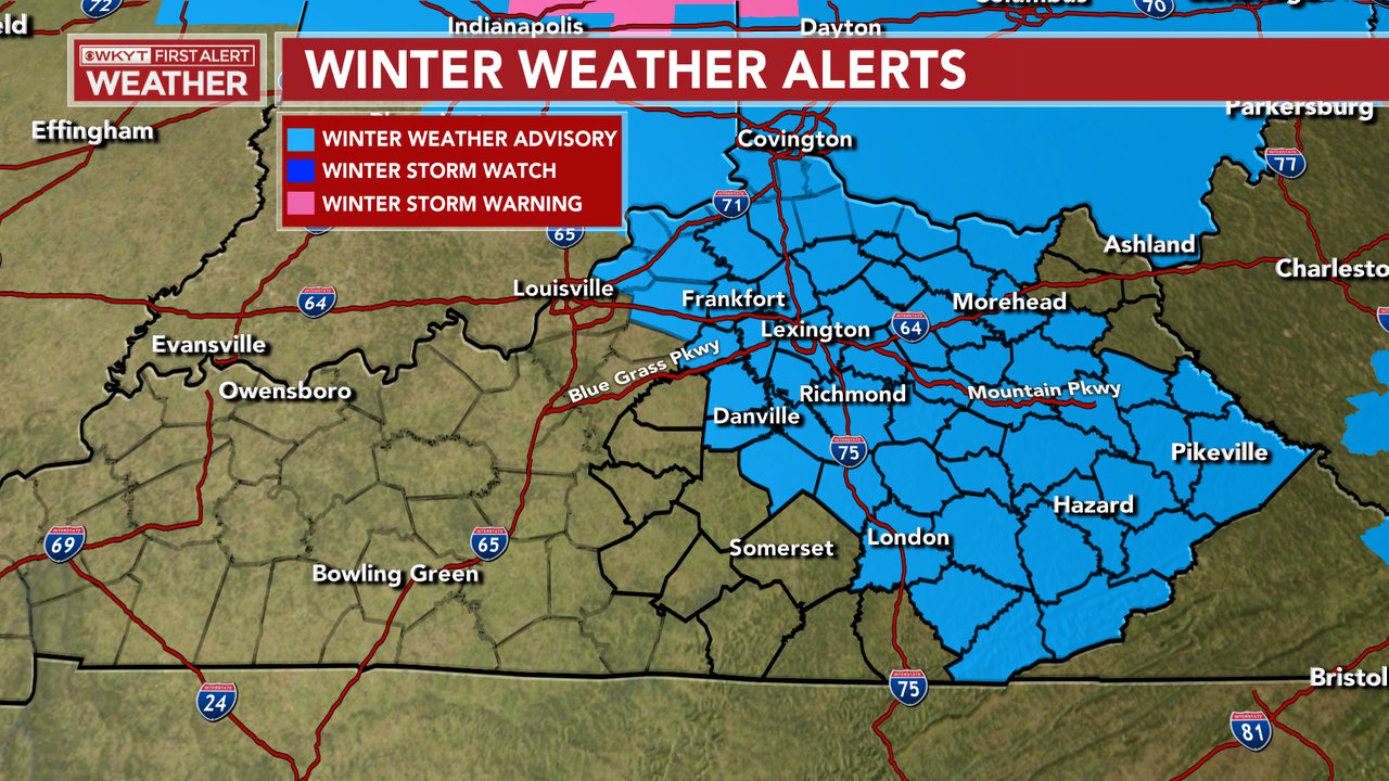
Good evening, folks. The front end band of snow and a wintry mix I’ve yapped about all week is doing some work across central and eastern Kentucky. This is beginning to impact some roads out there, especially untreated roads. For that reason, A Winter Weather Advisory has been issued.
This goes through midnight for central and eastern Kentucky and through early Sunday in the north…
The snow is coming at this area in two bursts. The one that’s lifting northward now can drop a quick inch or two. Another band develops late evening into the wee hours of the morning and may impact some of the same areas. Farther south and west… It’s rain.
Here are your radars to follow along…

Everyone goes to rain from the southwest tonight and Sunday. From there, we watch some healthy wraparound snows set up Sunday night and Monday with snow showers and squalls Monday night and Tuesday across the eastern half of the state.
Here’s the NAM snow totals from everything that falls tonight through Tuesday…

That’s trending toward what the EURO has been showing and continues to show with the late day run…

The end of next week into the weekend has an interesting look to it, but the models handle it differently. The EURO has a nice hitting winter storm…

The GFS blasts arctic air in behind front with a wave of low pressure along it…

There’s a lot of winter waiting to be had over the next 4-6 weeks.
Enjoy the evening and take care.

Very heavy snow falling in my area of Carter County has created a beautiful white blanket in just a few minutes!
It’s another disappointing storm scenario for the area of Warren County, just south of Bowling Green.. We recorded a trace of snow during the Winter of 2019/2020, and the current Winter is on track to match it.
#NewNormal
This storm was certainly no disappointment for the Chicago Metro area, it’s more than lived up to expectations. As of midnight, 4.5 inches of snow has fallen at Chicago’s O’Hare Airport, while at the NWS forecast office in Romeoville, 35 miles SW of Chicago and five miles from where I live, 6.6 inches of snow has fallen. As of 3:15 AM local time, the snow is still coming down at a fairly good rate across the whole Metro area, and we could even get wraparound snow as the low pressure moves away later this morning. Many areas will come close to, if not exceed, 10 inches. The computer models sure nailed this one.
I’ll be out later this morning shoveling and enjoying the picturesque scene of everything under a thick blanket of snow.