Good evening, everyone. A major winter storm/ice storm is set to blast the bluegrass state tonight through Thursday. My concern for this turning into a big time ice storm continue to increase, especially for areas along and south of Interstate 64.
An ICE STORM WARNING is out for much of the state through Thursday with a Winter Weather Advisory to the north…
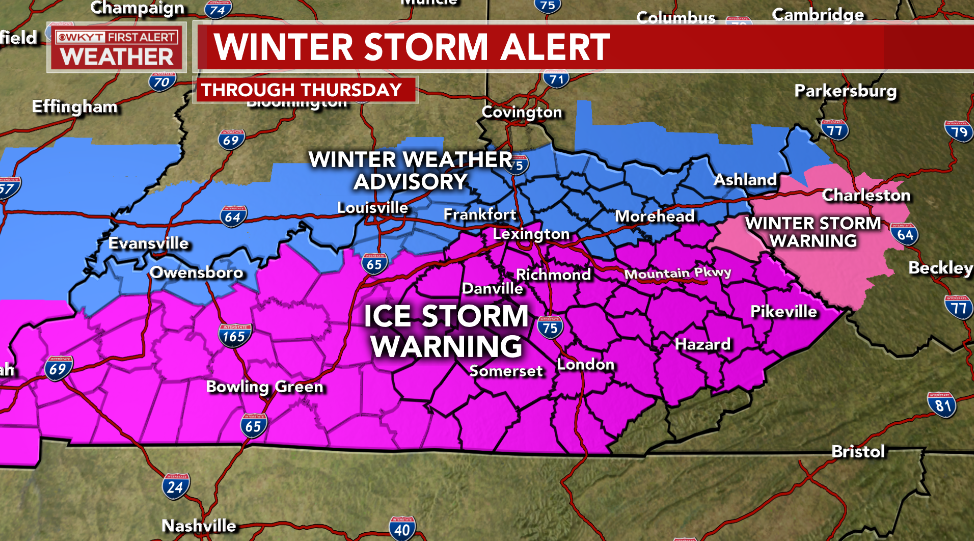
You may see all that moved around just a bit based on the latest trends.
The initial band of precipitation moves in tonight and early Wednesday and looks fairly light. But, it just takes a little bit of freezing rain to cause issues. The main action then arrives Wednesday evening through Thursday.
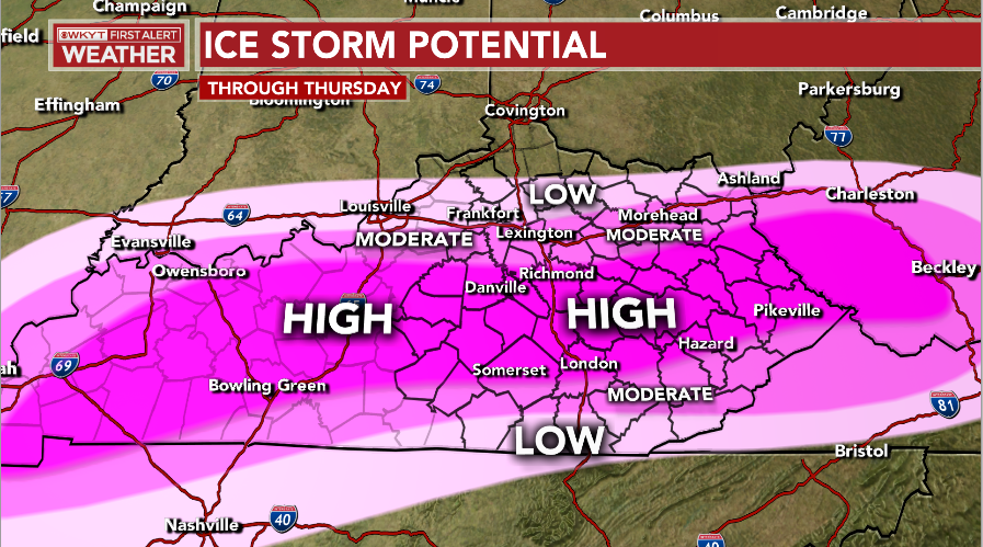
Let’s talk about just the pure Ice Storm Potential for this setup. Here’s a risk map I put together for you guys…
Damage to trees and power outages are likely to occur with the sprawling ice storm area, so please take all precautions possible before the storm hits.
Here’s my updated look at the snow and ice potential…
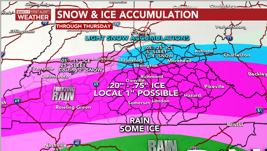
Again, nothing about that is set in stone, so expect further revisions to that through tonight and early Wednesday. We obviously would like to see less total precipitation or more sleet and snow. Can that happen? Sure, but those aren’t the likely outcome at the moment. The late day GFS came in with much less precipitation and we are all cheering it on. Unfortunately, it’s an outlier right now.
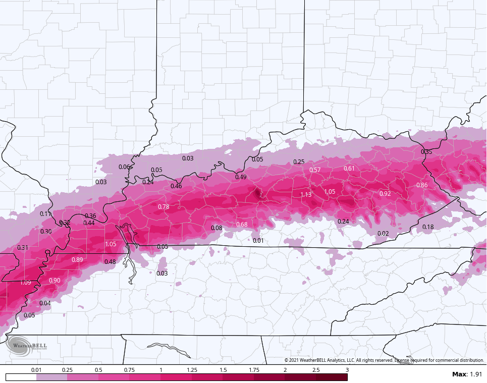
The late day runs of the NAM are the models we want ZERO part of. I suspect these models are also outliers in the other direction…
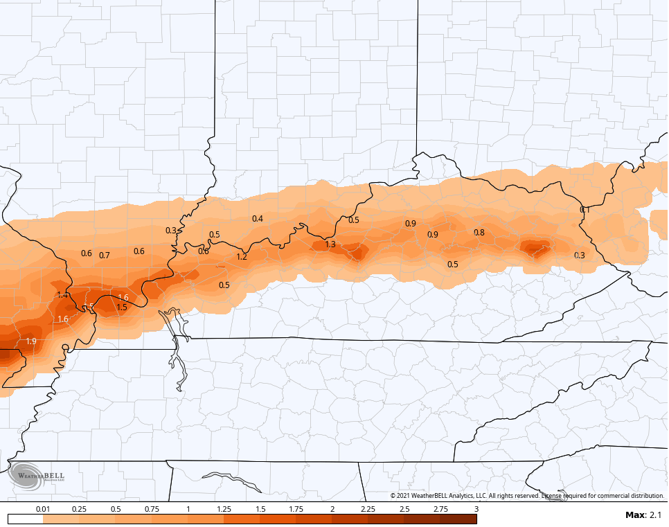
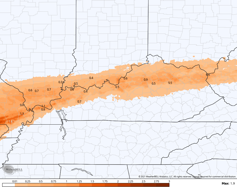
NAM FREEZING RAIN

HI RES NAM FREEZING RAIN
NAM SLEET
HI RES NAM SLEET
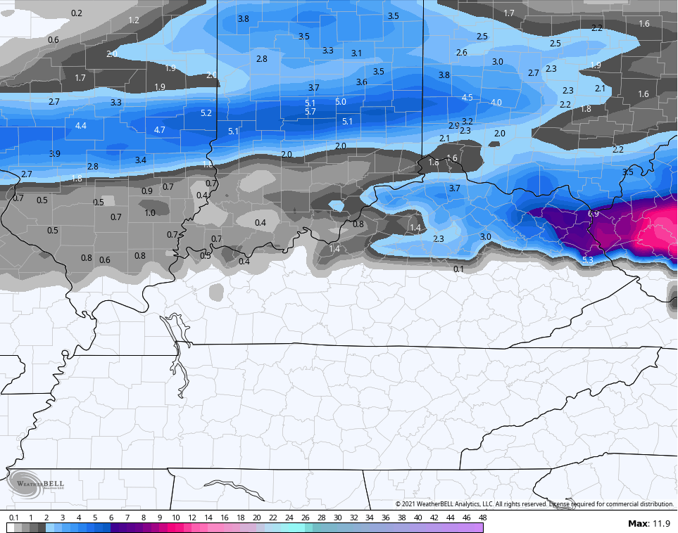
NAM SNOWFALL
I may drop by for another update later this evening and will have the latest on WKYT at 11. I leave you with your radars to track an increase in the action from the southwest…

Have a good one and take care.

The site is getting bogged down from all the people visiting! Hoping we get less ice but if the NAM run holds true, it will be a storm to remember.
I have things ready for no power just in case. Prayers for everyone to stay safe and warm.
Me too! Morehead has been on the fence back & forth all day. I have no idea what to expect! Lol
Yes,been a head scratcher.One model run showing over 1.5 then the next run by the same model showing just over half inch.You would think all models would be in agreement by now.Maybe the GFS scores a big win.