Good afternoon, everyone. Winter Storm Watches continue to be expanded farther south as our storm system looks to target the southern half of Kentucky with an Ice Storm. Significant amounts of freezing rain are likely in this region with lighter amounts in the north, where snow and sleet will also show up.
Let me start out by saying this is a tough forecast in determining the exact placement of where the Ice Storm will hit and additional changes are likely. Anytime we are dealing with 4 different precipitation types, things get super tricky in terms of amounts and placement. Here’s my First Call for Ice and Snowfall…
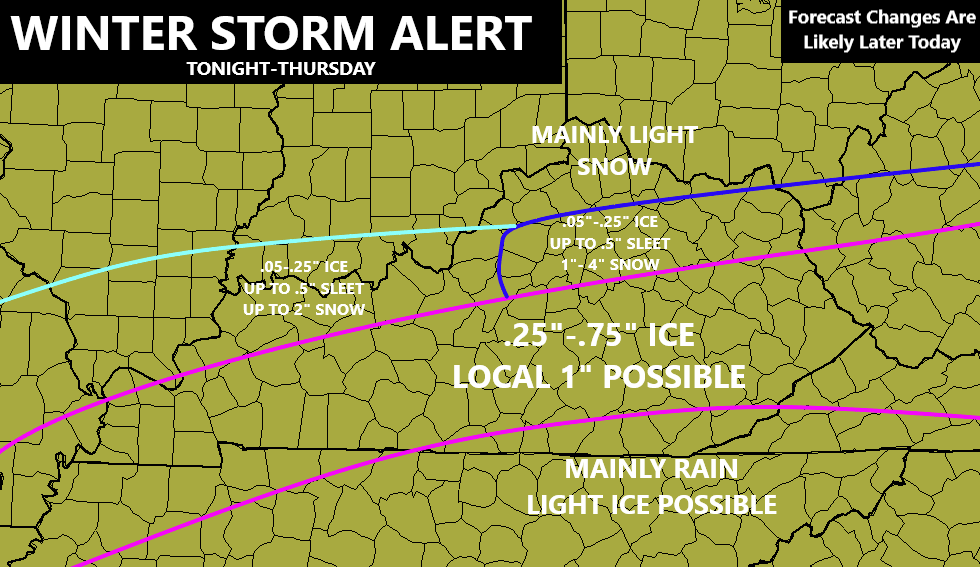
The lines are approximate, so keep that in mind.
A few thoughts:
- As expected, you’re seeing the cold air flex a little bit, pushing the whole setup a little farther south. I had already taken this into account with my earlier maps.
- The area I’ve outlined with the pink lines have the best chance for a true ice storm. Given many of these counties have hard to reach power grids and power lines, issues may be fairly widespread.
- Father north, I’ve tried to spread the precipitation types out just a bit as sleet and snow will show up. This corridor looks fairly narrow, so the placement of this is still in flux. Any one precipitation type could win the battle in these areas, leading to much more of one over the others.
- Northern Kentucky now looks to have mainly some light snow with light accumulations.
- The entire forecast is subject to change as new data comes in later today as any small deviation in the track can have a large impact on where you live.
- If you’re in the ice storm area, let’s make a worst case scenario plan just to be safe. I would much rather have you guys overly prepared than underprepared.
- Here’s hoping the freezing rain part of this never fully materializes and this forecast goes bust. I would gladly take the L on this one.
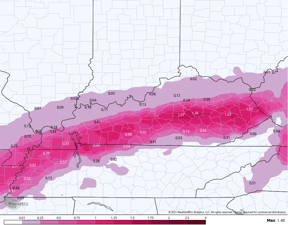
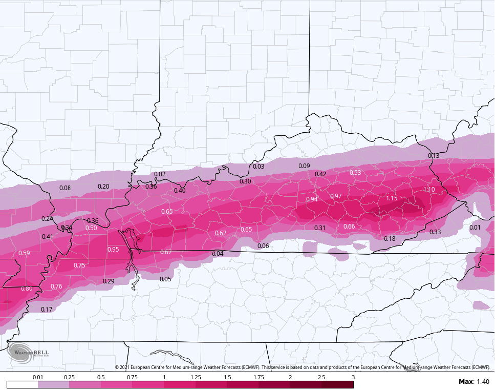
In terms of models, I’m riding the NAM and EURO. These two models currently have good agreement and that always lends confidence this close to a forecast.
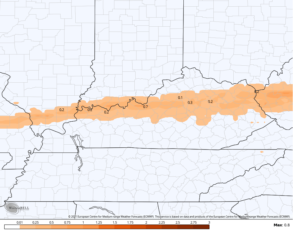
NAM Freezing Rain
EURO freezing rain
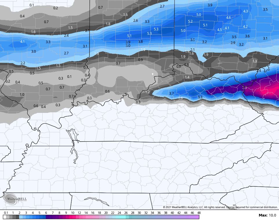
NAM Sleet
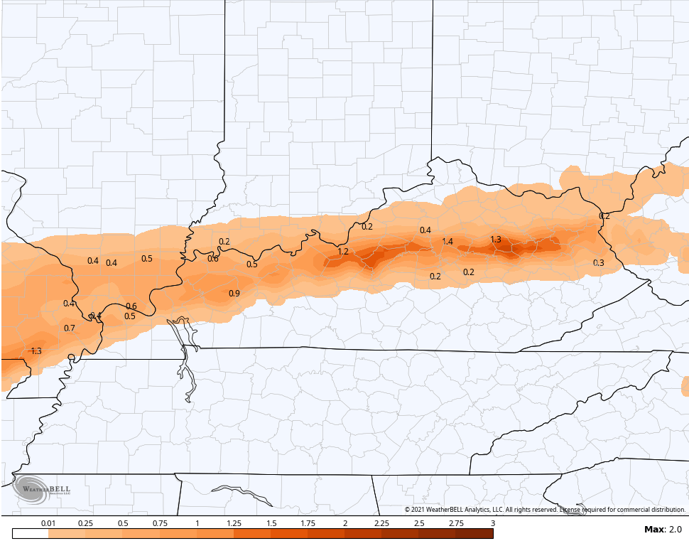
EURO sleet
NAM snow
The EURO snow still includes some from very early this morning in the north…
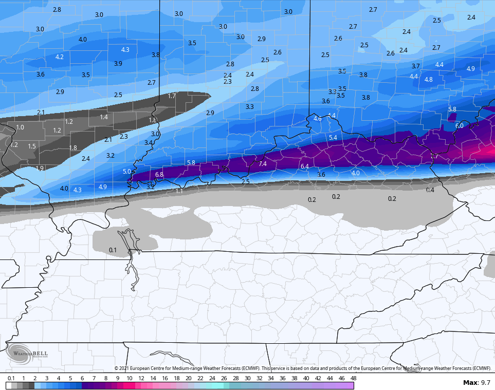
You can see how the two models have the same general forecast, but the EURO is much more widespread with the swath of snow.
It should be noted the GFS has shifted everything farther south, but the model has been known to do this from time to time. If we see other models going that way later today, then we can also start to trend that direction.
Once this moves through, we have no time to waste before the next Winter Storm threats. One moving in later this weekend with the next quickly coming in behind it early next week.
I will have updates on our current storm on WKYT starting at 4pm and will likely make changes to the forecast a few times this evening. I will also have another KWC update or two later today.
Have a good one and take care.

Thankful that Bell Co. is outside the ice area. I’ll take the rain any day over ice
Looks like Morehead & Fleming are barely in an area the should at most just have an advisory ..what’s 1-4 inches of snow? A nuisa ctce. We were in the high impact zone..some excitement! Lol
Boy getting on here to comment is harder than Chris trying to forecast this Winter Storm… Been trying to comment for 6 hours now lol.
The Southeast Ridge Has Been Protecting Our Area For Today. I don’t Know About Tomorrow Night and Thursday.
If The NWS Is That Confident They Should Issue A Freezing Rain Warning For My Area Of Kentucky Like they Did Back In 2009. They Issued The Warning 48 Hours Before It Happened.
One Meteorologist Out Of Louisville Was Spot On With The Severity Of That Ice Storm. It Did Over $40,000 Worth Of Damage To My Property.
Home Owners Insurance Was Very Little Help Most Of The Cost Came Out Of My Pocket.
This Storm Better Be All Snow !
The National Weather Service Just Issued An ICE STORM WARNING FOR TAYLOR COUNTY.
They Must Have Read My Post.
Power Failure Likely.
This Is Probably My Last Post ?
Any chance this shifts a bit farther north or will the snow pack keep it south?
The core of the ice storm has move just south of here in Union. Co. But we’re not out of the woods by any means still some ice in forcaste with snow on top.. Stay safe to all
As Taylor Swift says “Trouble Trouble “
https://www.pivotalweather.com/model.php?m=nam&p=zr_acc&rh=2021020918&fh=54&r=us_ov&dpdt=&mc=