Good Wednesday, everyone. The first wave of freezing rain, sleet, snow and rain is working across the Commonwealth today, kicking off our ice storm. Once into later today and tonight, we will really get into the thick of things as freezing rain becomes much heavier.
Let’s start things out with a quick synopsis of where things stand in my eyes:
- An Ice Storm Warning continues for much of Kentucky.
- On the overall scheme of things, I haven’t seen much to make any wholesale changes from my earlier thoughts.
- My above statement will probably change on more than one occasion today. 🤷♂️
- The first wave of light wintry precipitation is out there this morning with freezing rain, sleet and some snow across the northern half of the state.
- Areas of the southern half will see mostly rain through the early evening.
- The greatest threat for a true ice storm continues to be across the southern half of the state. That’s where the heaviest freezing rain sets in tonight into Thursday.
- Power outages and tree damage will be possible in these areas.
- Farther north, sleet and snow will join in on the icy fun. Accumulations are a good bet.
Here’s the area most at risk for the worst of the ice storm…

I will keep the overall forecast for snow and ice, but will make adjustments as needed through the day…

Now, let’s take a look at what the latest models are showing for this storm. The NAM continues to be the farthest north and has the most damaging freezing rain look…
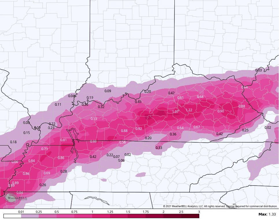
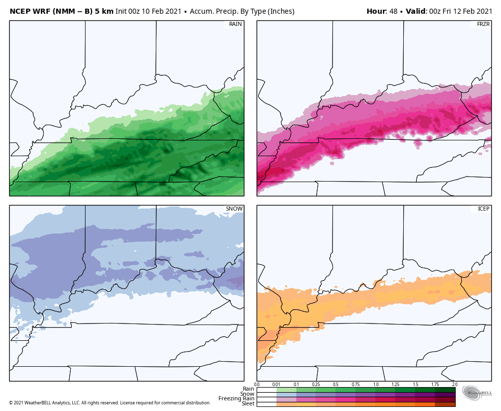
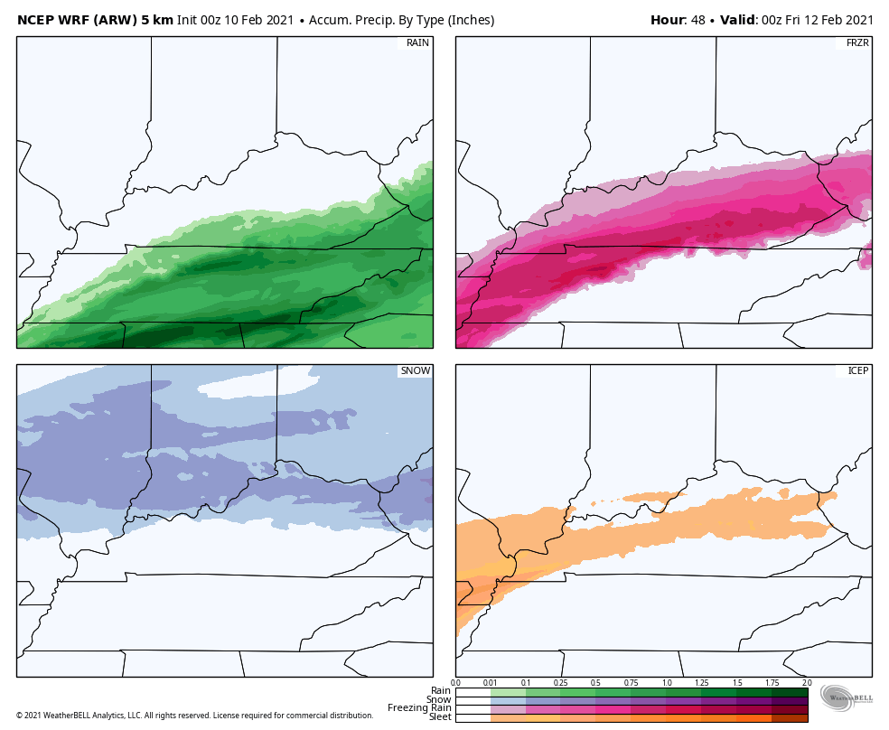
The model does have support from different versions of the WRF model…
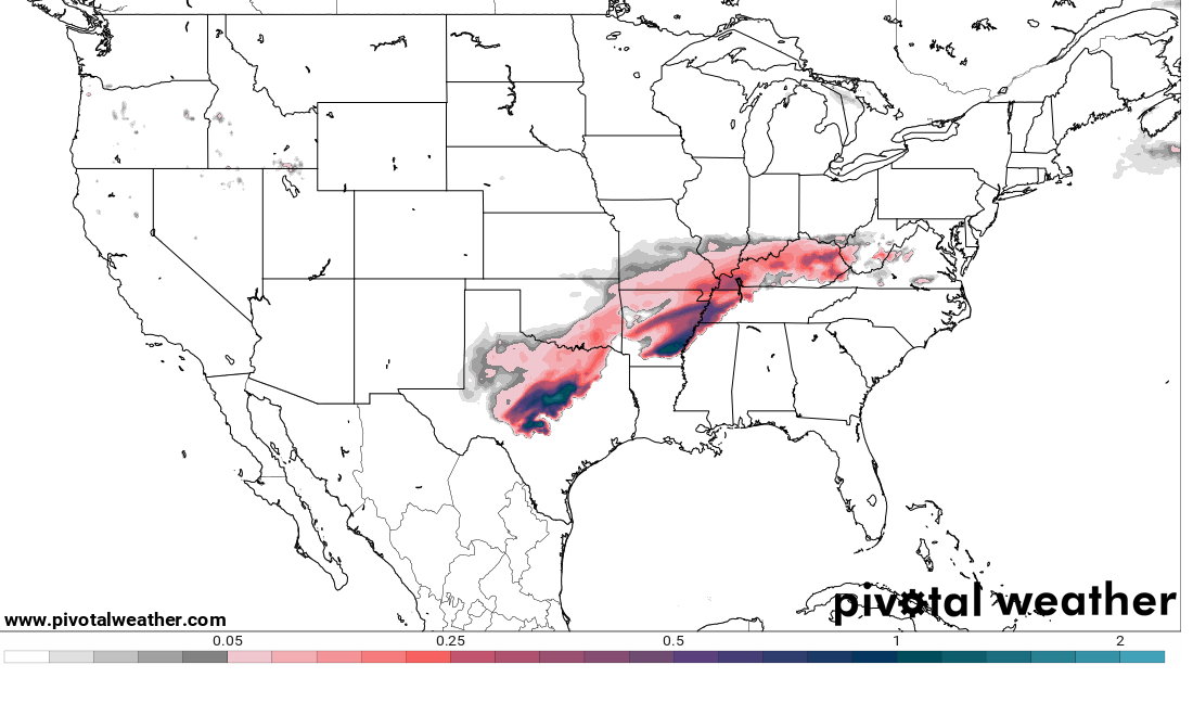
The RAP model isn’t as extreme, but it has a major event that’s farther north…
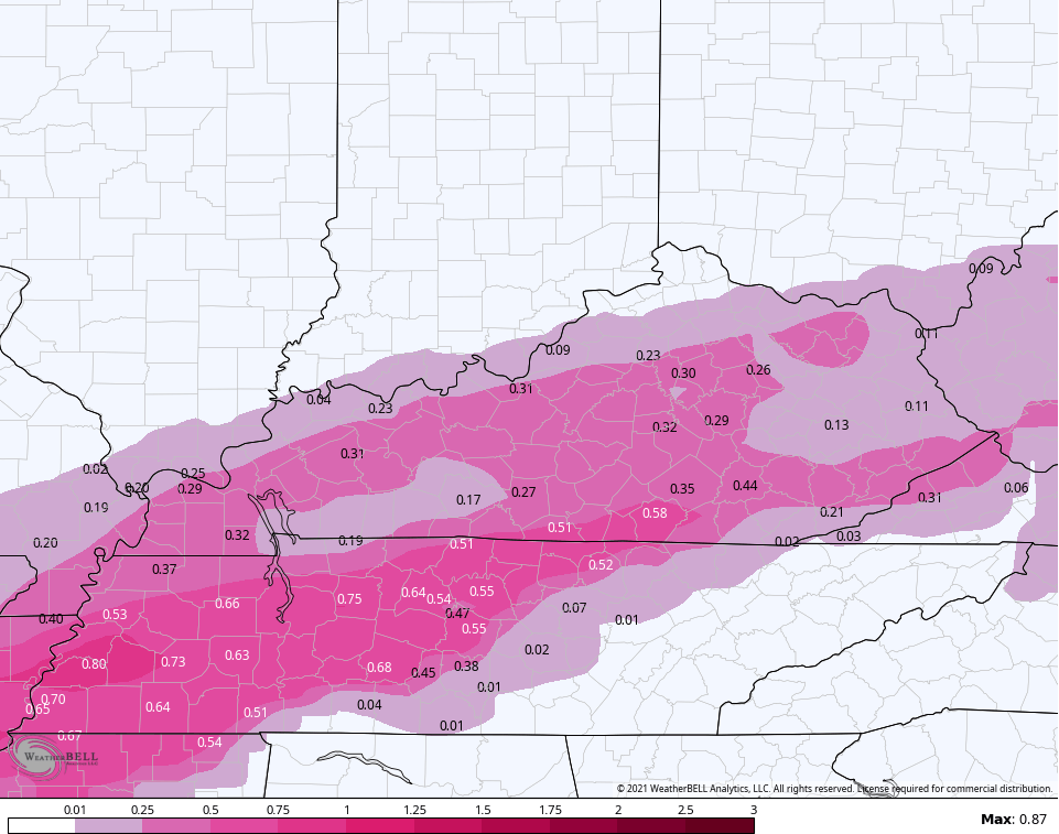
The Canadian is farther north than earlier runs of the model. Here’s the freezing rain it has…
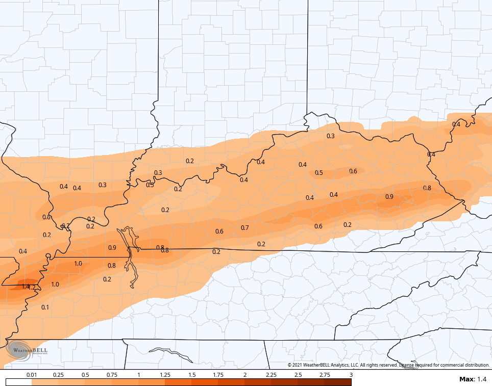
The model has a ton of sleet…
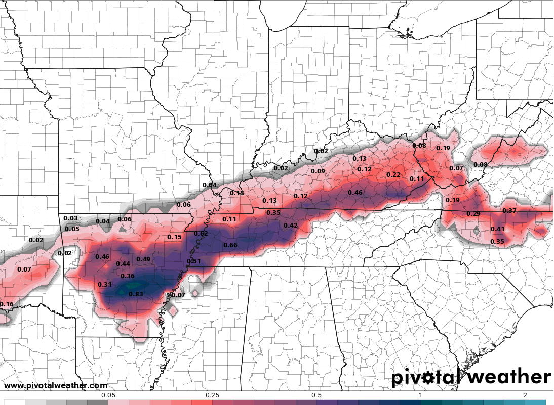
The GFS continues to be the weakest model in terms of all precipitation types and is too far south and southeast for my taste. Still, it has an ice storm in the south and southeast…
There’s a new version of the GFS that’s slowly taking shape and it has a broader swath of ice…
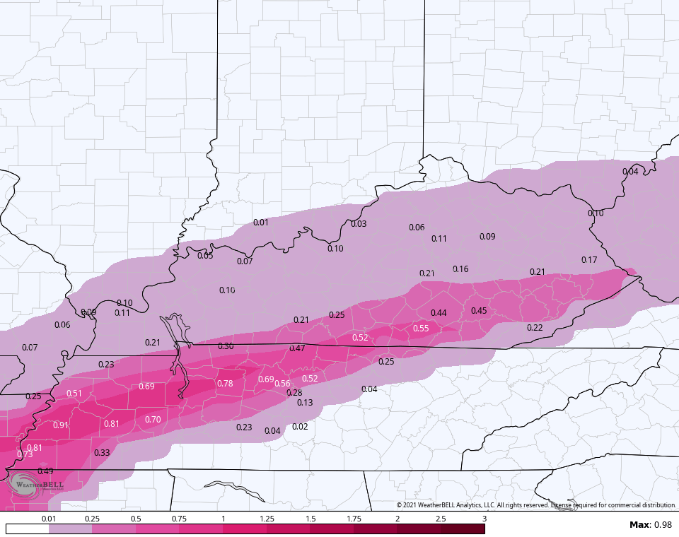
Now, the new EURO did go toward the GFS…
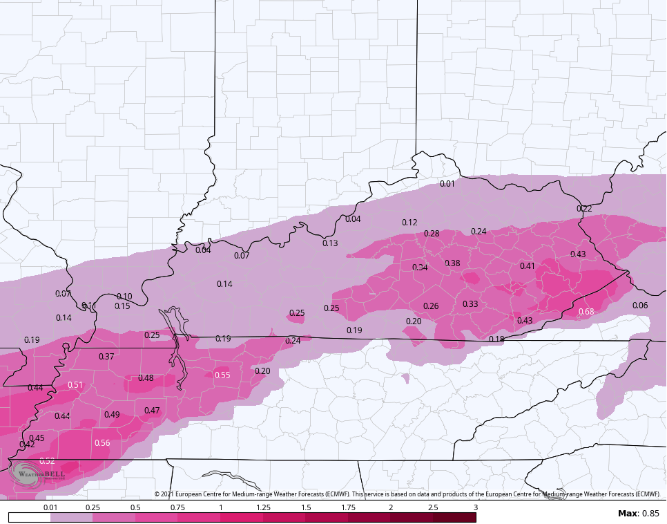
Still, that’s a healthy ice look for many, but the whole run of the EURO looks like it’s holding too much energy back in the southwest the entire run.
The setup for the weekend and early next week will feature two more systems. The first one moving through on Saturday looks like the lighter of the two, with the one behind it for Monday and Tuesday looking more like another major storm…
Multiple updates will come your way throughout the day and, of course, we will have full team coverage on WKYT. I leave you with your radars for the day…

Make it a great Wednesday and take care.

It seems like most everyone but the NAM is showing less precipitation for the storm. Hopefully that will play out.
Sleet and Ice storms = Miss would be great. I wouldn’t be disappointed at all. Snow = miss I would def be disappointed.
Big Thanks Chris For keeping All Of Us Updated On This Potential Hazardous Situation.
Thank you Chris for keeping us updated and informed of everything that could and will happen. Everybody be safe! Be as careful as you can.
Looks like models still having disagreements.Don’t believe this is going to as bad as what models were showing yesterday.Seems like totals keep going down.Which is a good thing.Not often you hear the EURO caving to the GFS.One for the USA.
I got a call from my sister and she said Louisville is getting a lot of ice.
We have a light glaze of ice in Bardstown so far this morning with freezing drizzle. I’m really wishing this thing would bust, but as my grandpa used to say, “Wish in one hand………” 😀 Y’all know that old saying! LOL!
Thanks Chris for your coverage and hoping everyone stays safe!
That’s about the worst forecast I’ve seen in a very long time for Perry County area.
Widespread power outages. Multiple ice storms within days of each other.
I pray for all of us. It is going to be a dangerous and rough span of time.
Thank you, Chris, for doing all this work to keep us all safe and informed. We are so lucky to have you. ♥️
From the biggest snow lover around, I think I’m gonna join #TeamSpring.
NWS Paducah has moved the Ice Warning more north to the Ohio River.
NWSLMK added more North Central counties to the Ice Storm Warning. It’s creeping north.