Good afternoon, everyone. Our Ice Storm is about to really ramp it up a notch as heavy freezing rain, sleet and some snow works into the region late today and continues into Thursday. Overall, the forecast remains in good shape, but I’m nudging the high risk for ice a bit north and broadening the risk area.
Here’s a look at the midday Winter Weather Alerts…
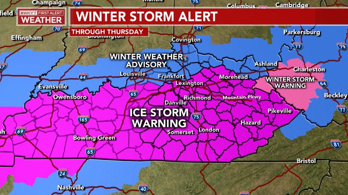
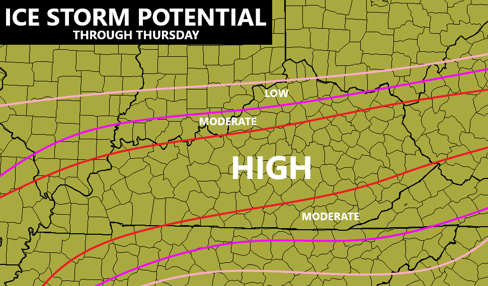
That Ice Storm Warning has been pushed farther north and I suspect we may see a few more counties added on the north side of it. Here’s my updated map for the increasing risk for this ice storm…
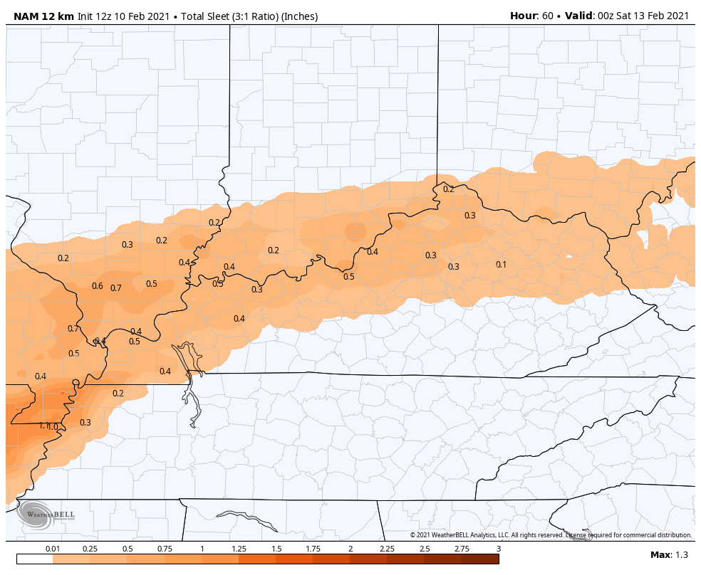
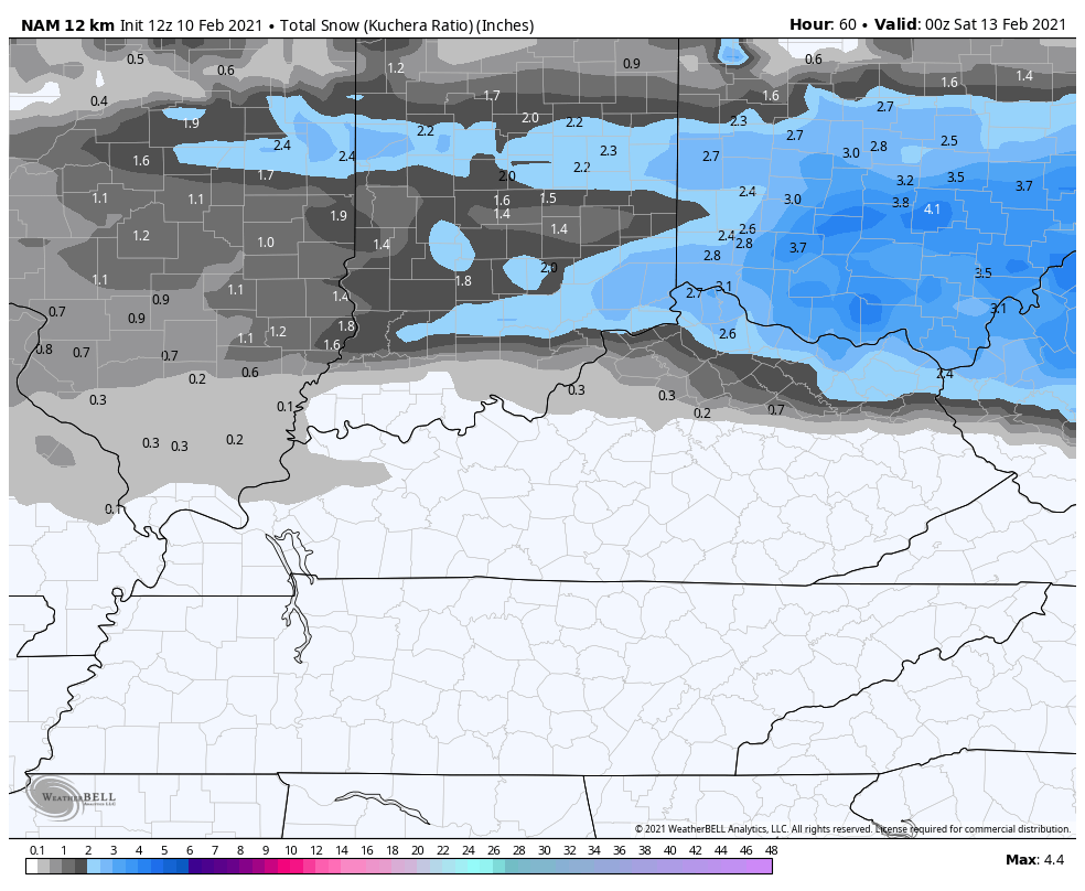
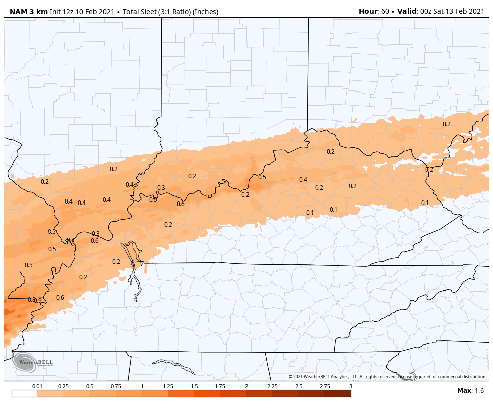
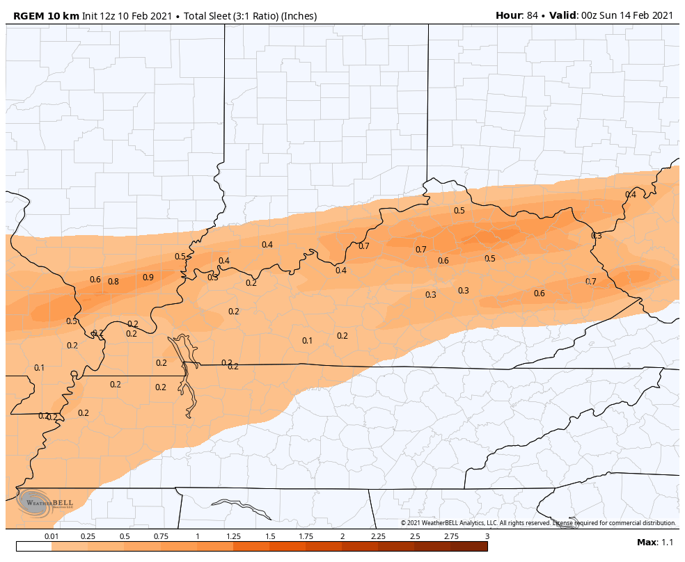
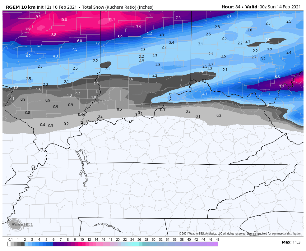
Sleet and snow will also get involved, especially across the northern half of the state. Several inches of snow and sleet may show up for some. Precipitation type totals for any one location continue to be problematic.
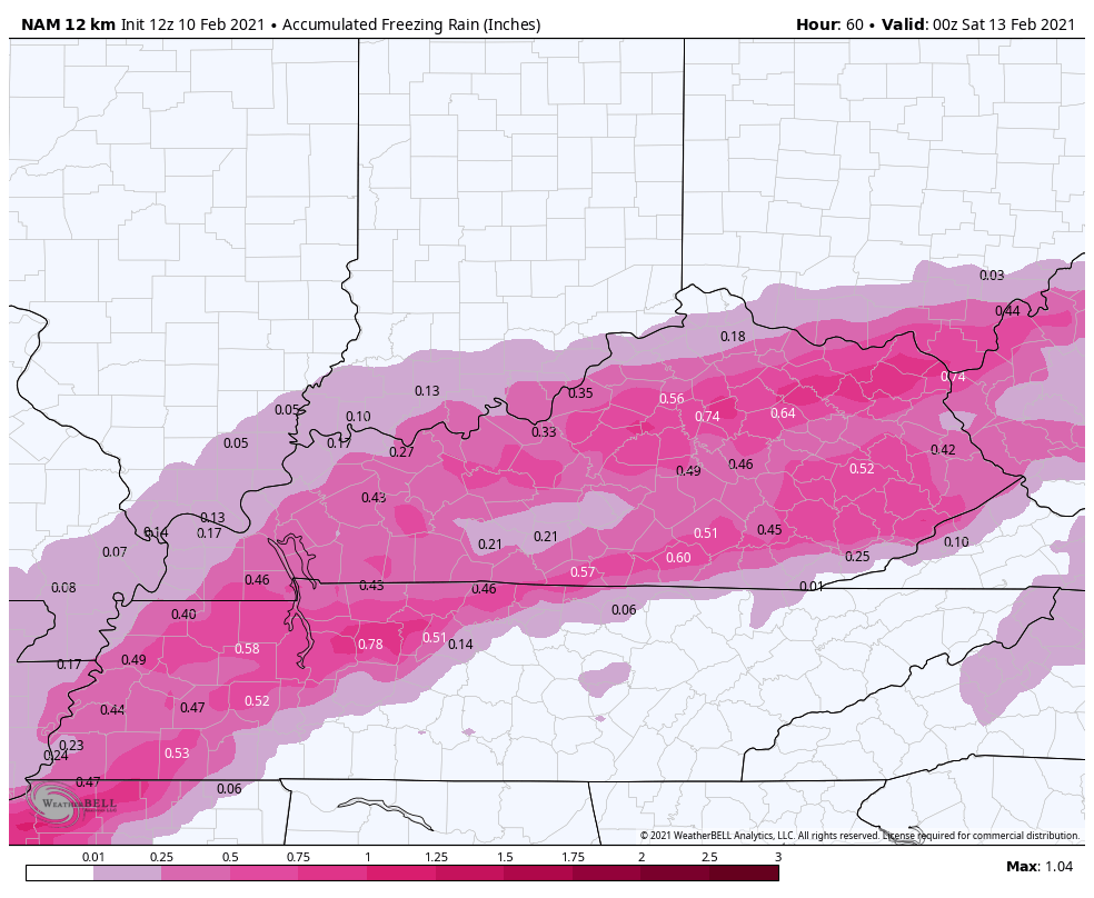
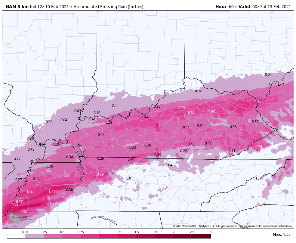
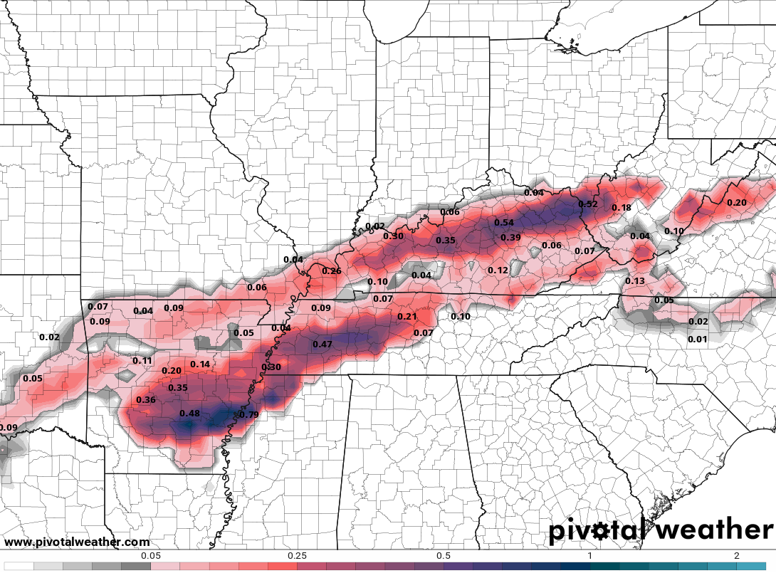
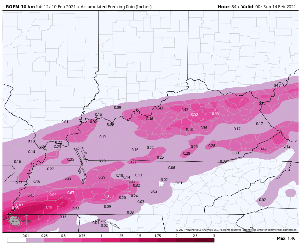
The computer forecast models appear to be trending in the direction of what the NAM has been showing for the past few days and that’s a major ice storm for more areas. Here’s the latest from the NAM…
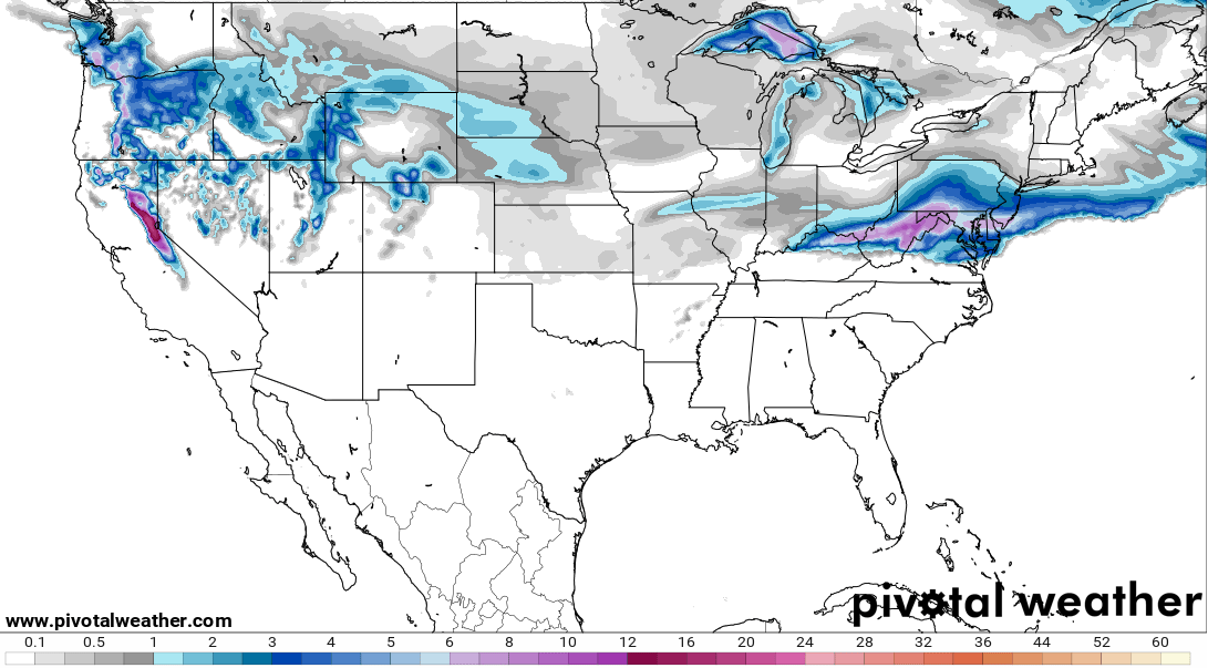
FREEZING RAIN
SLEET
SNOW
HI RES NAM FREEZING RAIN
HI RES NAM SLEET
New version of the GFS FREEZING RAIN…
SHORT RANGE CANADIAN FREEZING RAIN
SHORT RANGE CANADIAN SLEET
SHORT RANGE CANADIAN SNOW
RAP FREEZING RAIN
RAP SNOWFALL
After all this, I will probably pull the trigger on the next Winter Storm THREAT for Monday and Tuesday.
I will have updates as I can though the rest of the day and will be on WKYT with team coverage all day and, likely, through the night. Here are your radars to follow the increase in the heavy stuff from the west…

Stay safe out there and take care.

If themps don’t drop we won’t have Ice. I saw on the satellite a small wave in the clouds moving north I wonder if it was warm air?
Is it me and wishful thinking, or are the numbers for accumulating ice in those model maps about 1/3 of what the models were saying for the past few days?
It’s 33 degrees here in Hagerhill Johnson Co. 33.8 at Mesonet at Paintsville Lake
Mets in the Ville now urging folks to leave work NOW-it’s coming hard and heavy and quick towards Louisville and points a little south. I have a feeling this is only going to get worse. Even TWC is all over it, and usually lately, they’re the last to even mention us in KY for any type of wx. “KY blew clean off the map this morning, but look at the snow coming down hard in NYC and Connecticut!! And that 80° down in Miami is perfect beach weather!” LOL! 😀
One decent snowfall every 5 years. I starting to realize that is not worth doing this year & year out.