Good afternoon, I wanted to drop by for a quick update on the changing situation with our ice storm as it continues to overwhelm the region from the west. This can cause power outages and tree damage to much of the region through Thursday.
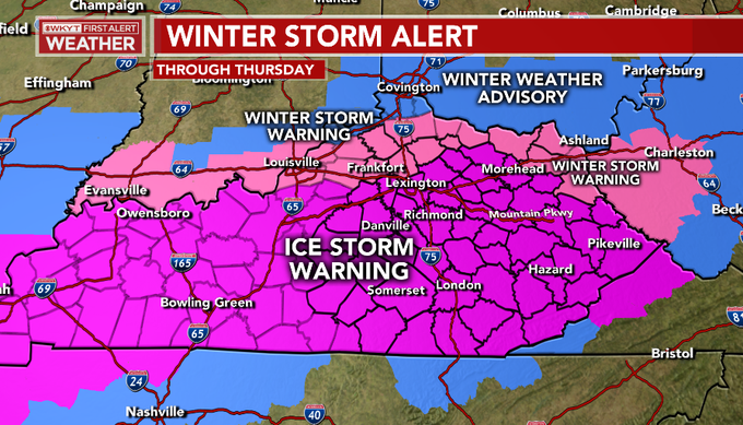
Here’s the updated Winter Storm Alerts map (through 2:45pm)…
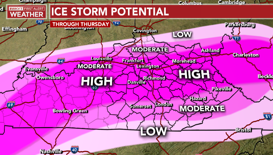
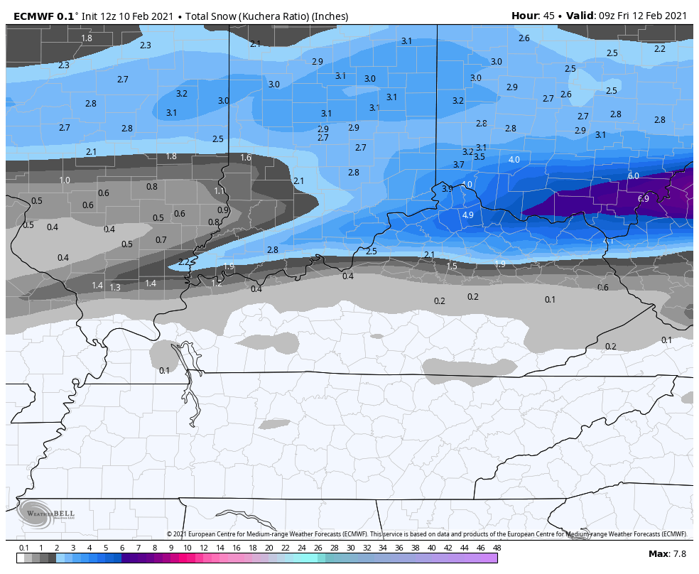
My ice storm potential map…
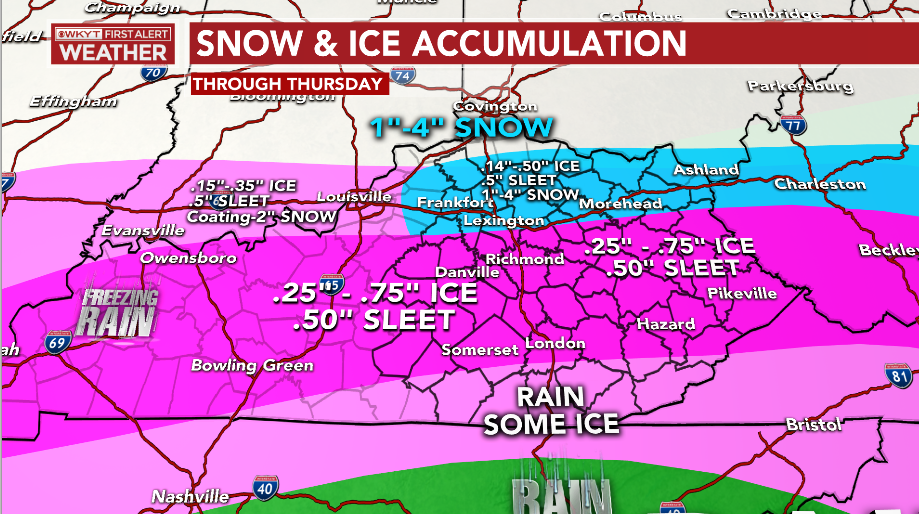
The current forecast…
Again, exact lines and amounts are a work in progress as we see the storm unfolding through the rest of the day. Small deviations in trajectory and temps can make huge differences in any one location.
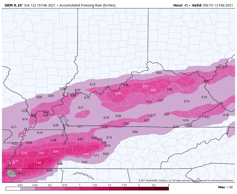
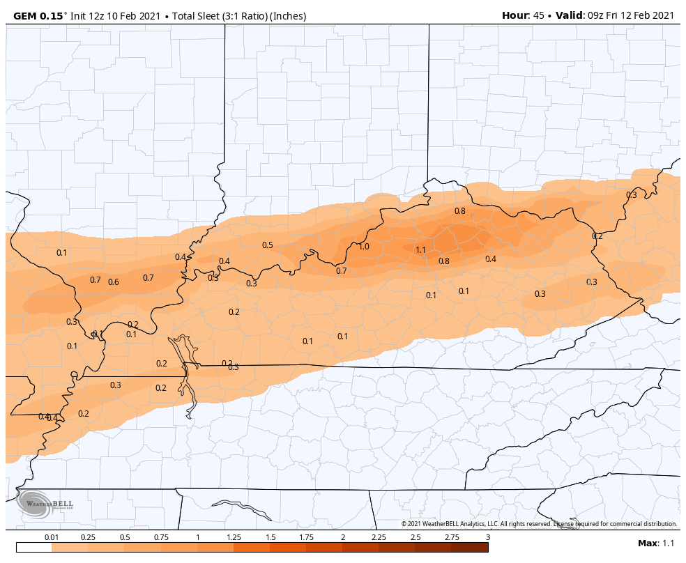
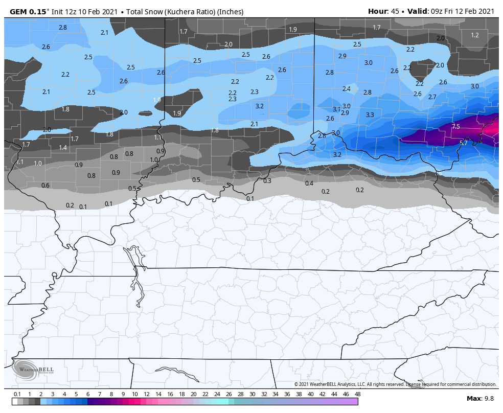
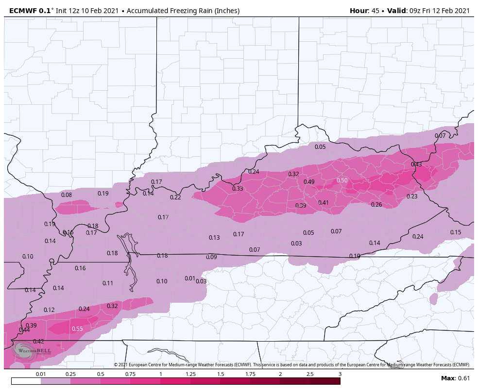
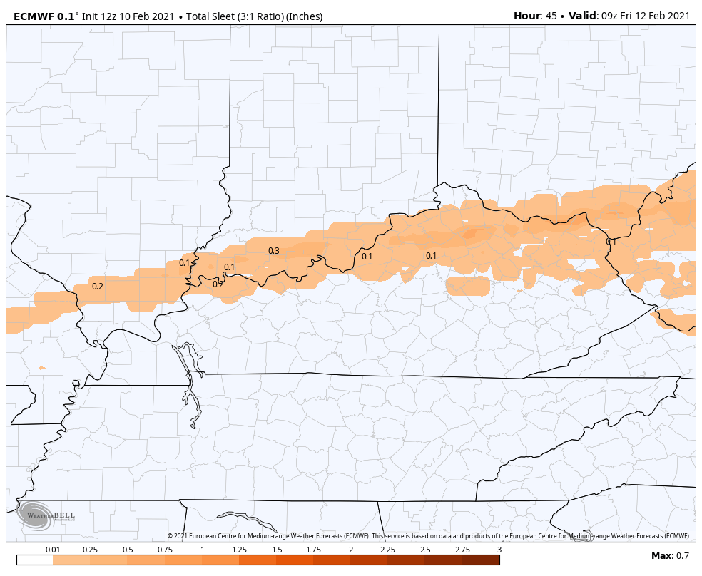
Some additional models for you…
CANADIAN FREEZING RAIN
CANADIAN SLEET
CANADIAN SNOW
The EURO has been all over the place of late and is playing catch up…
EURO FREEZING RAIN
EURO SLEET
EURO SNOW
Another system will bring light snow and a mix in here Friday night and Saturday.
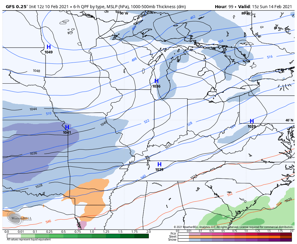
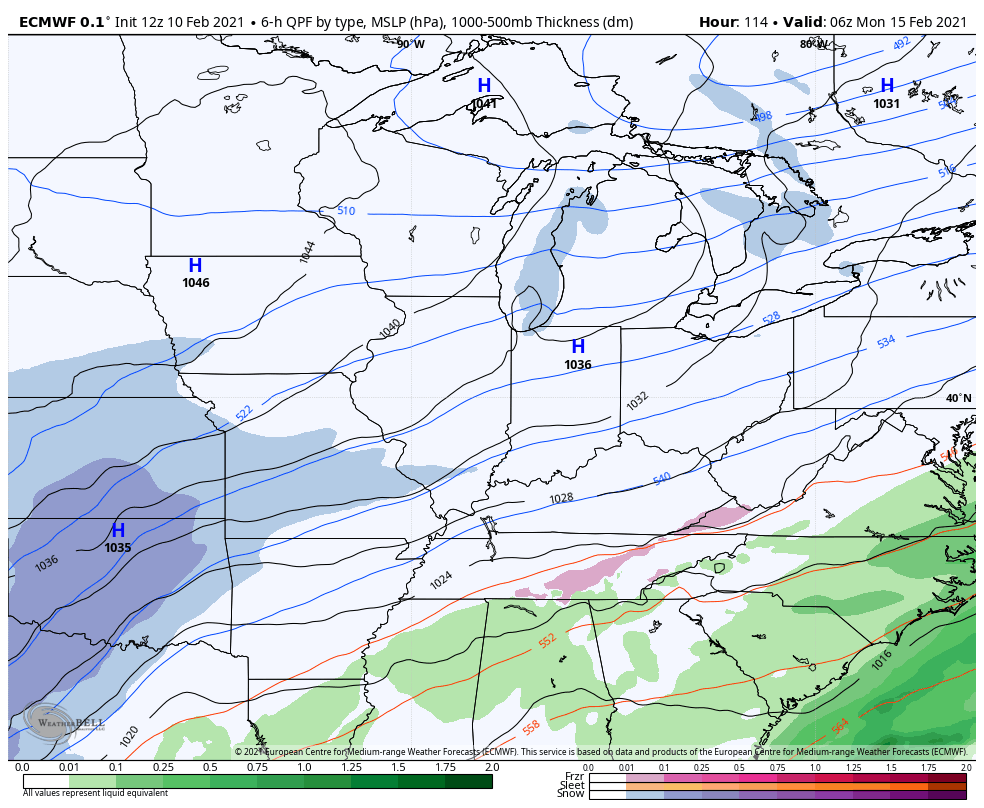
Back to back significant winter storms are then possible next week…
GFS
EURO
Wow.
I will update when I can today, so be patient. I will also be on WKYT through the evening and into tonight. Here’s a link to the WKYT live stream:
Here are your radars to follow the winter storm…

Stay safe and take care.

Somr forecasters in the Bowling Green area are starting to waffle on the potential severity of tonight’s ice event, claiming that the worst will be well north of the city. The weather app forecasts are even worse… AccuWeather’s app displays a link to the NWS ice Storm Warning, but this evening’s and tomorrow morning’s forecast calls for “A bit of ice”. But I don’t buy it, I’m taking an expect the worse stance. The models for next Monday to Tuesday’s storm seems to worsen with every run. We need to be prepared.
May I ask what next weeks storm is looking like? Worse then today’s? Thank you and stay safe.
That’s because the storm has moved more north.
The model trends seem to be giving a false sense of security to me, since the ice accumulation is less on the model maps now and weighted more north. Talking ice here- not sleet.
Ironically, I’m more concerned about next week. Regardless if this is big or not, looks like another ice event could be brewing and with more juice.
Wishful observations:
1. The model maps appears to be projecting less than half the accumulating ice of what they have been, for the past few days.
2. Ice accumulations seem to be weighted more north than before
Does this mean the “warmer” air is playing more of a factor?
Mentioned that this morning.Guess the cold Arctic air ain’t pushing like it’s supposed to.lol.By the way to lazy to look are they still giving -15 degrees.
Nope on -15, but if the moisture coming early next week pans out, it could be interesting. Seems warmer air is flexing it’s muscle though.
For this event, let’s hope warm air aloft also some has warm air aground 😉
Bardstown is getting slammed right now with heavy Frz. Rn. It wasn’t doing anything, then about 30 minutes ago, “BAM!!”….Looks like some sleet and snow is trying to mix in every once in a while, as well. Just hoping everyone will stay in and be safe tonight/tomorrow! Next week’s storm is a bit concerning, too. But let’s get through this one first! Take care everyone, just in case I lose power. I’m in a new neighborhood, so don’t know how this will work out!
Canadian model puts down some pretty significant snows next Monday: https://www.tropicaltidbits.com/analysis/models/gem/2021021012/gem_asnow_neus_24.png
With an inch of ice under it for us 🙂
Should be a 😉
Well you have all been wishing for winter to return now for the past 10 years…..looks like you finally got it
I don’t know anybody that is a fan of ice.
I am fan of Spring but I am not a fan of Tornadoes.
But I will say this winter here in Ky. S&$ks.
We got it five years ago, with three huge snowstorms in less than a year. Pretty sure nobody refers to ice for winter storm yearnings. Seems that’s a tad presumptuous.
Well, I did say winter…didn’t specify what type of precip. did or didn’t want
Temperature at my PWS near Bowling Green is currently 34°, down 4° in the past hour and a half, and radar is indicating freezing rain in northern Warren County. The cold air is on the move!
Besides the Christmas snow the rest of winter has been pretty boring.Dislike the nickel and dime events.Hoping Western KY cash in on next week’s system.Looks good so far but with models waffling like with the current ice storm you really don’t know.Sitting here right now on the Perry and close to other county borders and still don’t have a clue how much freezing rain to expect.So here’s hoping Western Ky gets the rest of what snow is left this winter.Ready for spring and gardening.
Exactly we have had a total of 7.7” of snow this season in Louisville. It seems that it has taken about 15 snow events to reach that mark.