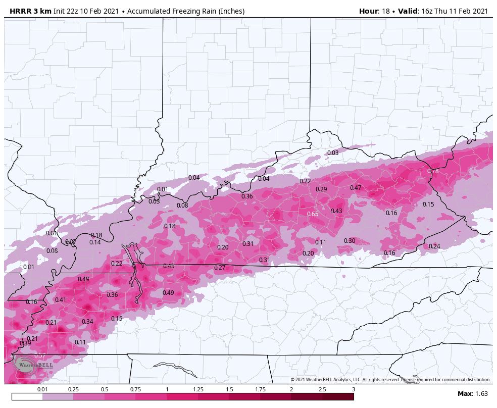
Good evening, gang. Our ice storm/winter storm continues to unfold fairly well with my forecast and the overall consensus forecast across the state. A pipeline of freezing rain is really targeting areas along the Bluegrass Parkway into the Lexington Metro and east along Interstate 64.
The late evening run of short range HRRR continues to indicate quite a bit more freezing rain through late Thursday AM…
The model continues to way overdo the sleet forecast…
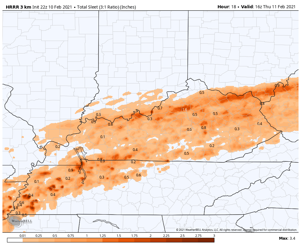
Instead of sleet, much of that is likely to be in freezing rain form.
Here’s the snow map from that same run…
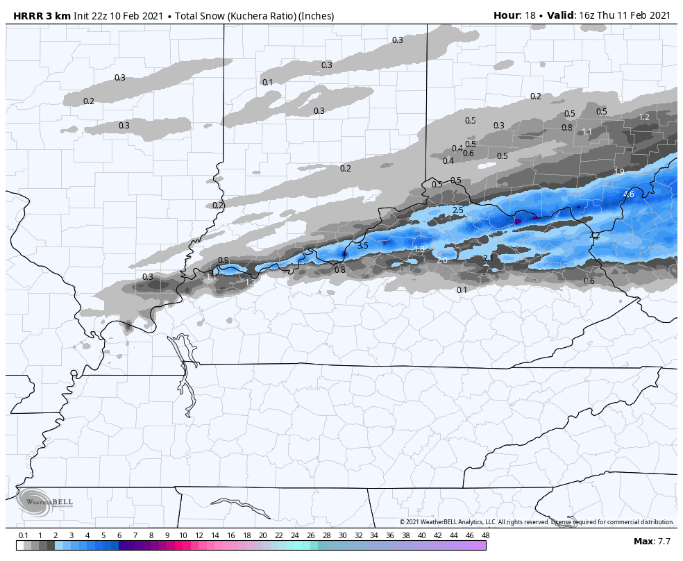
Again, it’s likely overplaying the snow as well.
Notice how the RAP has much more of a freezing rain signal through early tomorrow afternoon…
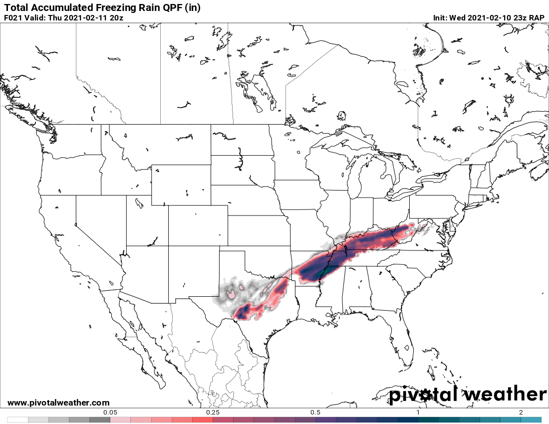
That matches up well with the current forecast and the current radar trends.
Power outages are already starting to come in and I suspect we will have many more to come tonight into early Thursday.
I will have the latest on WKYT tonight at 11, but I leave you with your radars…

Make it a good one and take care.

The only good thing I see looking over all the models on the website is that at least I am not in dark blue bruise segment.
Just now starting to accumulate on trees in north Richmond and coming down about medium pour now. Does seem the main ice action shifted more north than expected earlier today, since they were to be more on the sleet side of things. Hopefully if we can keep this less than .5″ for most areas, to reduce power issues. A bird can land wrong on a tree where we live and the power could go out.
Given the flow of next weeks system, seems perhaps the cold air decided to stay more up north? The really cold air has been showing a week or two out every week for us. Running out of winter runway.
Can anyone report how much ice has accumulated in the Louisville metro where power outages are occurring.May help in determining how much to expect as it moves East.
I still have my power at this moment. It is now sleeting and snowing.
A few moments ago I walked outside and shovel my back porch & I did hear a tree or branch fall or the tree was bending in agony.
Lol.Nothing like a tree bending in agony.Been in a few of those situations myself.Stay safe and hopefully power remains on.
Heavy freezing rain here in Bardstown. The northward shift put us dead in the center of the heavy stripe. Have the generator and propane heater ready.
Good luck my living room light is beginning to flicker.
Btw the sleet at my house has changed back to rain.
I am a little nervous.
Hopefully you want need it.Know it’s hard to tell but how much accumulation of ice you think you have at the moment.
I really don’t know. All I can see in the dark is that all the tree branches are buckled. If this event went on for a few more hours I would be really nervous about my electric. Happy that there was no wind involved.
The best news of the night is that I did get back my Dtv.
We’re at around .2 inches of ice in Bardstown.
Approx. where are you in B-Town(don’t give exact…lol) I’m not that far out, I can overlook Walmart/Lowe’s/BG! We’ve had heavy frz. rn falling since around 6pm, maybe before…thinking about entering our 60- lb. Lab pup(he’s 6 mo’s old today!) in the Olympics Ice Dancing in a few years- he’s so suave out on the deckk!!! 😀 (He keeps trying to make me dance, too, but I’m too busy holding onto something……) Just moved into our new home late ’19, so wondering how the power grid is here, because prior home would shut down the whole street if we had 3 ice pellets or a thunderbolt….?! 😀 Stay safe, my friend! 🙂
I’m out towards Springfield. Typically our power situation is pretty good. Southern Nelson County, however, will probably mostly lose power if we get .5 or more.
Well, we aren’t too far apart! I just took a last gander outside, and it’s still coming down pretty good. Just heard a lot of sirens coming from BPD out this way, hopefully nothing bad?! Probably ‘Burg Hill….I used to live towards Boston and that is one road I don’t miss!
Just lost power in Bardstown. Heard a boom that woke me up.
Salt River outage map shows my area out but we still have power somehow