Good Thursday, everyone. Our ice/winter storm continues to press across the region with today’s focus more on the south and southeast. Significant amounts of ice continue to cause a lot of issues across the Commonwealth as this crazy active pattern rolls on. We have two winter storms that look to target us over the next week.
As mentioned, the ice storm shifts into southern and southeastern parts of the area today. This is where additional ice accumulations range from .10″ to .40″ today. Farther north, the ice aspect of the storm has transitioned into more of a wintry mix of sleet, snow and some freezing rain. This is still causing lots of issues for areas that don’t need any more. Tens of thousands were without power as of this writing and additional outages are a good bet early today.
Look at a sampling of the damage from Wednesday evening…
Lexington:
Tree and power lines down at Jefferson and Maryland, just beyond downtown Lexington. Police have section of the street blocked off. @WKYT pic.twitter.com/R7p9QszwYQ
— Shelby Lofton (@ShelbyWKYT) February 11, 2021
Make sure the sound is up on this one from Lexington…
@Kentuckyweather can’t see much of anything in the video, but you sure can hear the tree limbs falling outside the house. (Shillito Park area) pic.twitter.com/58HAIdLpmq
— Derrick Blevins (@DJB9580) February 11, 2021
Louisville
TREE ON A HOUSE‼️
6300 blk of Oakdale LnThe resident was home at the time but was not injured. Wildest thing of the night for sure so far. @WHAS11Doug @WLKYJayCardosi @MarcWeinbergWX @WHAS11Ben @KevinHarned @NWSLouisville #kywx #LouisvilleKy pic.twitter.com/dxO4dLJMKh
— J.T. Yuodis,PIO (@PIOYuodis37) February 11, 2021
Just hit up my @kentuckyweather Twitter feed to find all the latest pics and videos from this storm.
I suspect we will get a few similar images out of the south and southeast today as this next round of freezing rain focuses here.
Road conditions areawide will be awful today, even after the precipitation stops falling.
The pattern from here continues to be absolutely loaded. A pocket of light freezing rain or freezing drizzle may linger into Friday across areas of eastern Kentucky.
Another system then works into the region on Saturday and may bring a wintry mix across central and eastern Kentucky…
NAM
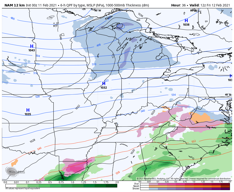
That could actually get a little messy.
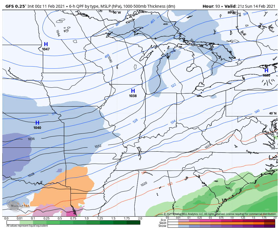
From there, we have the potential for back to back winter storms next week with the first arriving Monday and Tuesday with the other a few days later…
I will have your normal updates later today. Until then, here are your radars to follow along…

Have a good one and take care.

We just transitioned to sleet in Bardstown
Thanks Chris, As usual the greatest updates. hope you and your Family are warm and safe.
Don’t really know how much ice has accumulated here in Taylor county until it gets later in the morning.
So far we still have power, But I wouldn’t be surprised if we loose it sometime today.
Take care everyone and may God Bless.
We’re still entrenched in pure Arctic air in the Chicago Metro Area, as it’s 5 degrees above zero here in the SW suburbs this early morning under a deep snowpack. The last six days have featured highs ranging from the single digits to teens, with lows ranging from the single digits to below zero. More cold and snow is on the way for the weekend, but it remains to be seen if any of that snow will be significant.
It’s Unfortunate That Kentucky Is Almost Always In The Shallow Cold Air.
Many Years Ago The Arctic Fronts Would Sink Farther South And If They stayed Long Enough With An Active Subtropical Jet stream We Would Get Snow Instead Of This Destructive Ice.
As Always It’s Too Early To Predict The Next System.
I am preparing myself for another two ice storms next week. Hopefully for the folks in w. Ky. you might get some snowfall out of it.
Here in Louisville I have given up on this winter.
Ready for some spring weather.
Here’s Some Real “EYE CANDY” From Our Friends GFS (Accumulated Snow Over Next Ten Days.)
https://weatherstreet.com/models/gfs-acc-snow-forecast.php
The Above Accumulating Snow From The GFS Will Likely Disappear Or Shrink In A Couple Of Days Or Less.
They Will Finally Realize The Mistake They Made.
Now That It’s Light Enough Outside, We received 0.25 Inches Of Ice On The Trees. A Ten To Fifteen MPH Wind Will Bring Tree Limbs Down And will Probably Take Our Power Out Later.
Hang In there Everyone.
nothing but lots of rain here in pikeville, which im thankful. radar shows ice/freezing rain but its not on the ground yet. however, the tree tops are glazed over on some of the higher elevations. at 5am it was 36*. its 803am and its still just rain. local mets say its gonna change over this morning and be a freezing rain mess throughout the day. i certainly hope we continue to dodge this icy beast.
Some Parts Of Tennessee Reported Thunder Ice.
Chris…thanks for your expertise and time. Much appreciated. All the best.
We be in a deep freeze when the next storm hits I don’t think we will have toworry about ice in the next go around.
W. Ky. appears to be in the best position to receive some real significant snow accumulations next week.
At The Latest It Looks Like All Snow For Your Area in Northwest Kentucky And Maybe Heavy Snow.
I Think My Area Will Be In The Low’s Path Or The Dry Slot Of The Storm.
I Hope We Don’t Get Ice Again Before The Dry Slot Enters Our Area.
I Can’t Believe We Still Have Power !