Good Wednesday to one and all. It’s another gorgeous mild day across the Commonwealth as temps have us thinking spring thoughts. A weak cold front will drop in here tonight, knocking the numbers back down. This is also kicking off a pattern that continues to look super-active for the close of February and this rolls into early March.
Temps today reach 60 or better for much of the state. Southeastern Kentucky may even push into the upper 60s for a time on a gusty southwest wind ahead of our cold front. This front will touch off a few showers by the evening hours. Here are your radars…

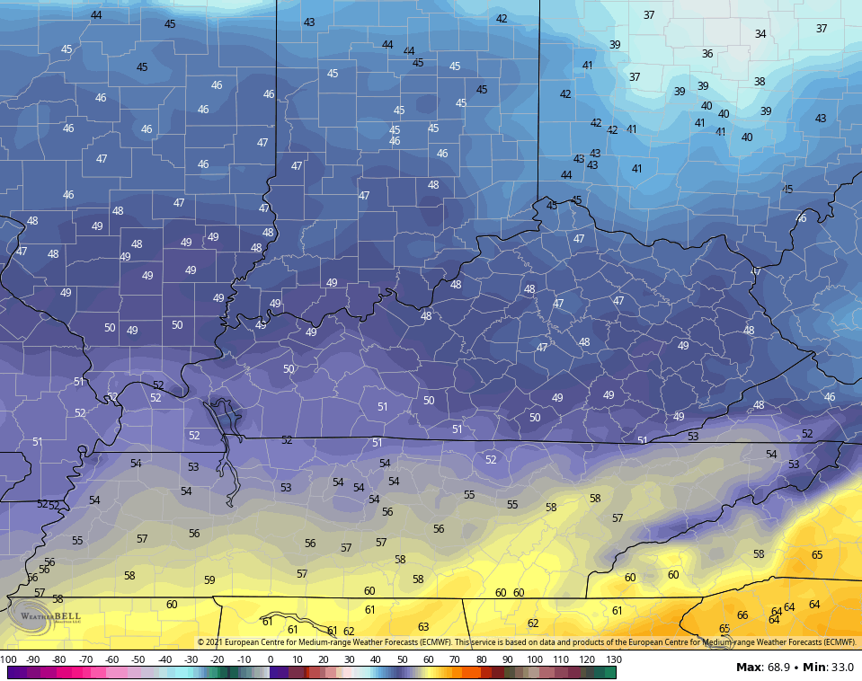
Temps come back down on Thursday with many areas in the 45-50 degree range which is close to normal for this time of year…
The pattern will then send rain makers our way starting Friday into early next week. The timing on these remains a little tough to pin down, but the potential is there for several systems that can bring heavy rains our way. Showers and thunderstorms look common this weekend into Monday…
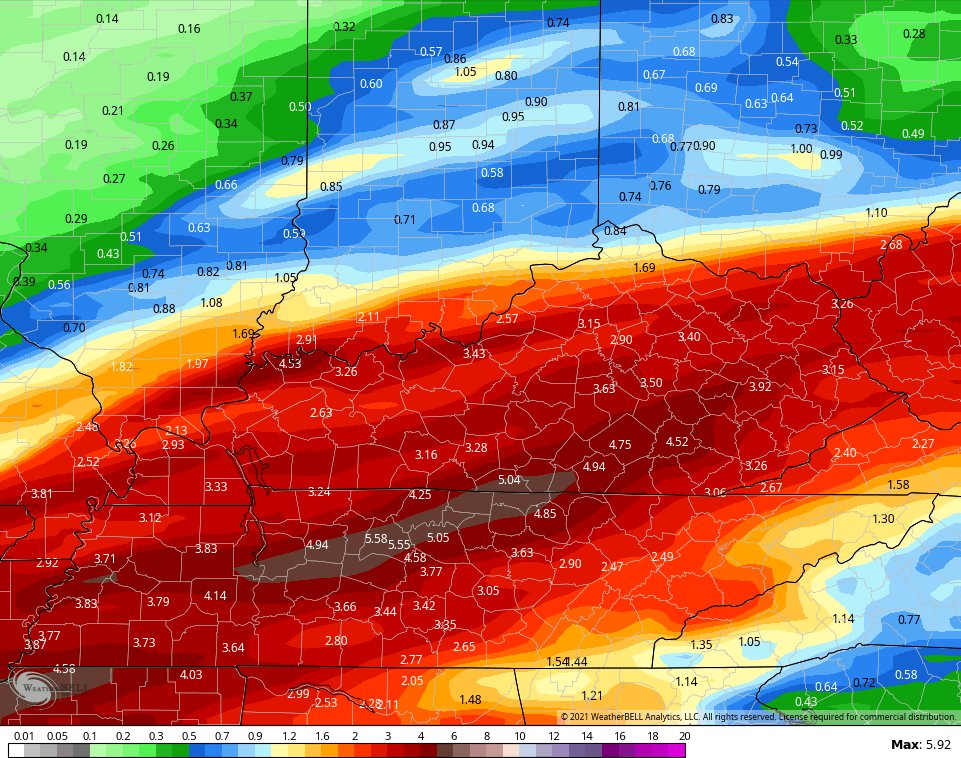
The new version of the GFS is picking up on this heavy rain very well. Here are the totals through Monday…
The Canadian is also on it…
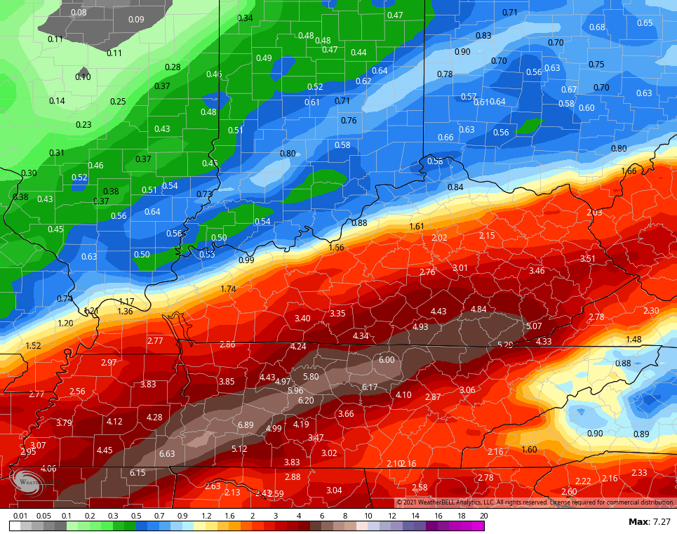
So is the EURO
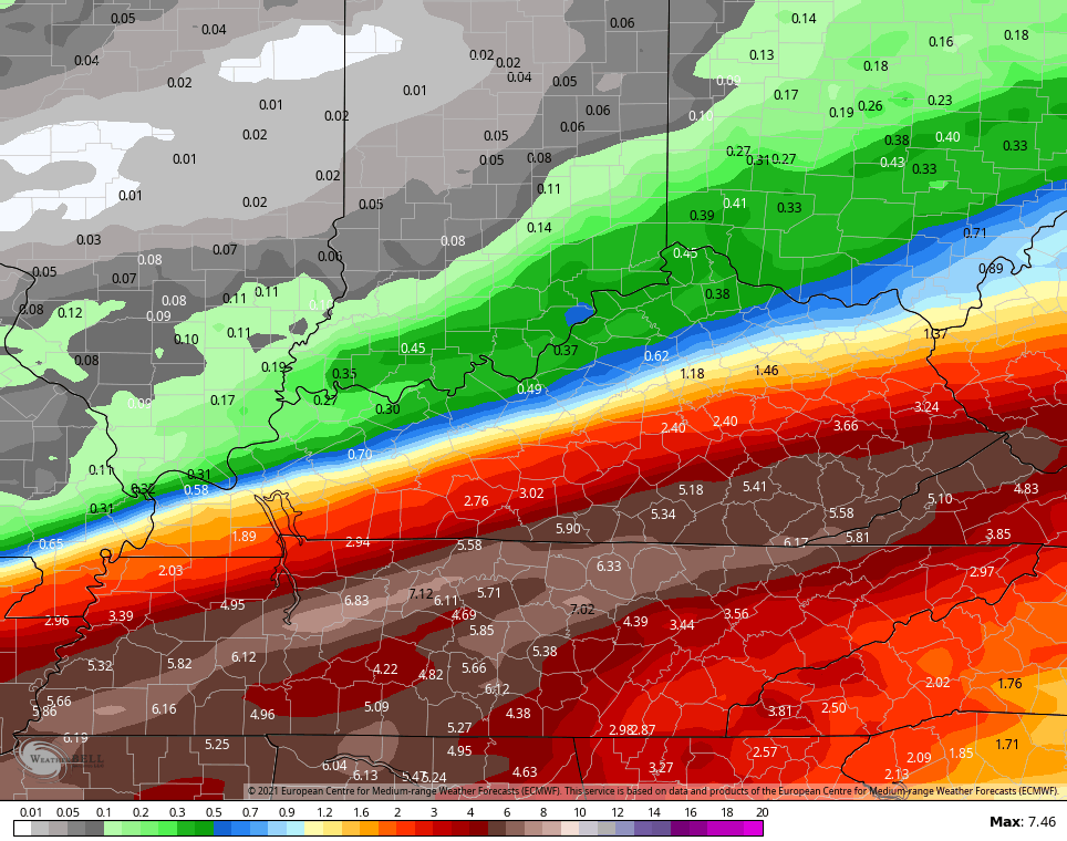
Been trying to get you guys ready for this potential since the last winter storm ended. It’s a setup that, if it happens, can easily cause high water issues.
Yesterday, we looked at the long range EURO WEEKLIES that were indicating above normal rainfall through March. The GFS Ensembles Extended also show this through March 28th…
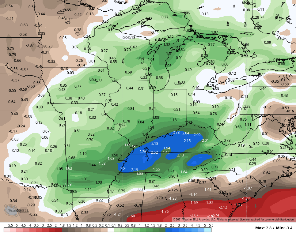
The Control run is even wetter…
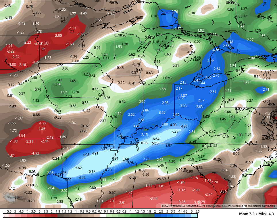
#MarchMud might be trending in the coming weeks.
I will drop by for another update later today, so stop back. Have a good one and take care.

It was the warmest day of the year Tuesday at Chicago’s O’Hare Airport, with a high temperature of 47 degrees under mainly sunny skies. Very impressive to get so mild with such a deep snow pack, which has eroded some the last few days with the mild temps.
Very little precipitation if any is forecast here through Sunday, which is a good thing because any significant rain combined with the melting of all the snow would create major flooding problems.
Absolutely beautiful weather here in central Kentucky. High temperature of 61 degrees yesterday with light winds. The only thing left of the Snow and Ice is piled in front of my East facing porch steps that came off my steep roof.
The Arctic Air has returned to Europe and Asia and of course has retreated in North America’s Arctic. Will it change again and give us another bout of severe Winter weather as we enter the month of March ?
My guess is YES ! Just hope it happens before all the plant life breaks dormancy.
It just figures that this year instead of March Madness, we’ll have March Mudness to look forward to.
I wish we could go 7 straight days without any thing following from the sky.