Good afternoon, folks. Temps today have us thinking full blown spring and your friendly #TeamSpring President is loving it!! Unfortunately, with the good comes the bad and the bad looks to be a lot of rain ahead. Rounds of showers and thunderstorms target us this weekend into Monday and may cause high water concerns.
Let me kick this off with tracking a cold front across the state today. This is bringing a band of showers in from northwest to southeast. This will actually increase a bit as it moves into the south and southeast. Here are your radars to follow along…

Waves of rain then look to target the region from southwest to northeast this weekend. The first round arrives Friday into early Saturday, but the main action should take us from Saturday night through early Monday. That’s when thunderstorms try to get in the mix, upping the ante for hefty rain totals.
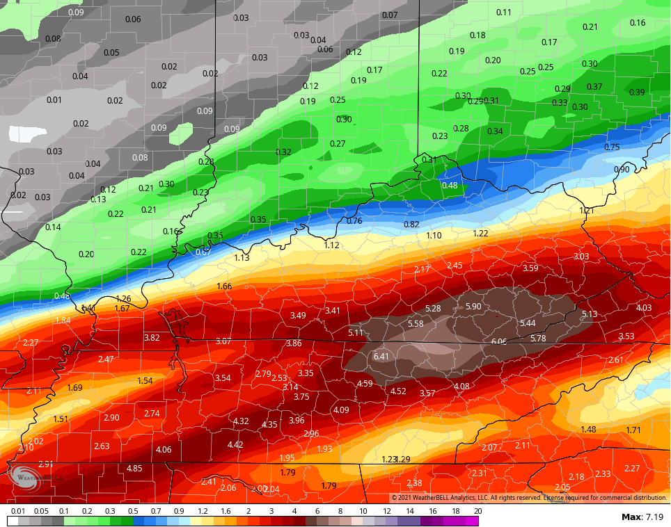
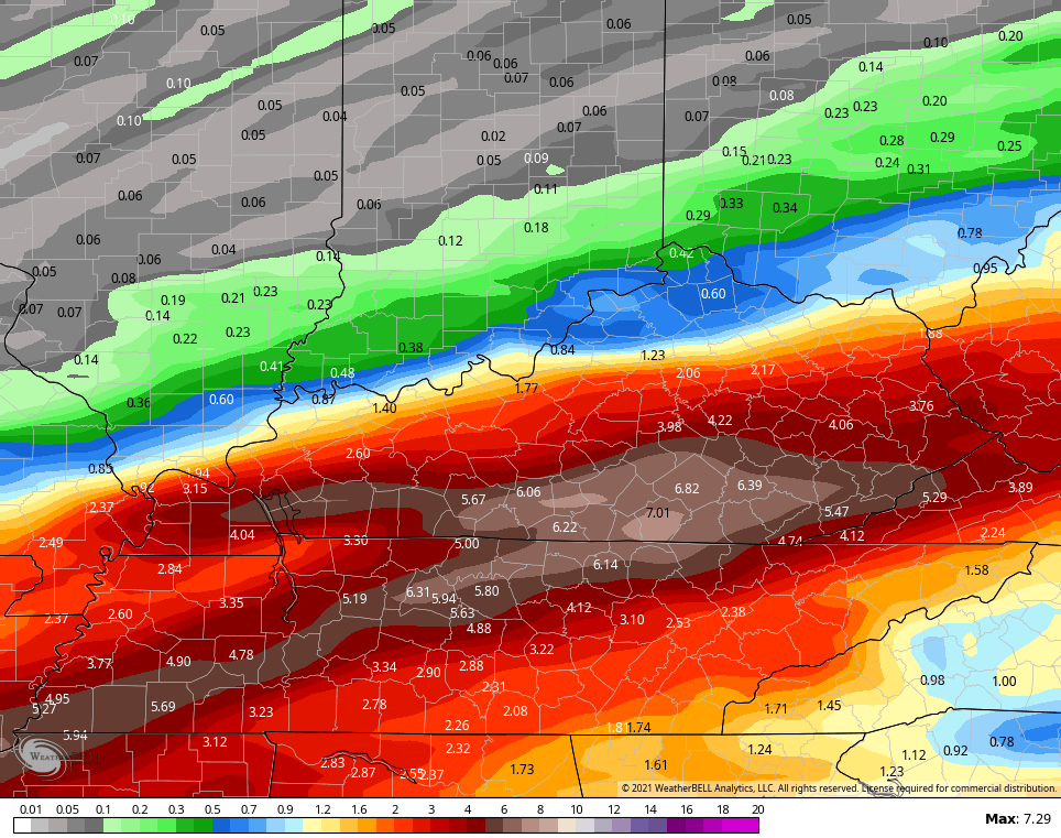
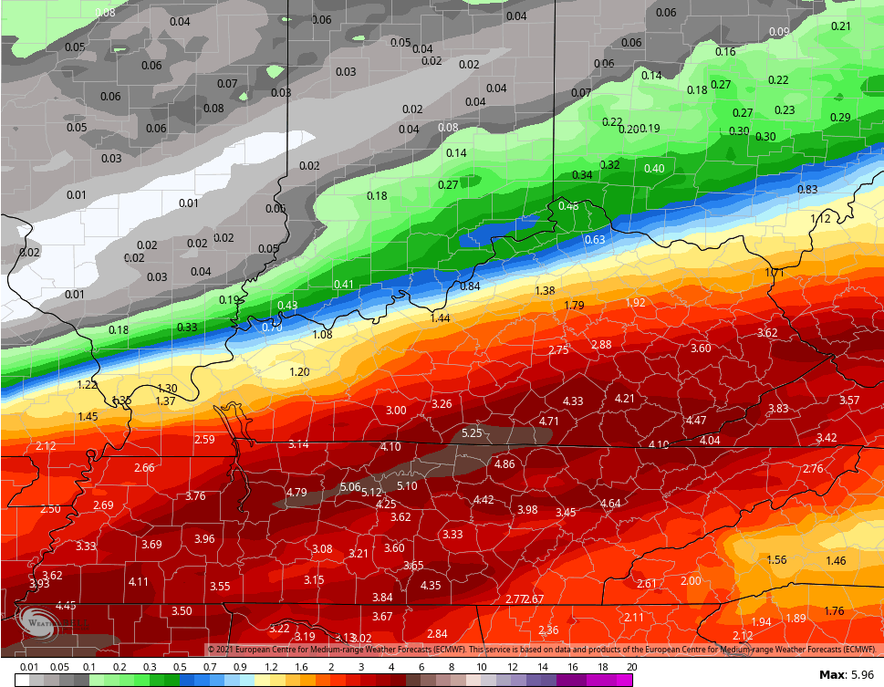
The greatest threat for several inches of rain looks to be across the southern half of the state and the models are going all in on this. These totals would cause flooding issues…
GFS
NEW GFS
EURO
Ugh.
Enjoy the rest of your day and take care.

Southeast Ky. is the place to be if you love rain.