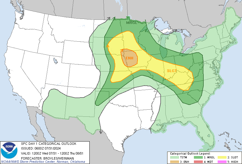
Good Wednesday, everyone. We continue to watch the increasing potential for strong to severe storms impacting the region through Thursday. This comes as a big time storm system rolls out of the Mississippi Valley and into the lower Ohio Valley over the next few days.
Let’s kick it off with a breakdown of how things may play out:
- Much of the daylight hours will be dry for most of the state as temps warm into the mid 60s and low 70s for highs.
- At the same time, a major severe weather outbreak is kicking off in the Mississippi Valley. This will continue into tonight with strong tornadoes possible in that area.
- A few rounds of storms begin to work into western and southern Kentucky late this afternoon into the evening. Some of those may be strong or severe as they push to the northeast.
- Rounds of storms then continue tonight for much of Kentucky. These storms may contain damaging winds and large hail as they zip through from southwest to northeast.
- With the low pressure working on top of us Thursday, we will need to be on guard for additional clusters of strong to severe storms developing. The best chance for this will be across central and eastern Kentucky. Large hail, damaging winds and even an isolated tornado will be possible.
- The Thursday threat for severe weather will increase a bit if we can get some midday sunshine to aid in the destabilization of the atmosphere.
Here’s today’s Severe Weather Outlook from the Storm Prediction Center…

This is the up close and personal look for Kentucky…

Here’s the Severe Weather Outlook for Thursday…

Much colder air crashes in behind this Thursday night as showers taper off and may even flip to a few flakes for a time by Friday morning. Highs may stay in the 40s for many on Friday before we bounce back in a big way for a nice weekend.
I will have updates later today. I leave you with your storm tracking toys…
Possible Watch Areas
Make it a good one and take care.


Chicago’s O’Hare Airport received 1.8 inches of snow from the Monday system, while in the SW suburbs just 0.3 inches of snow fell. It was the first measurable snow here in over three weeks, putting the season’s total at 48.8 inches for O’Hare and 46.6 inches for the NWS forecast office in the SW suburbs. It’s still going to be a challenge to reach 50 inches since it’s so late in the season.
A cold, heavy, wind-driven rain is expected here late tonight into Thursday.
Would rather have the cold rain than the severe weather that may invade our weather later today.
Those that study or chase Springtime storms must be really excited this morning, especially in the state of Mississippi.
Looking forward to the cooler drier weather this weekend. Hopefully, with lots of Sunshine.
Looks like clouds are going to hang tough keeping us in the low to mid 60s instead of low 70s today.