Good Thursday, everyone. It’s another day of tracking rounds of storms across Kentucky and a few may be strong or severe. We are also on guard for local flash flooding as these storms continue to put down a lot of water in a short amount of time. This action looks like a primer for a stormy first week of May.
The rounds of storms coming at us today will continue to pack the potential for damaging winds and some hail. That’s why the Storm Prediction Center continues to place much of the Commonwealth in a Slight Risk for severe storms…

Several areas have already picked up quite a bit of rain and additional heavy rains today may cause flooding issues. A Flash Flood Watch is out for much of the area through today.
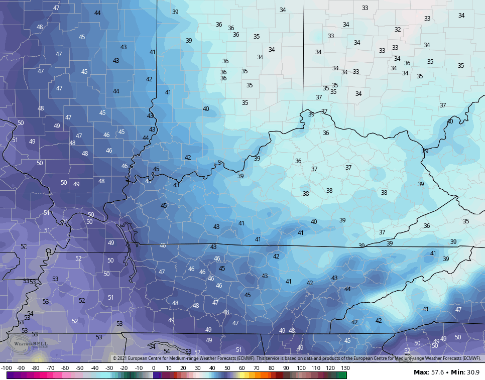
The weather improves quickly just in time for Oaks and Derby Day. Highs on Oaks Day will be in the 60s for many as a cooler and drier wind blows from the north. This cool wind may usher in a kiss of frost to start Derby Day as lows hit the 30s across central and eastern Kentucky…
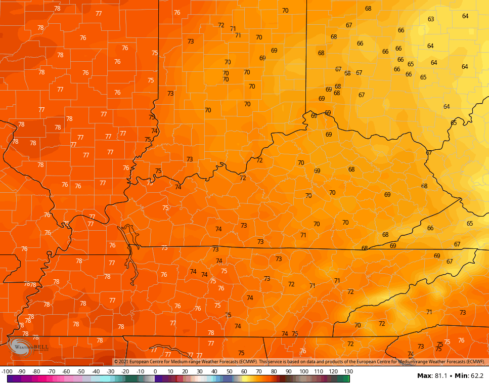
Highs should range from the upper 60s to middle 70s across the state.
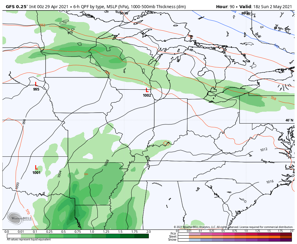
The setup after this features warm and moist air surging back in from the southwest as we see rounds of storms returning as early as late Sunday. That would continue through the first half of next week…
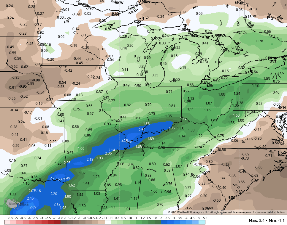
The GFS Ensembles show well above normal rainfall for the next 2 weeks…
That’s a stormy look for a lot of folks and the severe risks will also be showing up.
Here are your Thursday thunder trackers…

Current watches

Possible Watch Areas

Make it a great day and take care.

I am glad to see the weekend is looking great.
Last evening we had a garden variety thunderstorm that dumped around an inch.
This was an isolated event as the more pronounce rains and storms were will to our north and West.
I think today we will get in on the real action with the storms.
Landscape plants and native trees are beautiful and I can hardly wait till the Rhododendrons and Mountain Laurel bloom. My favorite plants.
The State of Kentucky is bless to have these plants ( Rhododendrons and Mountain Laurel ) as natives in the Eastern part of the State.