Good Thursday, folks. It’s a better day out there, but it’s still well below normal across the region as we wait on another cold front to drop in from the northwest. This will usher in chilly temps for the next few days as we continue to settle into a much cooler than normal pattern… Again.
Winds are gusty from the southwest ahead of our front today. Temps respond to the 60s as clouds thicken and a few showers and storms arrive by evening. Some of these storms may be strong or locally severe across western Kentucky, especially. The SPC has us in a low end risk for severe storms…

Hail and high winds are the main players.
As skies clear behind this, temps may reach the mid and upper 30s by Friday morning…

A few showers will still be noted on a strong northwest flow on Friday with highs struggling to get out of the 50s.
Saturday starts with 30s in the north and east…

Clouds will increase quickly from the southwest with showers developing quickly from southwest to northeast. Where the rains develop early on, high temps may be kept WAY down…

This brings us to an interesting setup for Saturday night and Mother’s Day. As low pressure develops in the Mississippi Valley and rolls eastward, a warm front will be draped right on top of us and this could fire off some strong to severe storms. Areas along and south of the warm front will need to be on watch for some big boomers…

Cooler air comes in behind that and this cool is pretty nasty. The 7 day average numbers from the 51 member average of the EURO Ensembles for May 7-14…
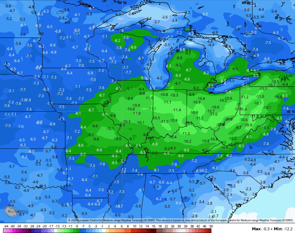
Ugh.
Make it a great day and take care.

I’ll second that UGH !