Good Wednesday to one and all. We continue to track some big changes blowing into the region behind a strong cold front. This ushers in a much cooler pattern before rounds of storms kick back in for Mother’s Day Weekend and into next week.
Let’s begin with what’s going on out there today. Gusty showers will be around this morning across central and eastern Kentucky as cooler winds take control. Whatever showers are left will show up on your radars…

Partly sunny skies take over this afternoon with temps reaching the low and middle 60s for many… That’s well below normal once again. By Thursday morning, a few readings may drop into the upper 30s…

This likely won’t be the last morning with the 30s. 😭
Temps recover into the 60s again ahead of another cold front dropping in by Thursday evening. This will have another line of showers and thunderstorms with it. A few northwest flow showers may linger into Friday…

Friday is another VERY cool day with highs in the upper 50s east to upper 60s in the west…

That brings us to Mother’s Day Weekend and the increasing potential for rain and some storms. The rain will actually scoot in here on Saturday and this may keep temps in the… GULP… 50s. The GFS has showers keeping some areas in the… DOUBLE GULP… 40s…

The storms would try to join the party for Mother’s Day with another system following that up a few days later…

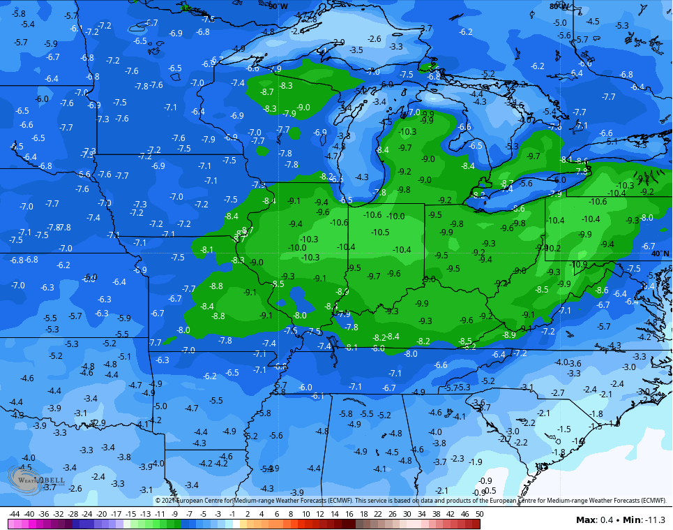
I’ve touched on the potential for a much wetter than normal pattern taking shape through the rest of May, but the current trend is also for a well below normal temperature pattern. The EURO Ensembles average temp departure for the second week of May is absurd…
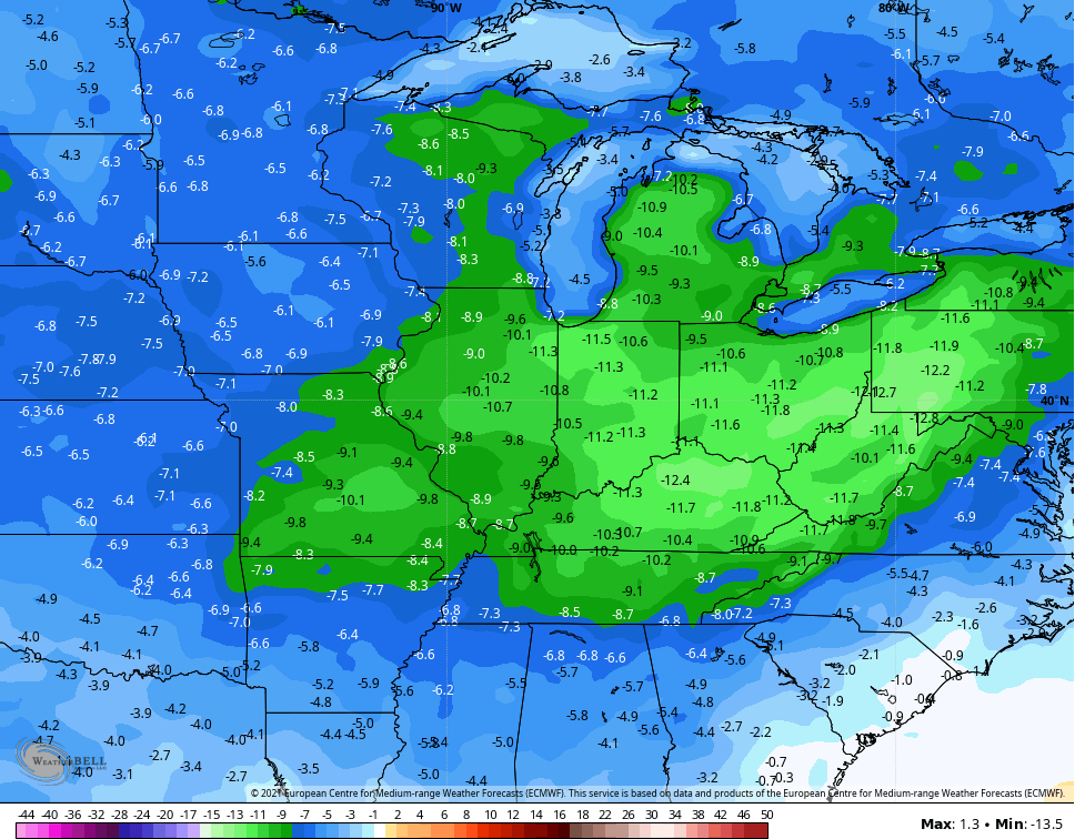
The Control run for the same period is even colder…
Once again, this spring pattern is running pretty close to the 2020 pattern for the same time. I expect this to roll right on into the summer with another tame one in the making.
Have a great day and take care.

I hate this. We need a small dry spell and heat.
Two inches of rain with this latest event. No severe weather to report in my county of Taylor.
Looks like a slow start to Summer.
May be due to the volcanic activity somewhere ?