Good Friday to one and all. It’s a windy and cool day across the Commonwealth as we focus on our Mother’s Day Weekend just ahead. It’s a weekend that features a potent storm system bringing some ugly to our region, including the potential for strong storms on Mother’s Day.
Let’s begin with our Friday and roll forward. Highs today struggle from the upper 50s to middle 60s across the entire state. The day starts with some showers in the east and may end with another line of showers dropping in from the northwest. There’s even the potential for some thunder and small hail out of this. Here are your radars to follow along…

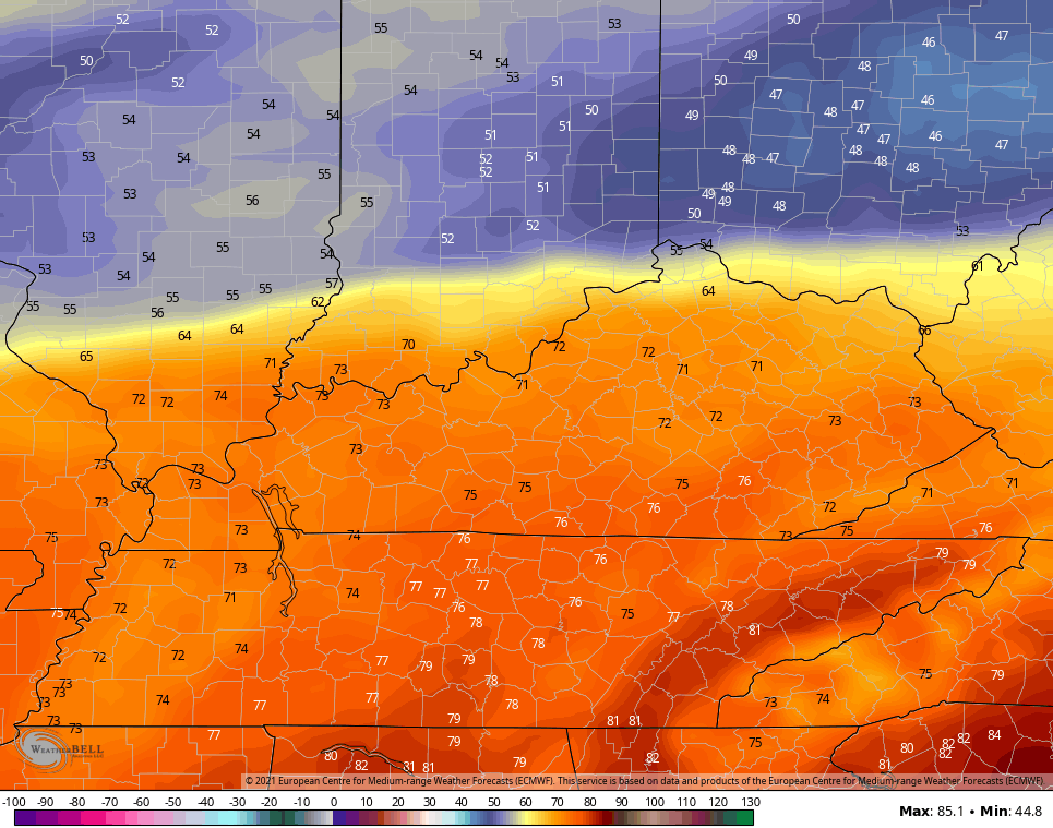
The weather picture for Saturday is looking just a bit better as we get closer. Temps may start in the upper 30s for areas with clear skies, but clouds will be slowly increasing from the west and southwest during the day. Given the clouds verses sun thing, it makes high temps tough to pinpoint for any one area. Lets say highs now range from the upper 50s to middle 60s.
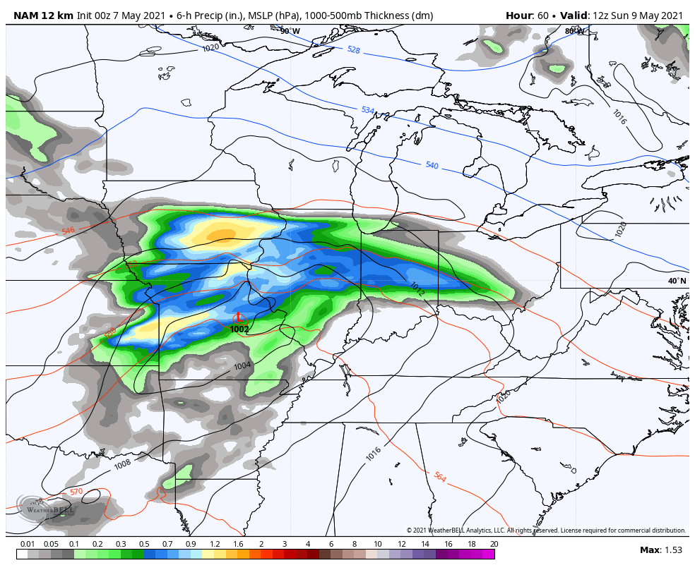
Low pressure then strengthens across the Mississippi Valley and works into the Ohio Valley on Sunday. The track on this continues to edge a little farther north with each model run and that does a couple of things. The first is that temps can spike warmer and briefly hit the 70s…
This allows more instability and gives us a better threat for strong to severe storms, especially during the late afternoon and evening…
Cool air then crashes back in to give us another week of solidly below normal temps across Kentucky. There’s also another potential rain maker around the middle of the week.
The overall pattern looks to flip toward warmer by next weekend into the following week. Watch how we start to see more of a ridge on the EURO Ensembles…

Bring. It. On!
Make it a great day and take care.

Yes to warmth and sunshine.
Very threatening skies yesterday evening without any rain or storms in my county of Taylor.
Severe weather this Spring has been a no show and I hope it continues. Looking forward to more warmer days with Sunshine and cool nights.
Actually, I like warm days and cool nights.
I had the lowest energy bill I ever had last month.
The only complaint I have is the flooding rains.
My heating and cooling bills are almost always reasonably priced, but that may change in the near future ?
We have not had as much rain as you have had in Louisville.
Seems like the storms die out before reaching my area of central Kentucky.
So far knock on wood.