Good Sunday, everyone. After a record cold Saturday across Kentucky, temps remain on the chilly side out there today, but things slowly moderate into Memorial Day. Once into June, we look to get into a pattern that turns rather stormy.
Let’s begin things with what’s happening out there today. Clouds are going to linger across the eastern half of the state, with some sun out west. This will lead to a big time temp gradient with the east in the 50s and the west closing in on the low 70s. Areas between the two will be solely dependent on how much, if any, sun you can get.
Memorial Day looks really nice with highs generally in the 70s.
Meteorological Summer starts on June 1st and it looks to begin with rather tame conditions. Highs are in the upper 70s to low 80s as clouds begin to increase from the west and southwest ahead of our stormy setup. I can’t rule out a late day storm on Tuesday, but much of the action looks to kick in on Saturday. This will then stick around for a while.
The rainfall forecast through the first two weeks of June from the GFS…
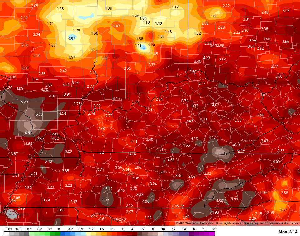
The Canadian Ensembles through the same time…

Temps are likely to average around normal during this time.
Since our temps are on the frigid side at the moment, I thought you might be interested in seeing the first seasonal forecast for next winter. The CFS looks familiar…

That looks a lot like our February temperature pattern and is similar to the once we’ve been in since April. Hmm 🤔
Have a great Sunday and take care.

I think you meant to say Wednesday when storms kick in.
Today & Monday looks to be great for my locality.
yesterday and todays weather is absolutely atrocious here in my corner of pikeville. i cant ever remember it being “turn on my heat” cold this close to june. i find it miserable, and right down depressing. seems the cold & rain of winter is still trying to drive me crazy. mother nature knows i despise winter and shes doing this on purpose 🙂