Good Monday, everyone. On this Memorial Day, we honor those who gave the ultimate sacrifice for our amazing country. For all those who have served, or are currently serving, thank you for your service. In terms of the weather out there today, things are looking pretty nice, but showers and storms are ready to rumble back in beginning Tuesday.
Our day starts with a few spots trying to drop back into the low 40s. Highs are in the 70s with partly sunny skies showing up. This is still cooler than normal as we put the wraps on one of the all time great late spring cold snaps. May as a whole comes in much colder than normal for the entire region.
This was also the quietest severe weather May I have ever seen around here and it continues the trend of the year. Here are the severe weather reports since January 1st here in Kentucky…
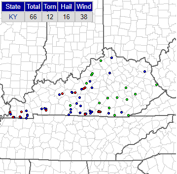
Again, those are just reports. We should be well into the hundreds by this point in the year. The spring severe weather season is likely the quietest in recorded history here in the Bluegrass state.
Showers and storms are set to return as we kick off Meteorological Summer on Tuesday. The first day of June will feature scattered showers and storms working in from the southwest late in the day. Here’s how the future radar looks…

Showers and storms then look to become a daily occurrence through the rest of the week and into the coming weekend. It doesn’t mean it rains every day at your house, but we will be tracking some action each day as a slow-moving upper low works into the region…

You can see the rounds of showers and storms spinning around this…

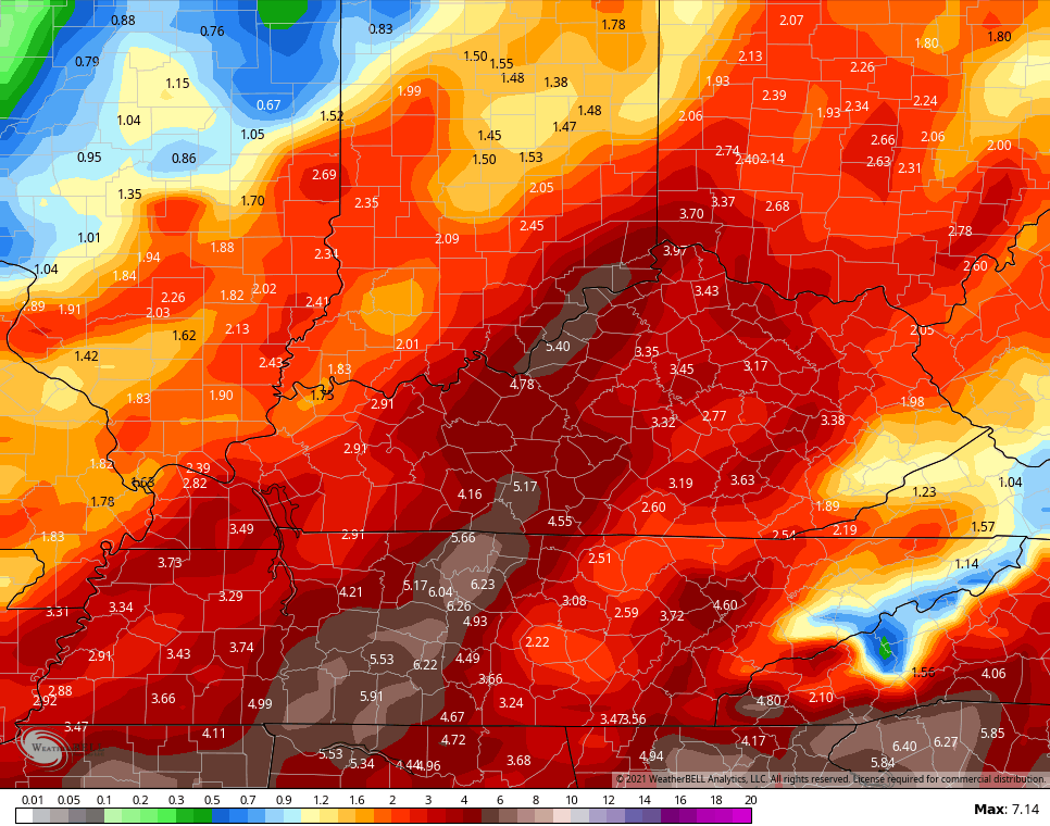
This pattern can produce some healthy rains through early next week…
Have a great Monday and take care.
