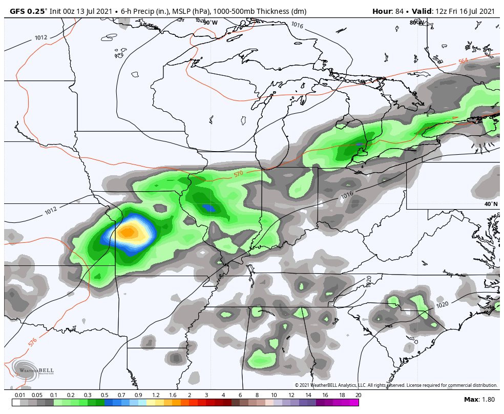
Good Tuesday, everybody. Storms have been a daily occurrence across the Commonwealth and there’s very little reason to believe this pattern changes much over the next week or so. This means additional showers and storms will be working through the area today, bringing the potential for a few big gusts of wind and torrential rains.
Today’s storms will be working through here from southwest to northeast. The Storm Prediction Center continues to indicate a low end severe threat for parts of the east…

Just like we’ve seen since Friday, these storms can put down enough rain to cause local high water issues to develop.
Storm chances come down as we go into Wednesday and Thursday, but the action picks up again by the weekend. That’s when another system drops in from the north and brings more showers and storms in here…
In terms of temps, you guys know this has been a tame summer around here and this was something I started picking up on back in the early spring. The average July temps to date are much cooler than normal from the plains east…

Here’s the GFS average temperate departure for the next 7 days…

Here’s the following 7 days from the same model run…

The overall pattern across the country continues to be stuck in neutral and has been in similar fashion since February.
As always, I leave you with your daily dose of storm tracking tools…

Current watches

Possible Watch Areas

Have a great day and take care.

So far in July, temperatures have averaged almost three degrees per day below normal in the Chicago Area. That’s quite a change from June, which averaged almost four degrees above normal. The last five days have seen high temps of only between 68 and 76 degrees.
We’ve had three straight days of on-and-off rain, which has totaled around three-quarters of an inch in the SW Suburbs.
Yesterday we miss the rains and after a gloomy morning we broke out into Sunshine with a humid high of 81 degrees. Any days in July where the high temperature is below 90 degrees is fine by me.
The warm ocean water in the North Atlantic would cause the NAO to go negative. If we could just stay in the neutral phase of ENSO we would have a better chance of a Snowy Winter ?
Until the PDO goes positive off the West Coast they will continue the extreme heat and drought in areas that don’t receive such insane high temperatures.
The Tropics remain quiet for now. Just give it a couple of weeks.
Here’s an article that explains the extreme heat and drought in our Western States. This is one aspect of meteorology that I have never studied. Maybe we all should pay more attention to this extreme warming ?
https://www.climate.gov/news-features/category/96/all
The persistence of the Northwest “Heat Domes” may actually strengthen the odds of a colder than normal Winter East of the Rockies, since it continues to heat up the Gulf of Alaska, which influences a corresponding movement in the Polar jet stream. This movement positions the jet to deliver Artic air into the Great Plains and Northeast, but it could also weaken the effects normally associated with La Nińa.
The persistence of the Northwest “Heat Domes” may actually strengthen the odds of a colder than normal Winter East of the Rockies, since it continues to heat up the Gulf of Alaska, which influences a corresponding movement in the Polar jet stream. This movement positions the jet to deliver Artic air into the Great Plains and Northeast, but it could also weaken the effects normally associated with La Nińa.