Good Monday, everyone. It’s more of the same out there today as rounds of showers and storms rumble across the region. This is bringing another day of a local high water threat and a few of the storms could be strong or locally severe. Guess what we have ahead of us? Wait for it… Wait for it… Wait for iiiiiittttt… more storms.
Some areas of the state picked up more than 4″ of rain over the weekend, so it’s not going to take much more to cause local flash flooding issues. Today’s storms are coming from the southwest as a surface low and upper level low spin just to our west. This may result in a few strong or locally severe storms and the Storm Prediction Center has us in a low-end severe storms threat once again…

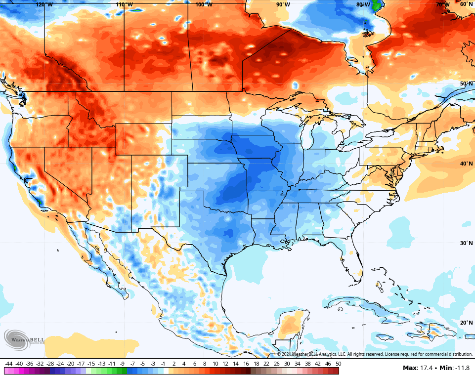
A similar setup is with us Tuesday and Wednesday as temps remain normal and below normal and this trend continues for the week. The next 7 days show below normal temps from the plains into our region…
The weekend and early next week will likely feature an increase in showers and storms as another upper level system drops in here from the north…

Check out the upper level low on the GFS…

Our tame temperature summer shows no signs of changing as we hit the midway point of summer this week. How hard is that to believe?!!!!
I’m have a day off from my TV job, so I may drop by for another update later today. Until then, here are your storm tracking toys to start the week…

Current watches

Possible Watch Areas

Make it a great day and take care.

I got my yard mowed Sunday afternoon so I’m happy.
The summer weather here hasn’t been ideal but its beats the dry hot weather out west.
Not complaining, but we could use some Sunshine in the coming days.