Good Sunday to one and all. Our stormy pattern continues out there today and shows little sign of going away any time soon. Waves of strong to severe storms will rumble across the region, putting down torrential rains that can cause flash flooding issues to develop.
Here’s a breakdown of what to expect:
- The storms come at us in waves today and into the first half of the new week.
- Each wave of storms can bring a damaging wind threat to any one area during this time.
- These storms are loaded with lightning and torrential rains. The torrential rain will lead to local flash flood issues developing.
- The concern comes when/if some of these clusters move over the same areas. That would up the risk for flash flooding.
- It’s important to note it will not rain all the time and you will have several dry hours to get some outdoor activities in.
- Additional showers and storms will be with us just about every day for the upcoming week. Those will also produce similar conditions to what we are seeing out there today.
- Temps continue to run tame for summer.
As far as the severe threat goes today, the Storm Prediction Center is has most of the region in a low-end risk for severe storms…

This low-end threat continues into Monday…

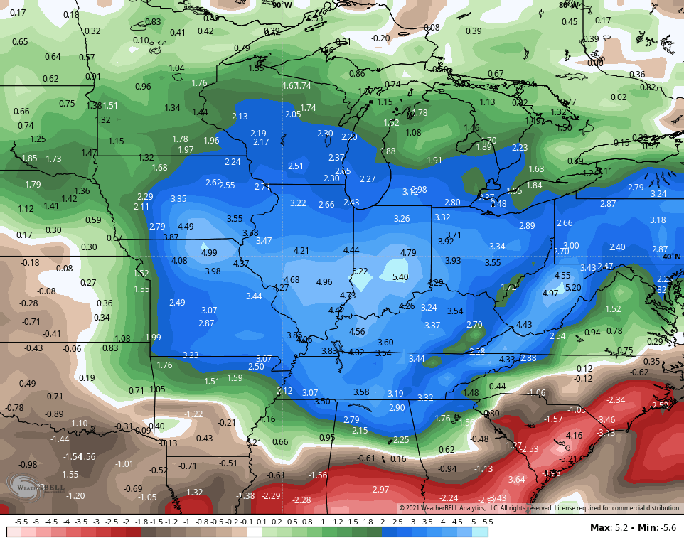
Folks, this is a stormy pattern and it looks to continue for the foreseeable future. The GFS Ensembles show well above normal rainfall for the next 2 weeks and change…
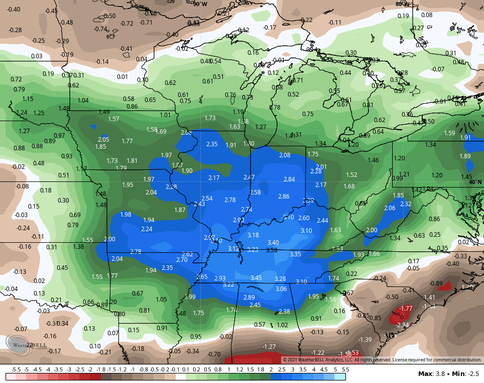
The GFS Extended Ensembles through August 13th keep this trend going wide open…
Here are your tracking tools for the day…

Current watches

Possible Watch Areas

Have a great day and take care.

I cam now proclaimed that the semi-drought at my home is over.
It reached 117 degrees on Saturday in Las Vegas, NV. This not only broke the all-time record high temperature for the date, but tied for the all-time hottest temp ever for Las Vegas! On four previous occasions, Las Vegas has hit 117 degrees, most recently in 2017.
In addition, the overnight low of 94 degrees broke the record for the date for the highest minimum temp.
Mike, lets go to the other extreme temperature ever recorded on Earth :https://wgntv.com/weather/weather-blog/what-is-the-coldest-temperature-ever-recorded-on-the-earth/
According to the Kentucky Mesonet, Taylor county received 1.77 inches of much needed rain and we are still adding to that total.