Good Thursday, folks. Many areas have had, at least, some rain for the past 7 days in a row and a few will make it 8 in a row out there today. 8 is great, but why stop there? Another system is on the way for the weekend, bringing more widespread showers and storms back into the bluegrass state as our cooler than normal and wetter than normal summer rolls on.
Temps today are deep into the 80s and may flirt with 90 in the west. A mix of sun and clouds will be noted and we will also see scattered showers and storms going up, especially across central and eastern Kentucky.
As always, here are your daily drop trackers…

Showers and storms will begin to move in from the northwest later tonight and increase later Friday. That’s when our system drops in from the northwest for the weekend, keeping rounds of showers and storms going…

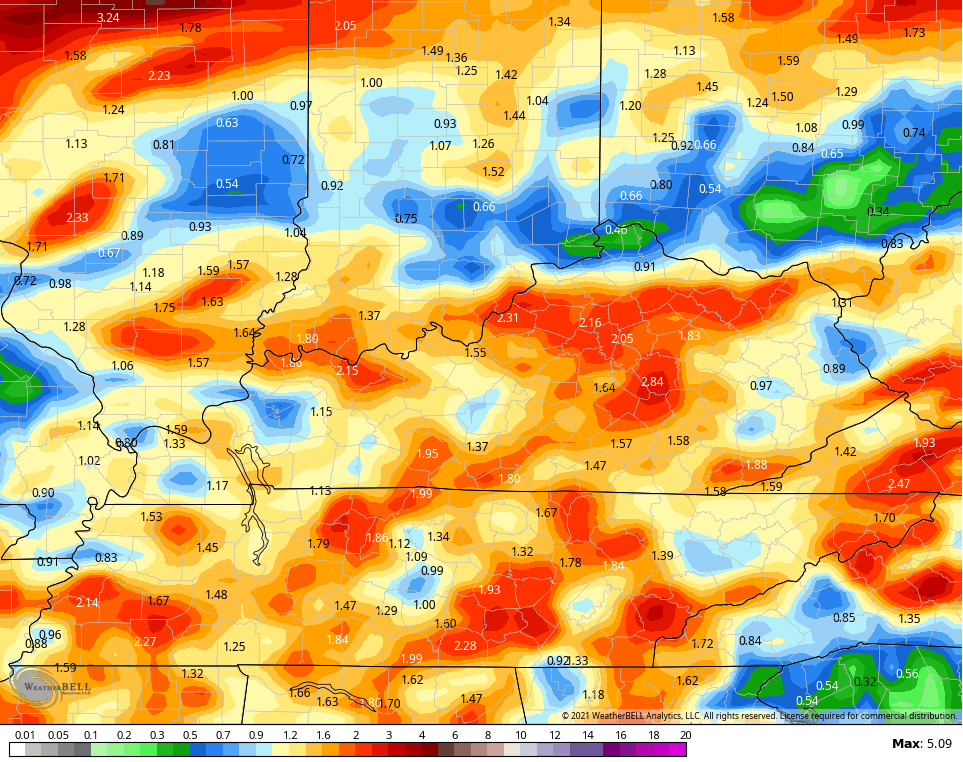
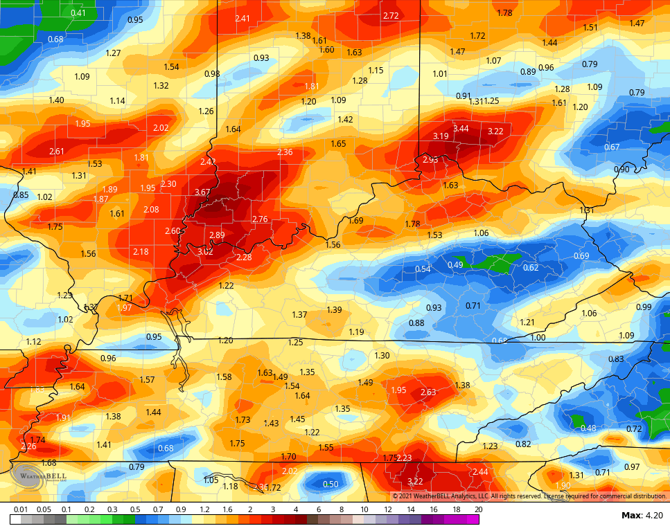
The good news is you will have some dry times out there. The bad news is heavy amounts of rain will fall from any storm that’s out there. Check out the rainfall amounts by Tuesday…
GFS
CANADIAN
Looking in the longer range toward late next week into the following weekend, a couple of the medium range models show a deep trough digging into the eastern half of the country…
CANADIAN
EURO

As we look at the latest CFS temperature forecast for August, you can see how this seasonal model continues to ride the below normal train…

It’s all in on September, too…

With today marking the mid way point of Meteorological summer, the chances for sustained heat continue to look low.
Have a great day and take care.

*thumbs down*
Probably in the last seven days we accumulated around 2.50 inches of rain here in parts of Taylor county. Now we need to dry out, but that doesn’t look like it will happen according to the local weekend forecast.
With the tame Summer temperatures in place, what will our Autumn weather look like ? I’m not going to even guess.
Yesterday at my house was great.
I did some work outside and it was very comfortable.