Good Friday, folks. We have an increase in showers and storms out there today and that’s a sign of what’s to come for the weekend. That’s when another system drops in here from the northwest and kicks off rounds of showers and storms, bringing heavy rains to much of the region.
Temps ahead of our front are back into the 80s today with a gusty southwest wind kicking up. Scattered showers and storms will be noted early today across the west and north, but the greatest risk for some showers and storms develops late today into the evening. Again, the greatest chances will be across the west and north. The Storm Prediction Center has a low-end risk for a few strong or severe storms…

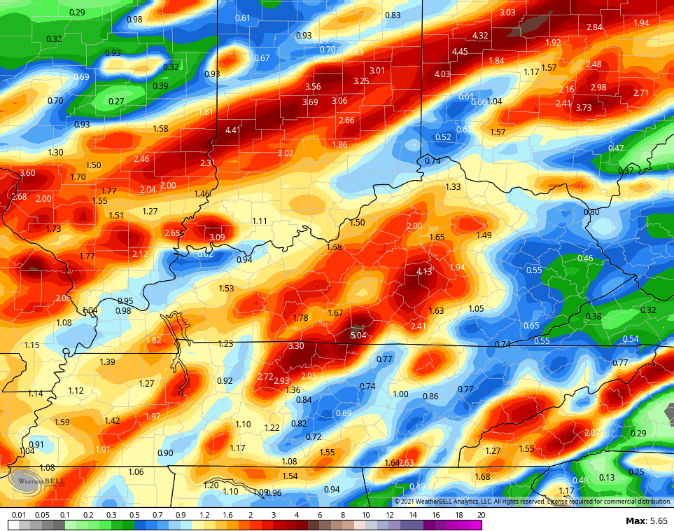
As we move into Saturday and Sunday, waves of showers and storms move across the region and bring the potential for heavy rains. Some of this action looks to hang around into the first half of next week. Locally heavy rains are a good bet for the weekend with some areas picking up some hefty totals. Here’s the NAM rainfall totals through Monday morning…
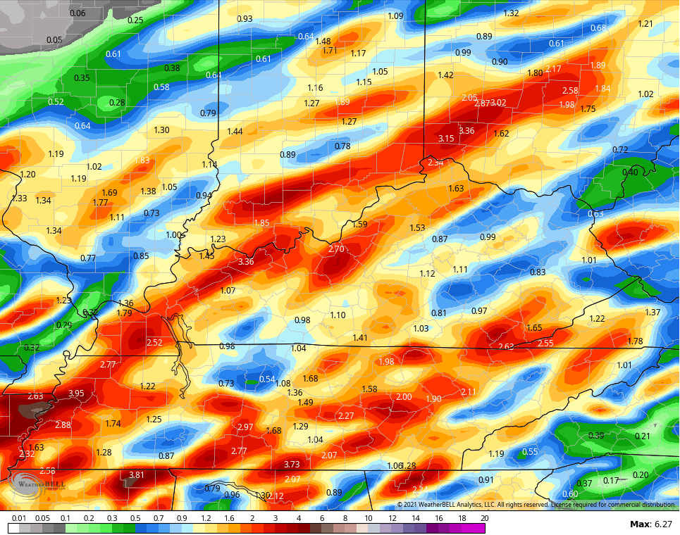
Short Range Canadian during the same time…
The GFS is on board with areas of very heavy rain through Monday…
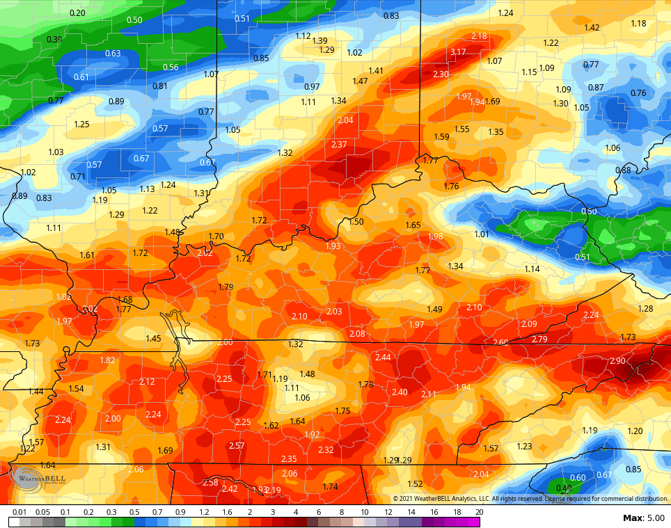
Obviously, the models show the typical deviations in totals and placement, but are all on board for heavy rains.
We may actually get a few dry days by the middle of next week before another big trough digs into the eastern half of the country…

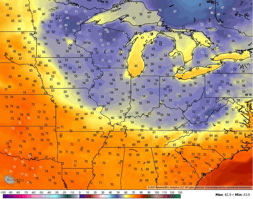
The latest GFS shows these numbers for lows a week from tonight…
The theme of the summer rolls on! 😎
Here are your tracking tools for the day…

Current watches

Possible Watch Areas

Have a great Friday and take care.

The theme of this summer is when you have a dry day take advantage of it, because the following day will be wet.
Wonder what the theme of this coming Fall and Winter will be like ???
Hoping the cooler weather for next week pans out. I need a break from the showers and humidity.
Tropics remain quiet, maybe due to dust in the atmosphere or that we are lock in on the neutral phase of ENSO.
Prediction that when we return( 65% chance) to ENSO La Nina the tropics will spring into action sometime in September ?