Good Monday, everyone. A cold front has stalled just to our south and it’s allowing for some pretty nice weather to take control of most of the region. As the week wears on, our attention turns toward another system or two dropping in from the northwest, bringing an increase in storms through the upcoming weekend.
As mentioned, the current setup finds out front slowing down across the Tennessee Valley…
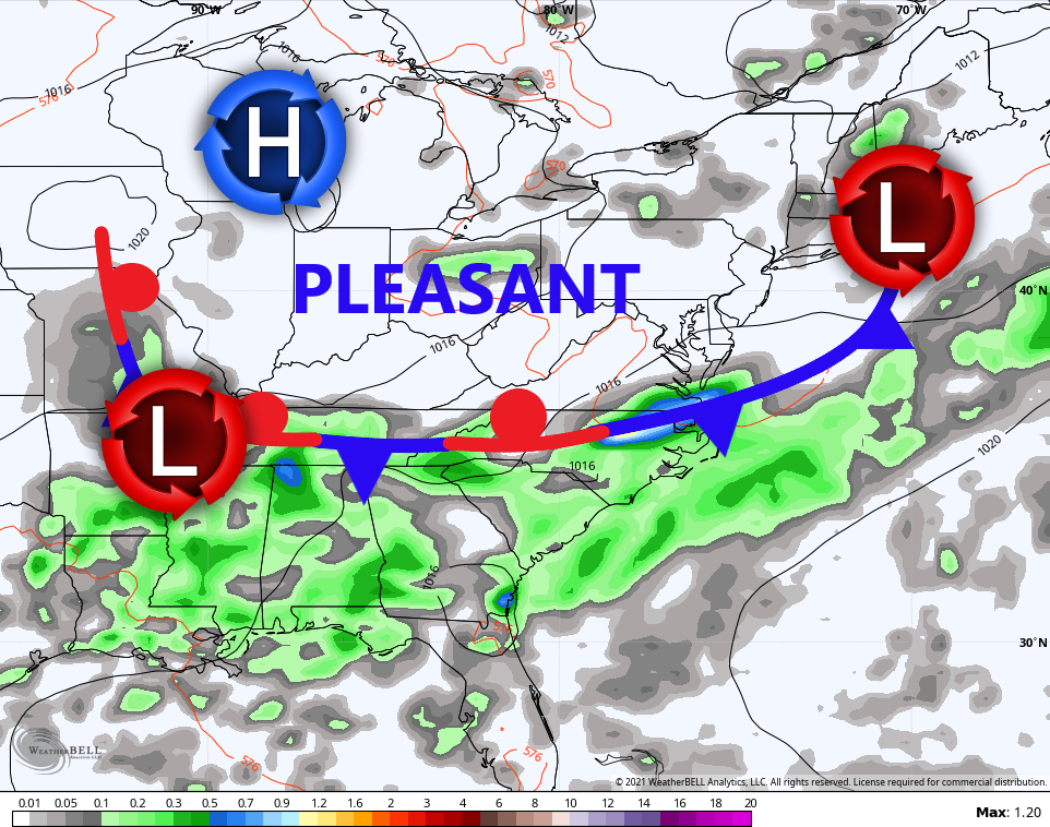
This will keep the chance for a storm or two going across the west and southern parts of the state. Much of the region deals with a mix of sun and clouds with pretty nice temps and humidity levels for the middle of July.
Here are your radars to follow the southern storms…

Tuesday and Wednesday look seasonable with just the smallest threat for a shower or storm. We start to see a few more storms returning to the picture by Thursday and Friday as a couple systems move in from the northwest. This keeps the storm threat going for a few days…
GFS

EURO

We are seeing the models backing off a bit on the intensity of the troughs working in during this time…

We will have to wait and see how those play out, but the less intense they are, the better the chance for a period of true summer temps showing up.
Make it a great Monday and take care.

I’ve had pretty much all that I can handle of “new normal” weather, and llook forward to a taste of “old normal”, if only for a little while!
Should be called a “lower dew point front” rather than a cold front, as there is not much change in the actual temperature. It will feel pleasant however and we may even dry out from the rains here lately ?
When it comes to the weather and the environment there is no normal.
I have notice that cold fronts are not moving as far South as in the past. Both Summer and Winter, but this may be due to the strong influence of the Bermuda High pressure system in the Southwest Atlantic and the phase of ENSO we are currently in. (neutral)
We haven’t had a long extreme heat wave this summer. *Cool* with me.
We will have to watch and see if that extreme heat in the North Central plains states makes into the Ohio valley later in the month ?