Good Tuesday, everyone. Temps continue to climb today as we see mainly dry weather across the Commonwealth. As we go into the second half of the week, we start to focus on a couple of systems dropping in here from the northwest. This setup will then keep a few storms around into your weekend.
Temps today are deep into the 80s with a mix of sun and clouds, with many areas still struggling to hit the normal high. We may also see a spotty storm or two popping, especially in the south…

A cold front drops in late Wednesday and may touch off a scattered shower or thunderstorm along the boundary. You can see the wind shift along and behind this front through Thursday morning…

That brings another shot of pleasant air into central and eastern Kentucky for Thursday. Here’s how the day starts on the NAM…

The afternoon temps really show how the boundary slows down from northwest to southeast on top of us…
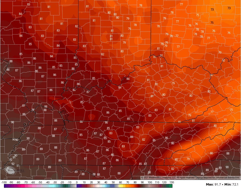
That’s some really pleasant air across the central and east with more normal summertime in the west.
The threat for a few storms will be with us from Friday through early next week as we watch the northwestern sky during this time…
GFS

EURO
Temps look to average normal or even slightly above on days with more sun than scattered storms.
Have a terrific Tuesday and take care.

Chris – over the years I notice little things with the weather pattern. Like this last forecast where the front was forecast to stall over KY…..but what almost always happens, the front has more push than forecast, and it ends up down in TN, giving southern KY the best chance for storms and leaving the rest of us completely dry. I’ve lost count at the times that scenario has played out over the years. Just something to note next time a front is forecast to stall over our area. It almost never does.
Enjoying the weather now with the warm temperatures and lower dew points. A string of 90 degree days is in my local forecast for early next week.