Good Wednesday to one and all. Smoky skies have been common across the region over the past few days and this looks to continue for a while longer. This comes as mainly dry conditions and comfy air takes control. As I look down the weather road, there’s the chance for some summer heat to finally build in around here. Is that a mirage or will this summer of tame temps pull the rug out from underneath it?
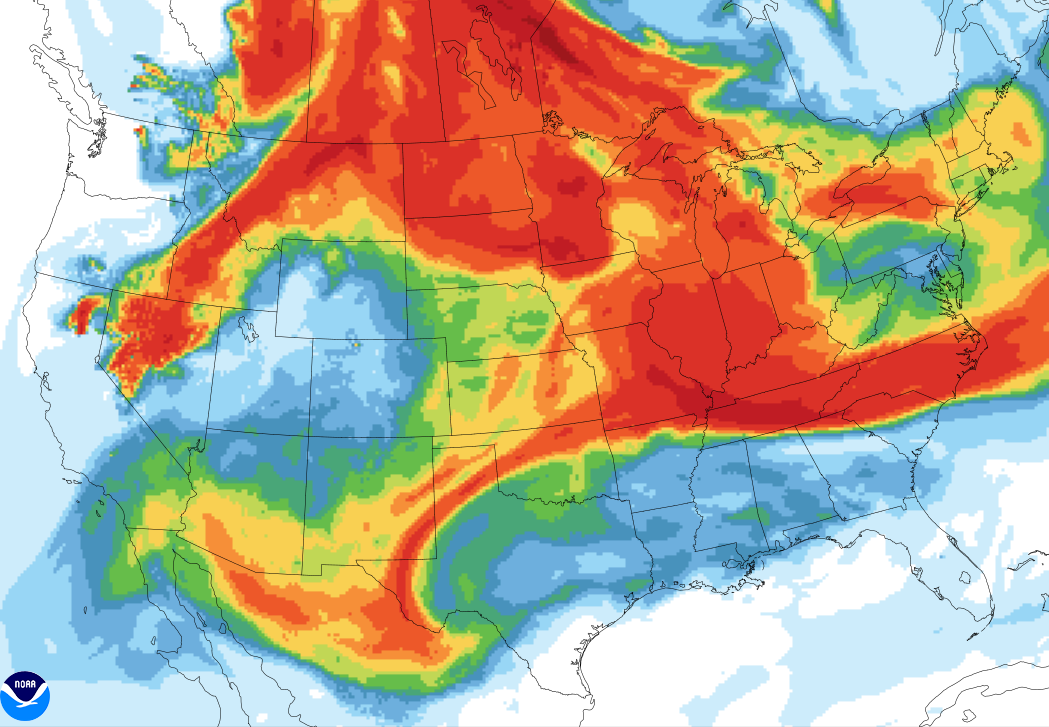
Hazy and smoky skies will be common today as the smoke from the western wildfires gets pushed all the way into the Atlantic. The smoke model for today is picking up on some expansive smoke in our region…

That’s insane to see, folks, and it’s a testament to the historic nature of the fires out west and in Canada. Smoky skies look to hang around into Thursday..
We do have a weak cold front out there today, bringing a tiny storm chance. Comfy air takes hold and takes us through Thursday and Friday, especially across central and eastern Kentucky.
Temps surge this weekend toward more typical summer levels and this will be complete with a few isolated storms. Storms do look to increase by early next week…

From there, a big heat ridge is going to be building in the plains and it tries to make a run at us by the second half of next week. The EURO is most aggressive with this…

The GFS is farther west with this ridge…

That would put us in more of a stormy look with the potential for big storm cluster diving in from the northwest.
Make it a great day and take care.\

I remember in years past, a long time ago we would have the”lazy hazy days of Summer.” No mention of smoke from wildfires thousands of miles away.
This can only be explained by very poor forestry practices over our entire country. Very sad…..
A smokey sky leads to a beautiful sunset.
True, but we really need to get our act together to protect our environment.