Good Tuesday, everyone. Hot and humid weather continues across the state over the next few days, but we have a massive change starting by the end of the week. That’s when we go right back into the pattern we’ve had for much of the year with a deep trough taking our temps below normal. This setup looks to hang through early August.
Temps out there today are toasty with readings mainly in the upper 80s and low 90s. Heat index numbers can push 100.
There’s still a shot at a storm or two going up, especially across the south and southeast…

Temps Wednesday and Thursday reach the 90-95 degree range for many with a heat index topping 100 at times.
A strong cold front puts an end to the heat as it sweeps in here with strong storms late Thursday…

This brings below normal temps for the weekend with another system following that up with some storms by Sunday. This will bring even cooler air as the numbers go well below normal for early August. Look at this trough on the EURO…

The GFS has a similar thought process, but goes more with a big closed upper low…

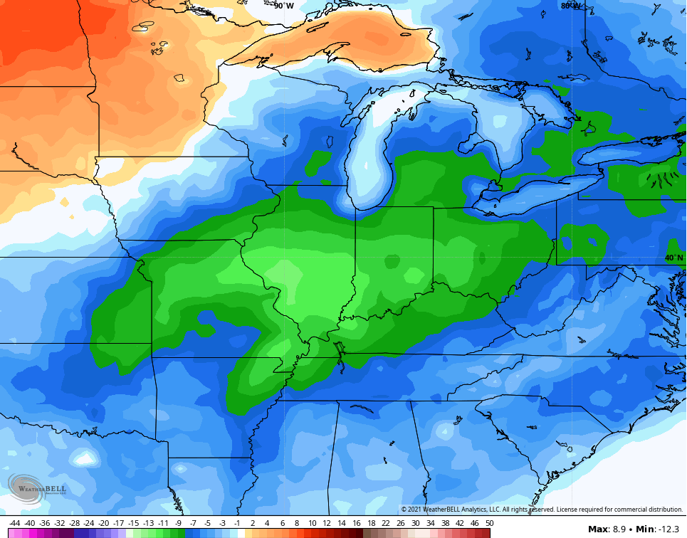
This leads to well below normal temps to end July and begin August. Check out the temp departures for the first 5 days of the new month…
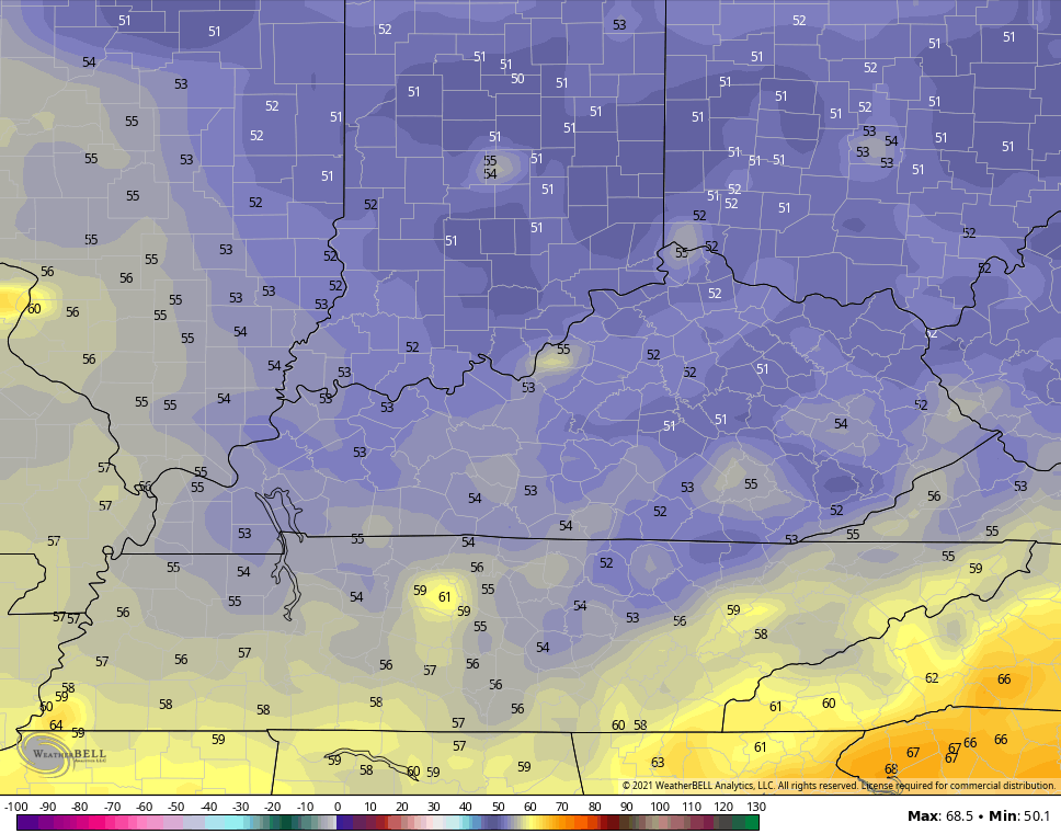
Look at the GFS lows for early next week…
The Control Run of EURO Ensembles keep a trough going into week two of August…

Make it a great day and take care.

Without rain, the summer sun and hot dry winds are really stressing our yard. The best upside are the many feathered friends who come to our six birdbaths – which need cleaning and refilling daily! A pattern that brings regular rain would be good.
I hope the Euro pans out.
Later this afternoon it is forecast to reach 97 degrees in Maple, Kentucky, the area where I live. A week from today the temperature is forecast for a high of 73 degrees and a low of 52 degrees. A welcome break if it pans out.
Here’s where you can cool off ! Current temperature in Barrow, Alaska, our Northern most US city. https://www.ventusky.com/71.2905556;-156.7886111