Good Wednesday, everyone. It’s another day of late August steam across Kentucky as heat index numbers hit triple digits for some. This comes with an increasing chance for some storms to flare up today with a better shot coming over the next couple of days. Next week could get really interesting with a tropical system in the Gulf that could impact our weather.
Let’s kick this party off by talking about about the weather of the precious present. Highs today are back into the upper 80s and low 90s for many with the usual hot biased thermometers checking in a little toastier. Humidity levels make it feel even steamier, so slow it down if you’re going to be outside for an extended period of time.
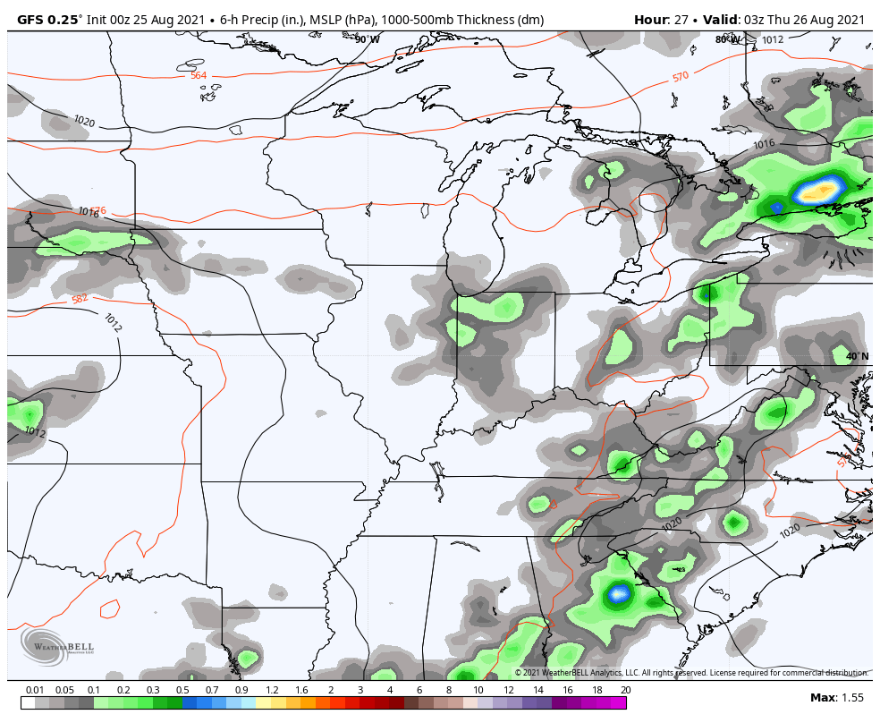
With a little more moisture streaming in from the south, watch for some scattered storms to flare up…

The threat for showers and storms will increase a bit for Thursday into Friday…
This brings our temps down a few degree before they bounce right back up this weekend. It looks like a weekend that will feature a stray storm or two to go along with more steam.
The tropics continue to flare up with the same three systems showing up on the tracking map from the National Hurricane Center…

The system moving toward the Gulf of Mexico is the one that continues to look rather interesting. As expected, the models waffle on how to play this potential tropical storm or Hurricane, but there is a notable trend toward a Louisiana or Texas hit this weekend and early next week.
The GFS takes this storm inland then meanders it around a while…
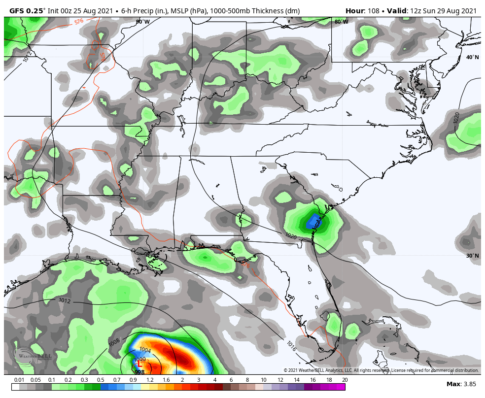
The model then brings that system across Kentucky by Labor Day Weekend.
The Canadian has a quicker storm and that takes a more direct path toward Kentucky…

The EURO was the first model to pick up on this trend and looks a lot like the Canadian…
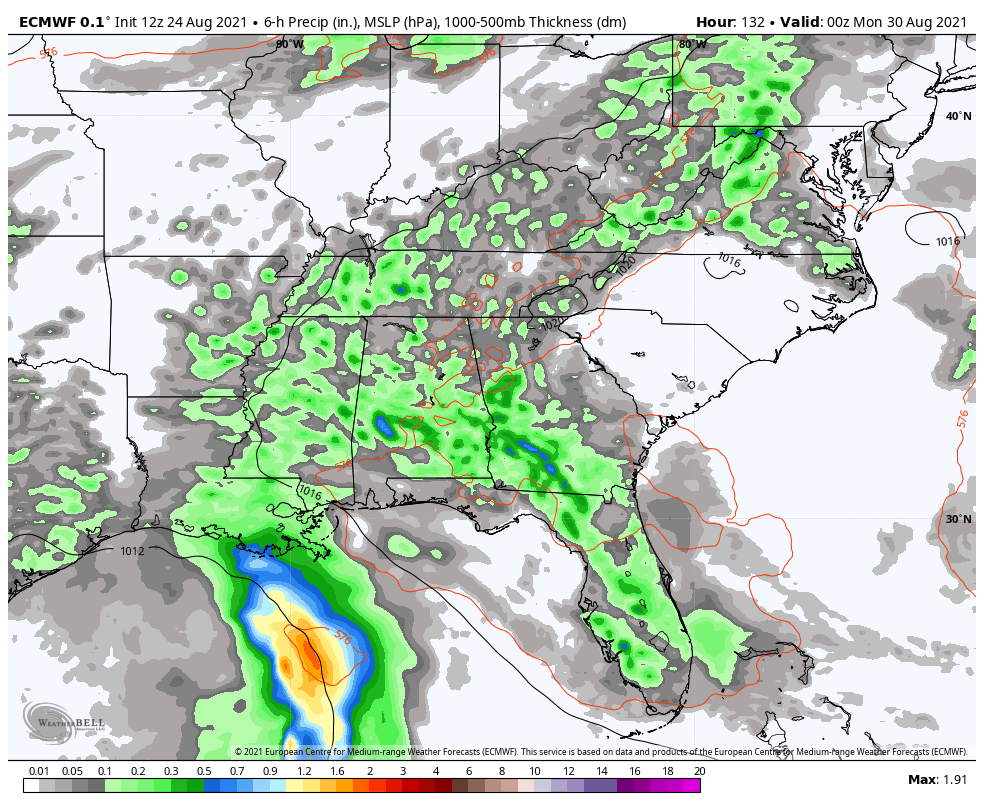
What does all this mean for us? It’s really too early to know for sure, but the first thing we have to watch for is the front dropping in and slowing down here by Monday. That may draw up some tropical moisture, leading to heavy rain producing showers and storms. From there, it’s about the track of the storm, but it has a chance to impact our weather.
Have a wonderful Wednesday and take care.

Man it is hot.
I am ready for a long extended fall season.
Miserable, is the word I use to describe the weather the past few days. I’ve been ready for Autumn weather since the Forth of July !
It looks now like a “Tropical Fall” is coming. UGH !
If the next tropical storm doesn’t effect it, i hear only in the 70’s next week
Very eventful weather day in the Chicago area on Tuesday! The official high of 95 degrees at O’Hare Airport was the hottest of the year, and the 1.91 inches of rain that fell in the early evening from the strong storms that went through was the heaviest daily rainfall so far this year in Chicago, and also the heaviest daily rainfall in 15 months, since May of 2020!
The Flood that happened in middle Tennessee on Sunday would cap all weather events so far this year.
I’m hoping that TennMark, who used to post here on a regular basis and who lives near Nashville, didn’t have any major damage from the flood.
I don’t think TennMark lived in Waverly, Tennessee, which is west of Nashville, Tennessee off HWY 70 going towards Kentucky Lake. That was the area that received 17 inches of rain in a very short time leading to the flooding.
I miss his very informative comments. One of the best. I hope he and his family are safe and well.
I wish all of the commentators that were on this blog would come back.
Maybe they or some of them will when the snow stats flying this winter.
Agreed, Schroeder! I always liked reading TennMark’s very informative posts and comments.
https://apnews.com/article/floods-tennessee-d35389e7d661cb1a225ae55af332022e