Good Tuesday, folks. The Final full week of August continues to bring the steam across Kentucky as we get set to track an increase in storms later in the week. This is also the time of year when our overall pattern can be bullied by what happens in the tropics and we are likely to be following a couple of storms.
Temps today are mainly upper 80s to low 90s with humidity levels making it feel toastier than that. We can pretty much take that last sentence and plug it in each day for the rest of the week.
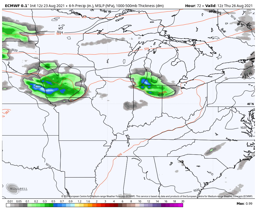
There’s also the chance for a storm or two to go up, but most stay dry. Still, your friendly radars are on duty…

As mentioned, the threat for storms will increase as the week wears on…
That will knock the edge off the temps a little bit, but we stay very steamy and above normal through the weekend. It’s at this point, the tropics likely start to play another role in the overall pattern.
The National Hurricane Center is tracking several systems. We have one in the Caribbean and two well out in the Atlantic…

The Caribbean system is the one the models try to take into the Gulf of Mexico this weekend. The EURO continues to show this system well and is back taking it toward Texas…
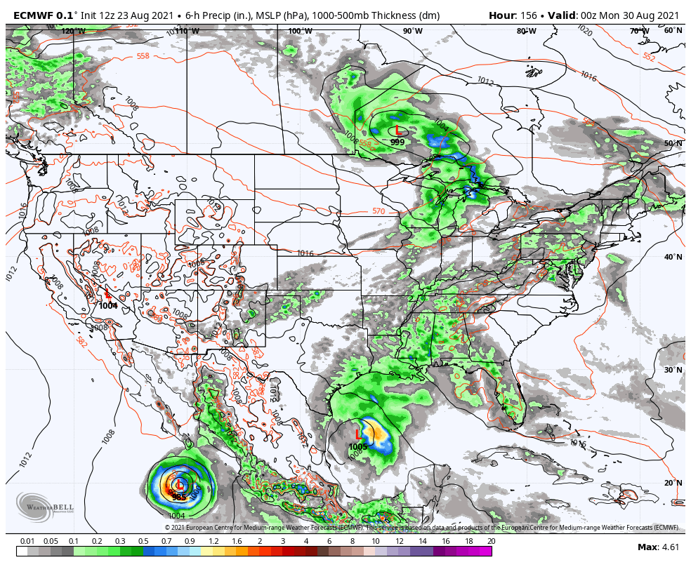
You will also notice a cold front dropping in here well ahead of that system, bringing a cooler brand of air next week.
Make it a great day and take care.

I feel like our hottest temps are mostly last half of August and first half of Sept BECAUSE of the tropics.
For Fall lovers, lets hope the Tropical season ends in mid- September and October is cold and dry with plenty of colorful Autumn leaves. Wishful thinking…….
Another hot August day.
I like to see a little rain sometime this week.
It’s a hot, very humid and breezy day with clouds building up here in the Chicago area. Temps are in the low 90’s, with a dew point between 75-77 degrees and a heat index near 105.
A Severe Thunderstorm Watch has been issued by the SPC for portions of Northern IL, including the far West and NW Suburbs of Chicago, until late this evening. There’s a pretty impressive line of storms in Eastern Iowa now, and scattered strong storms over Southern Wisconsin.