Good Monday, folks. It’s the final full week of August and the month is starting to throw a little bit of late summer steam at us. This steam looks to hang tough through much of the week as the threat for showers and storms slowly begins to increase.
Highs out there today range from the middle 80s to low 90s across the state. Humidity levels are way up, so it’s going to feel toastier than what the thermometer shows. Most of the region stays dry, but there’s the threat for a shower or storm to pop up. Here are your radars in case they do…

Tuesday temps are similar to today and that looks to take us into Wednesday as well.
The threat for storms looks to increase as we head into Thursday and Friday as temps stay steamy and this setup likely carries us into the final weekend of the month…
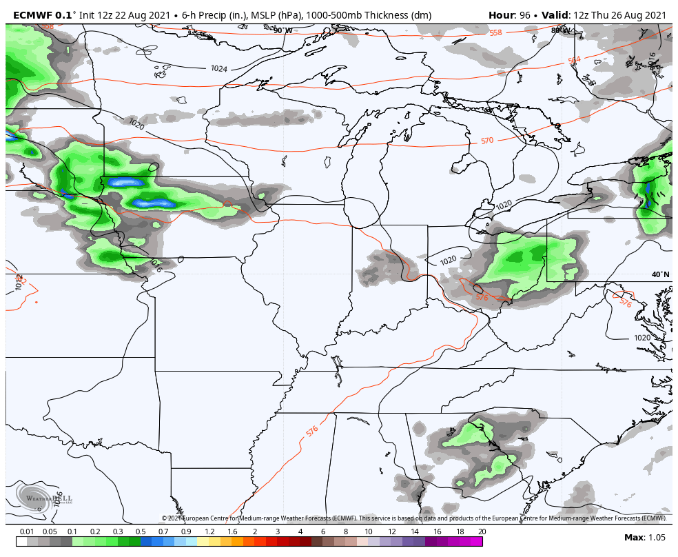
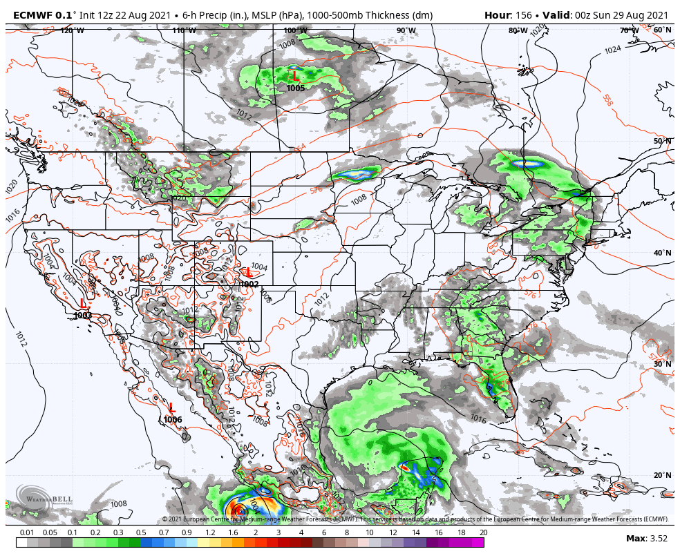
The pattern after this is still one to watch for a tropical system down in the Gulf of Mexico as a trough digs into the eastern half of the country. The latest EURO takes that tropical system toward Mexico as a cold front moves through here to end August…
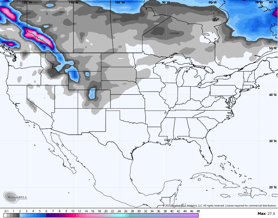
I started to narrow down my research for the winter forecast over the weekend and I’ll be dropping some hints about what I’m seeing over the next few weeks. In honor of that, here is the GFS Extended snowfall map for the country through September 26th…
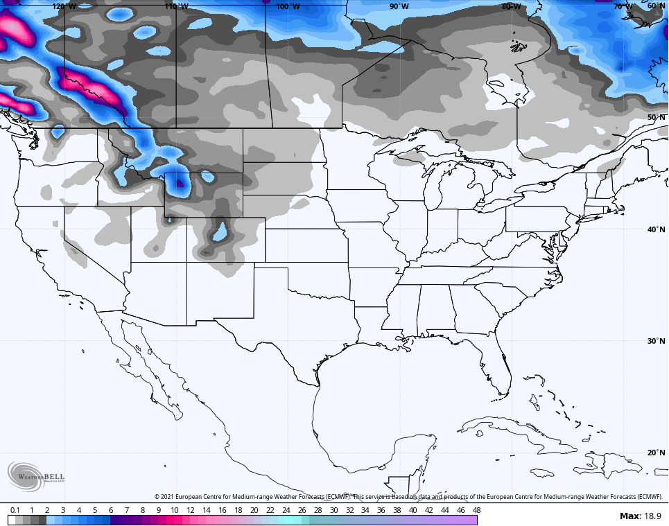
The EURO Weeklies through October 4th…
Tis almost the season! ❄⛄
Have a great Monday and take care.

I hope this is the last week of steam.
That depends on what goes on in the tropics ?
Looks like were going to deal another stretch of hot and steamy days this week. Had another foggy morning so as old folks say the more fog you have in August means the more snow will have this winter.
Sometimes those old sayings come true. Like they did in the Winter of 1969-70. Tons of Snow from December through March.