Good Sunday to one and all. The weather is fairly calm across our region as the focus continues to be on Hurricane Henri slamming into the northeastern part of the country. I have your tracking tools for Henri and we take a look at the changes for our week ahead weather.
Let’s begin with Henri. This storm will slam ashore near Long Island this afternoon or evening. Here’s the sat shot of what this looks like…

Here’s the latest information and track for Henri from the National Hurricane Center…

Our exclusive interactive radar gives you a front row seat to track Henri as it comes ashore. You can even see live streams from storm chasers in the path of the hurricane…
Back here in the bluegrass state, temps are generally in the mid and upper 80s with humidity starting to climb. There’s the chance for a stray storm or two going up, especially western and central parts of the state. Regional radar supplements what you get from the interactive radar above…

Temps are toasty into much of next week as humidity levels soar. This tropical feel will be complete with some showers and storms flaring up, especially for the middle and end of the week.
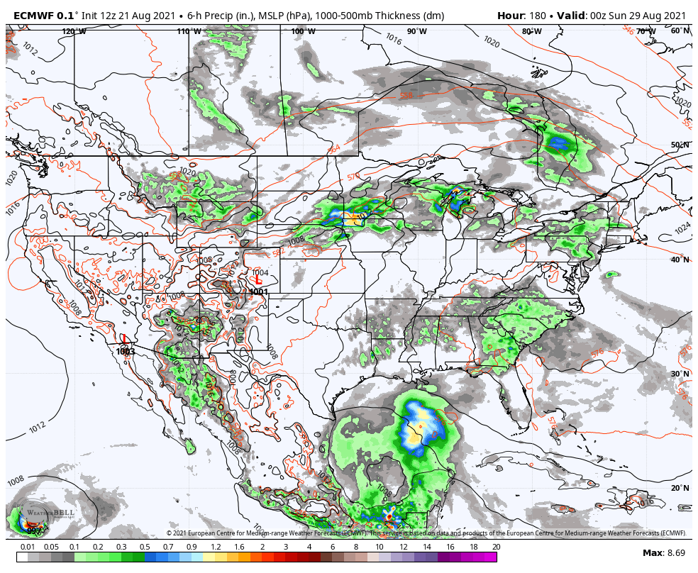
I’ve been talking about watching for another tropical system to get in the Gulf before August is through and now we are seeing the model runs showing something. Here’s the EURO…
Check out the huge trough diving in here on that same model run…
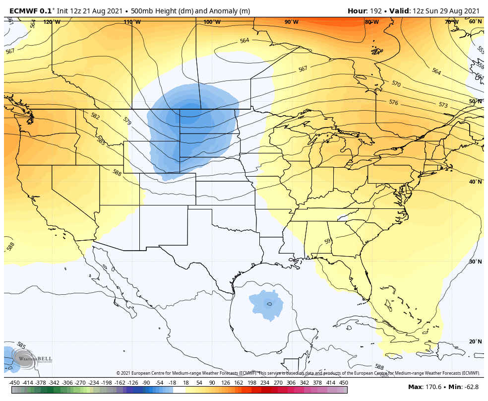
The closing days of August may very well feature a big storm in the Gulf, but you will see the models vary greatly on track and intensity. If this system does get into the Gulf, that gives us a chance to have some kind of impact from it.
Make it a great Sunday and take care.

Welcome tropical storms. They rescue parched lawns and provide water in kayak streams. Welcome.