Good Saturday and welcome to the weekend. The weather out the for the weekend is pretty bland with near normal temps and the threat for a storm or two. Once into the week ahead, we have more substantial changes that will lead to an increase in storms.
Temps today are mainly in the 80s for most of the region as a few storms start to fire up. The greatest risk is across the western half of the state and some of those may put down some pretty good rains in a short amount of time. Here are your radars for the day…

Temps turn more steamy from Sunday into early next week as humidity levels soar. There is also the smallest threat for isolated storms.
Henri continues to barrel toward the northeast and will make landfall as a hurricane on Sunday. This is a storm that’s looking much better…

This may be stronger than what the NHC has when it hits Long Island later Sunday…

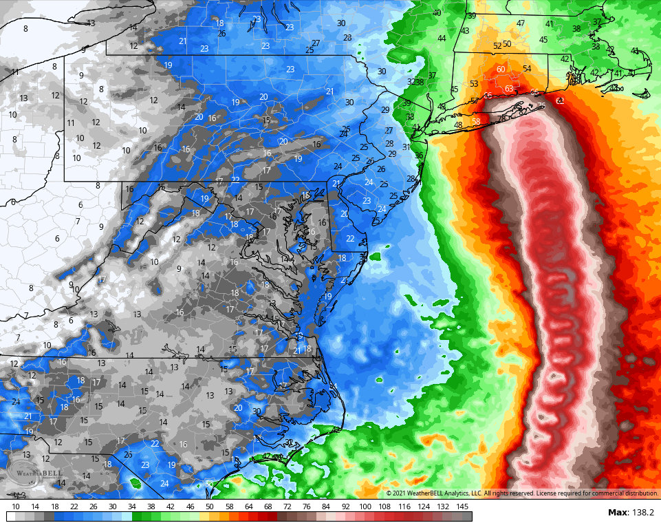
This isn’t a site you see very often…
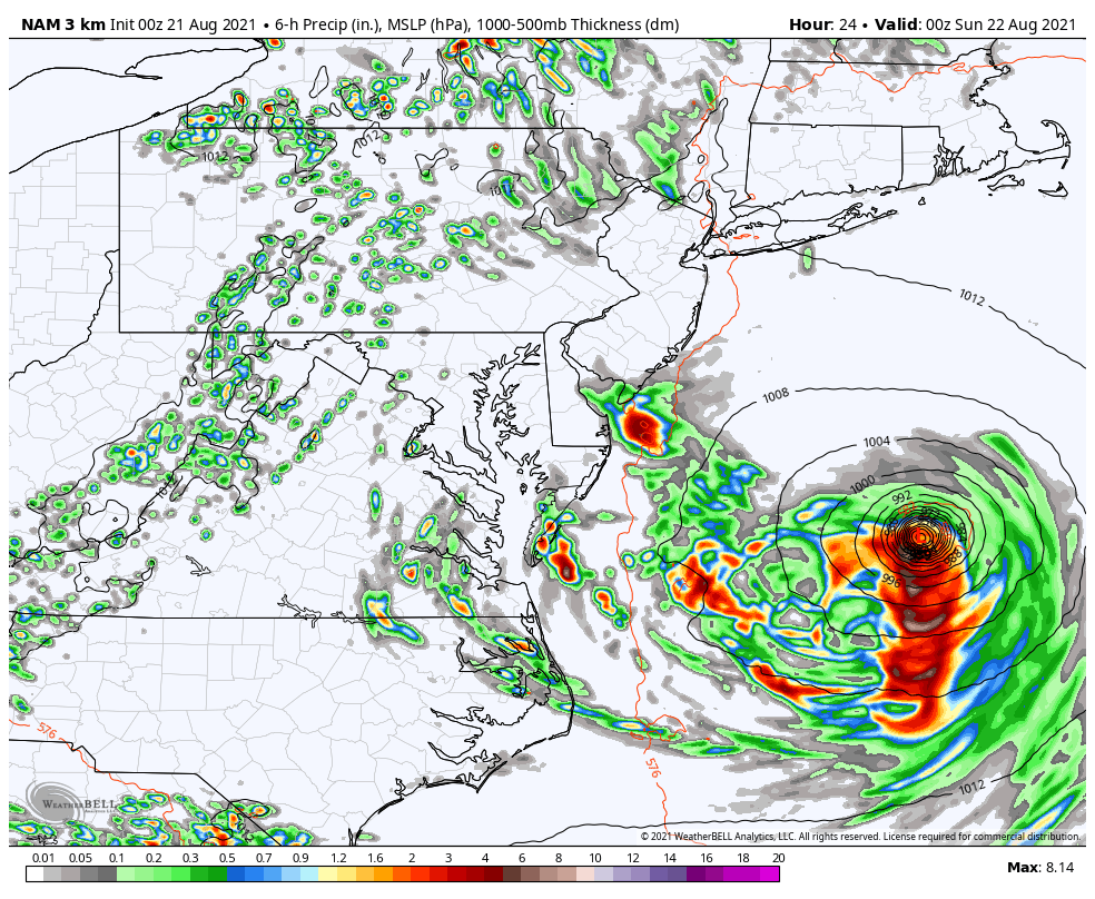
Check out what the Hi Res NAM is doing with those winds…
That won’t have any kind of direct impact on us and we also have a major hurricane in Grace heading into Mexico. The tropics are on fire right now and we are likely to see that trend continue for a while. Watch for something to try and pop off the southeast coast, but the bigger threat may be something going into the Gulf by Labor Day Weekend.
Back here in the bluegrass state, our weather is steamy next week before storms start to increase for the middle and end of the week…
Make it a great Saturday and take care.

https://www.boston.com/news/weather/2021/08/19/30-years-after-last-hurricane-new-england-braces-for-henri/
Richmond didn’t see a huge impact from Fred, but I’m not complaining. 😉
Yard work this weekend then it can rain all it wants.