Good Friday to one and all. We’ve made it to the end of the week and that can only mean one thing… The weekend is here. 🥳 As we head into the next few days, we continue to see temps starting to climb a little and the threat for a storm or two around. Next week promises bigger changes as things turn active once again. Oh, I’m also looking toward Winter. Just thought I’d sneak that one in on you guys. 😈
Let’s kick things off with our Friday. Skies are much drier out there today with some lingering clouds battling it out with the sun. Temps are seasonable in the 80s and all this bodes well for a pretty decent start to the high school football season.
Here are your radars in case you want to track a little shower or storm that goes up…

The threat for storms will increase on Saturday, especially across the western half of the state.
Hurricane Henri continues to be a serious threat to New England by the weekend and early next week. Here’s the latest from the National Hurricane Center…

This potential was first pointed out here on KWC well before the NHC started to trend west with the track. In addition to the track forecast, it’s interesting to see the various models take this into the northeast, too…
NAM
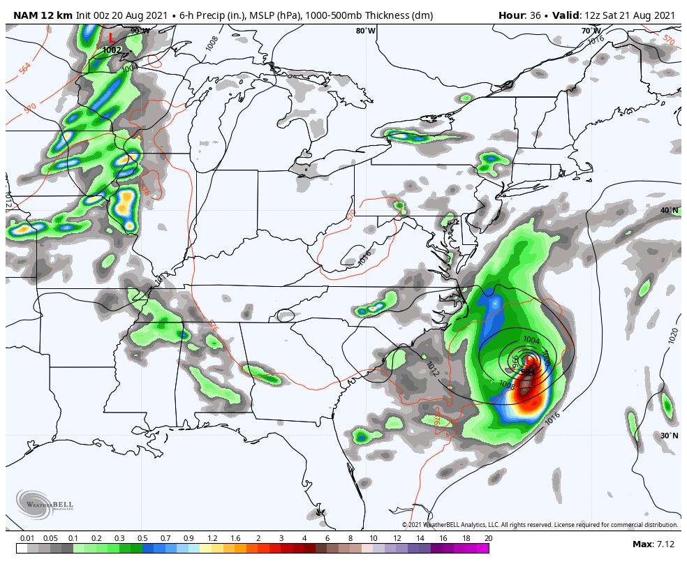
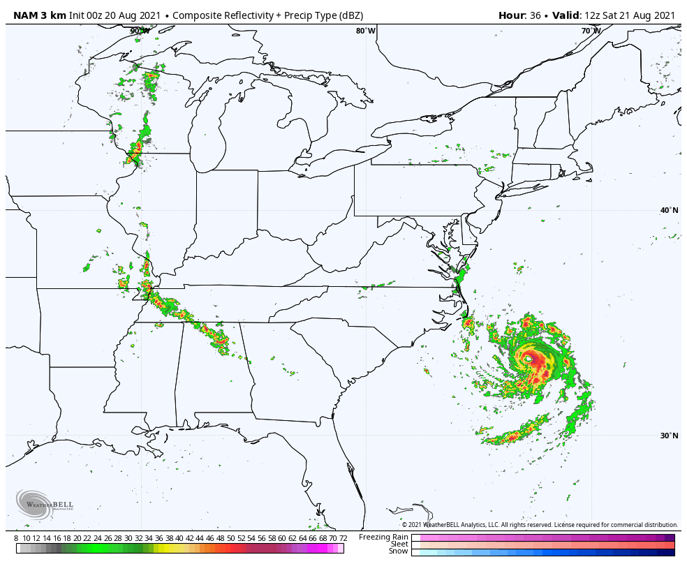
Look at the future radar from the HI RES NAM…
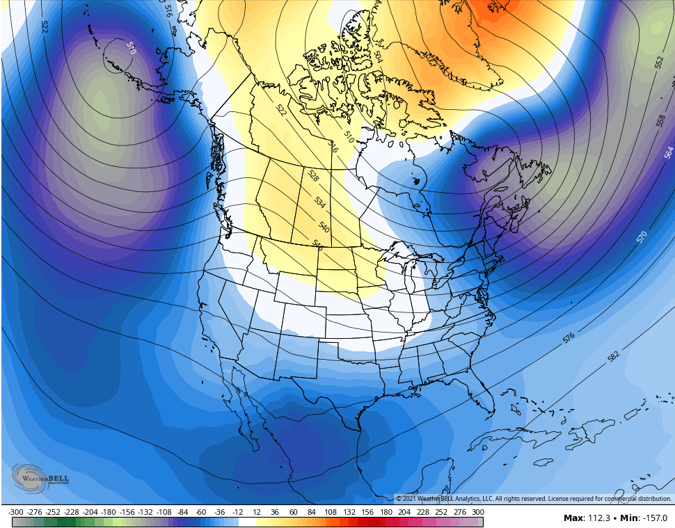
That whole setup will then slow down the pattern behind it across the rest of the country into next week. Temps will be very steamy around here for the first half of the week, but this super wet ground and lush vegetation is going to help tame the temps for many.
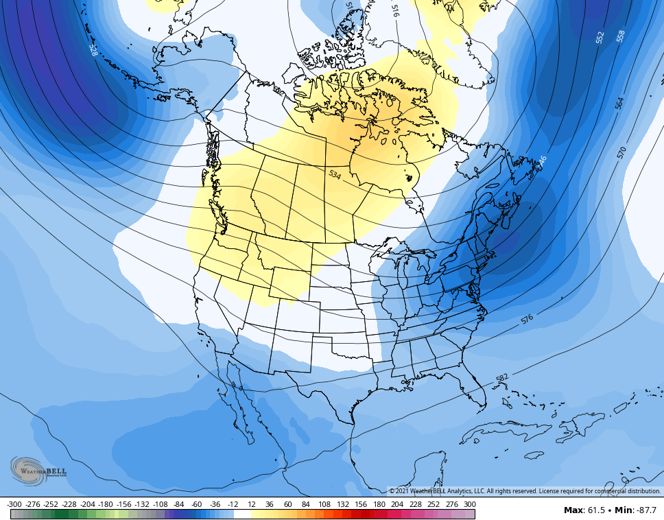
Let’s use this Friday as a check of the CFS model to see what it’s looking at for the upcoming winter. The true seasonal run of this only goes through November, but it’s showing the potential for another early start to winter with a trough in the east…
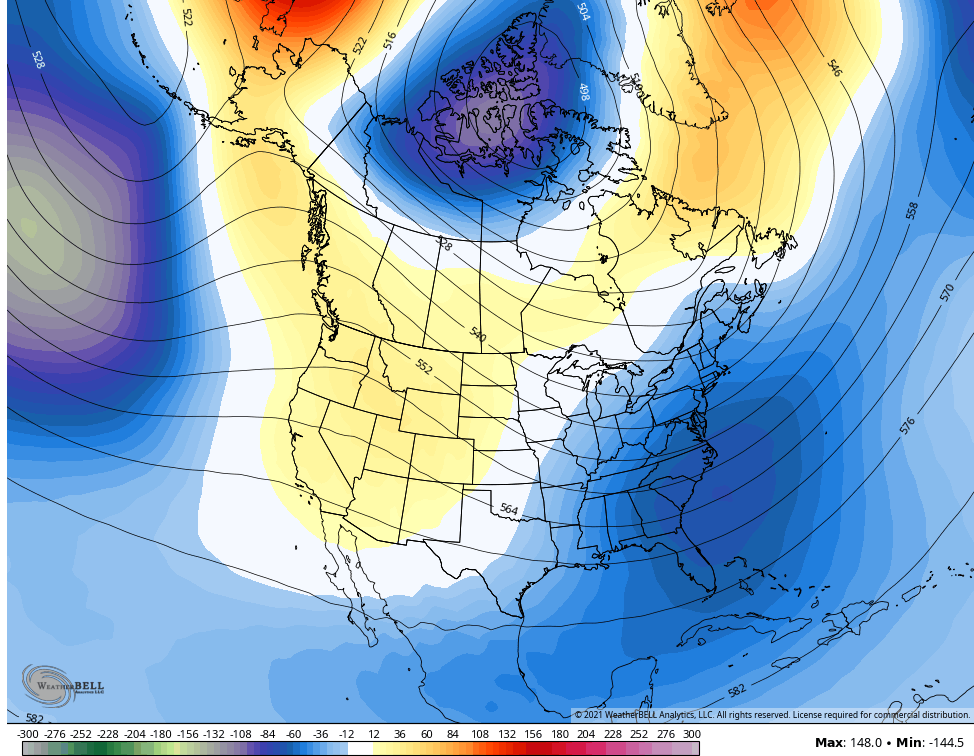
The control run of the CFS runs much deeper, but with a lower skill set. I took the same model initialization as the above looks like this for the rest of winter…
It has a big trough in the east for December…
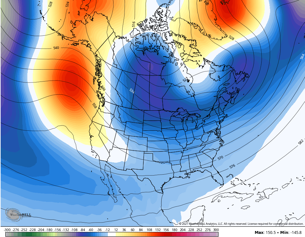
It relaxes it a bit for January, but it’s still cold…
It deepens again for February…
Then goes hog wild for a cold coast to coast March…
Again, this is a seasonal model, but it’s the time of year to watch for the trends that are showing up to see if they match what some of my personal analog years suggest will happen. I will tell you one thing, I like the November and December look from above. Not sure about the rest, though. ❄🥶
Have a great Friday and take care.

Excellent Chris !
Very foggy here this morning here in my neck of woods. That winter outlook is very interesting if it plays out. Were due for a cold and snowy winter only mother nature knows .