Good Friday, folks. As we head into the final weekend of August, we have a very active pattern taking shape and it’s one that will feature a major hurricane in the Gulf. What’s left of that system has a real chance to impact our weather with rain and wind by early next week.
I will get to this system in a moment, but let’s begin with the local weather through the weekend. Temps are toasty again as a few showers and storms go up. Just like we’ve seen in recent days, any storm that’s out there can be a little strong and put down torrential rains. Here are your radars…

The weekend features more of the same with steamy temps and a storm or two around.
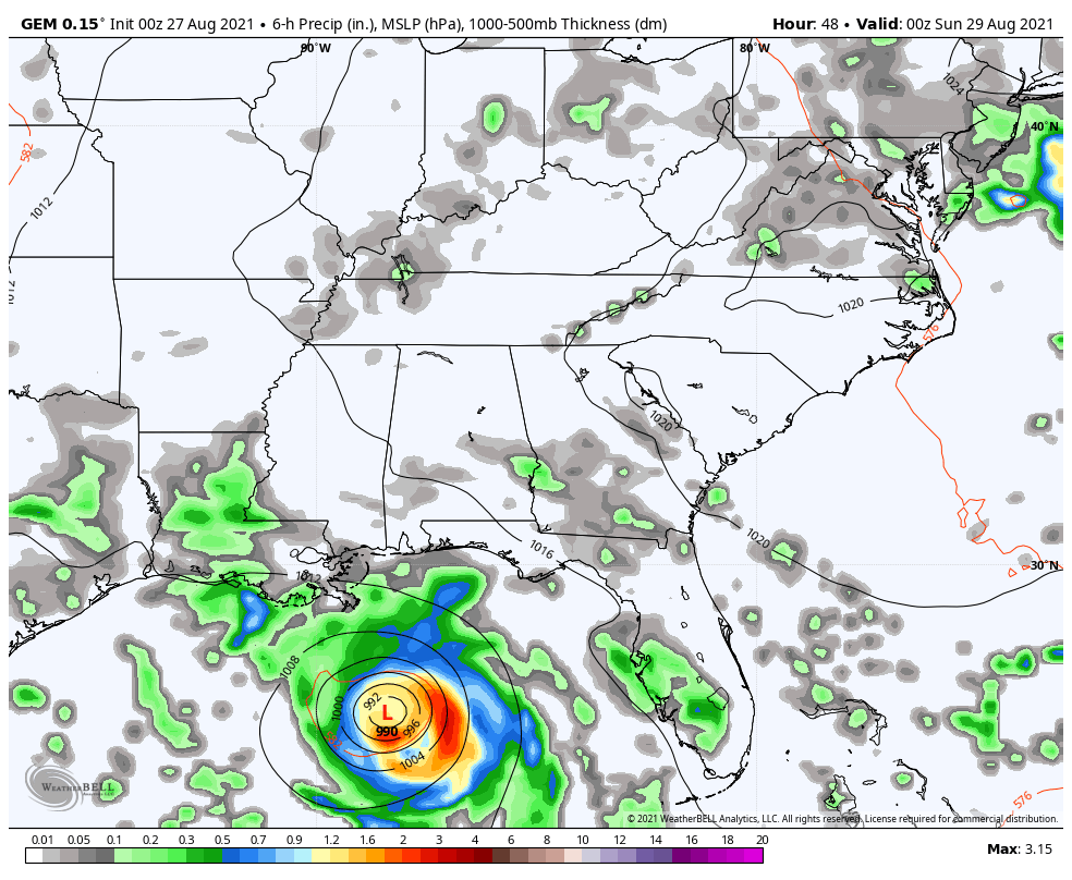
Let’s now go to the Caribbean and check on our future hurricane. Ida has formed and will work into the Gulf of Mexico over the weekend. This storm is just now getting into the sat shot of the Gulf…

This will likely become a hurricane pretty quickly and this may very well become a major hurricane as it steams toward Louisiana for a late Sunday or Monday landfall. Here’s the latest info and track from the National Hurricane Center…

From there, the center of circulation will spin northward into the lower Mississippi River Valley on Monday. That system will continue to lift northward toward Tennessee and Kentucky by Tuesday and Wednesday. It remains to be seen where the exact center of circulation winds up, but the threat for heavy rain will extend well outside of where the center is.
The various models are still showing some run to run deviations, but we aren’t seeing a lot of spread showing up at this point. That may change over the weekend, but the trend is pretty stable right now.
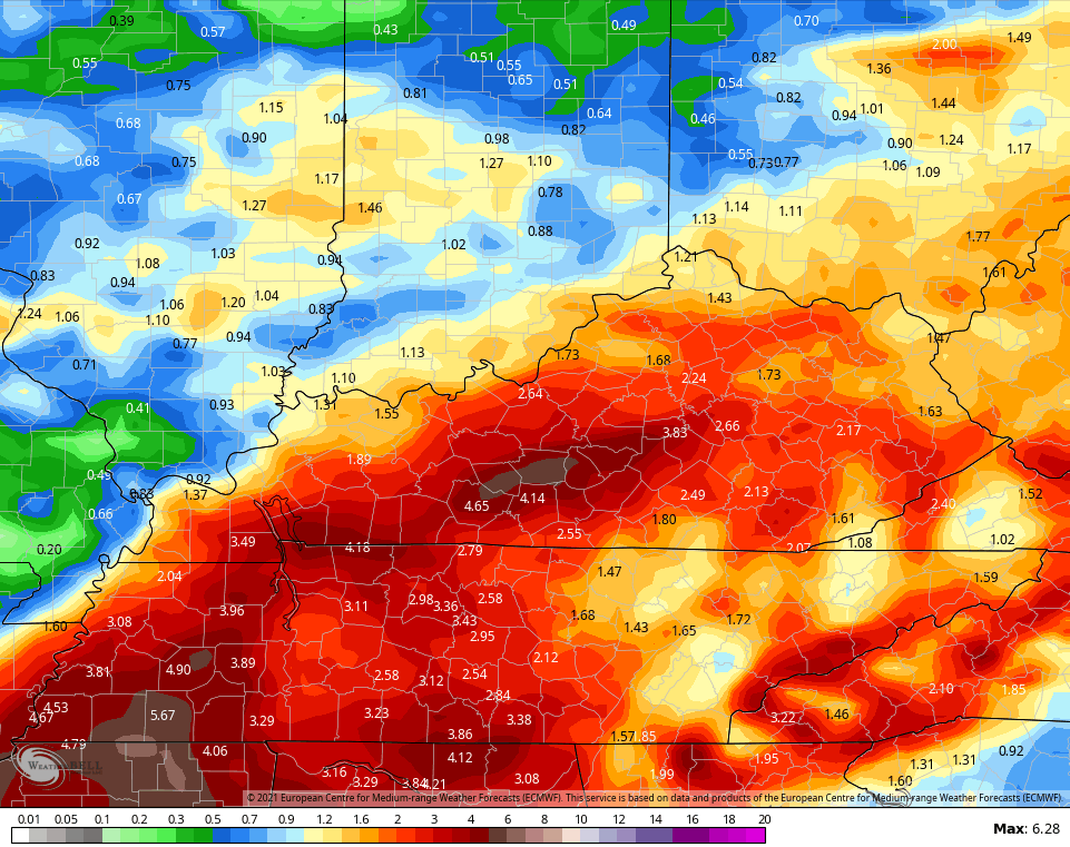
Here’s how the EURO sees Ida playing out…
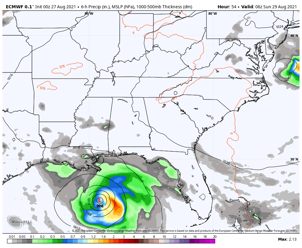
Notice it brings the heavy rain shield across much of Kentucky…
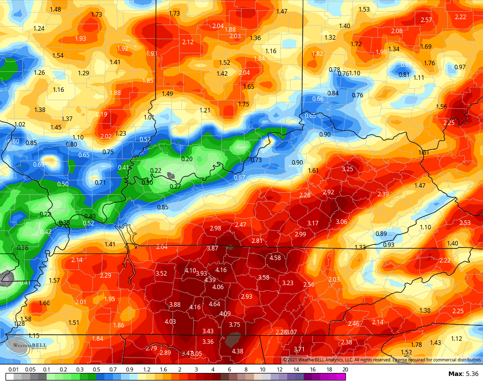
The GFS is the farthest southeast with the track of the leftover low…
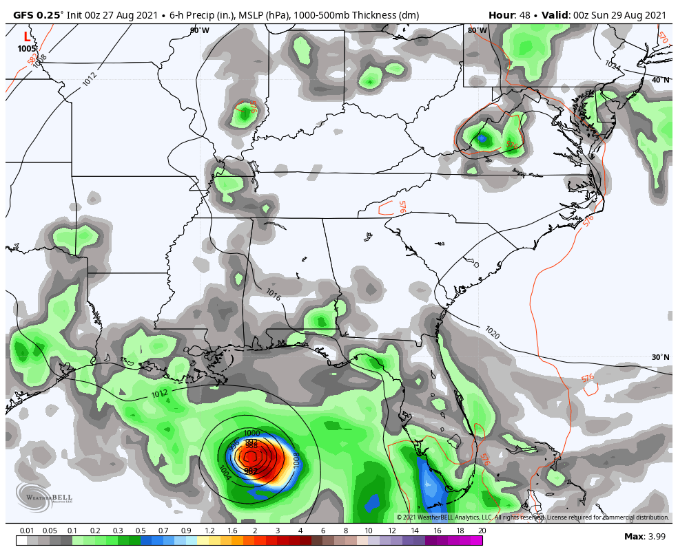
Here’s the rainfall forecast map from that run…
The Canadian Model is a bit west with the track and brings heavier rains to much more of the region…
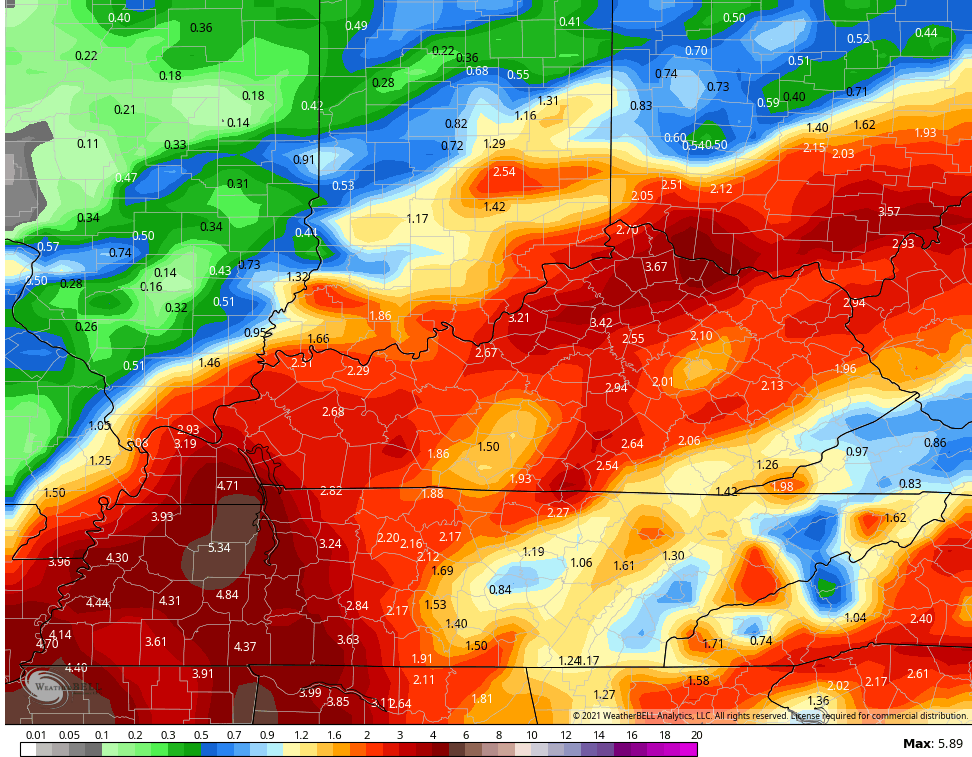
The ICON Model has a farther west solution with Ida and that results in a soaked region…
![]()
![]()
Again, all models will shift around from run to run with the track of the storm and that impacts rain totals around here. Still, confidence is increasing for some impact from Ida on Kentucky.
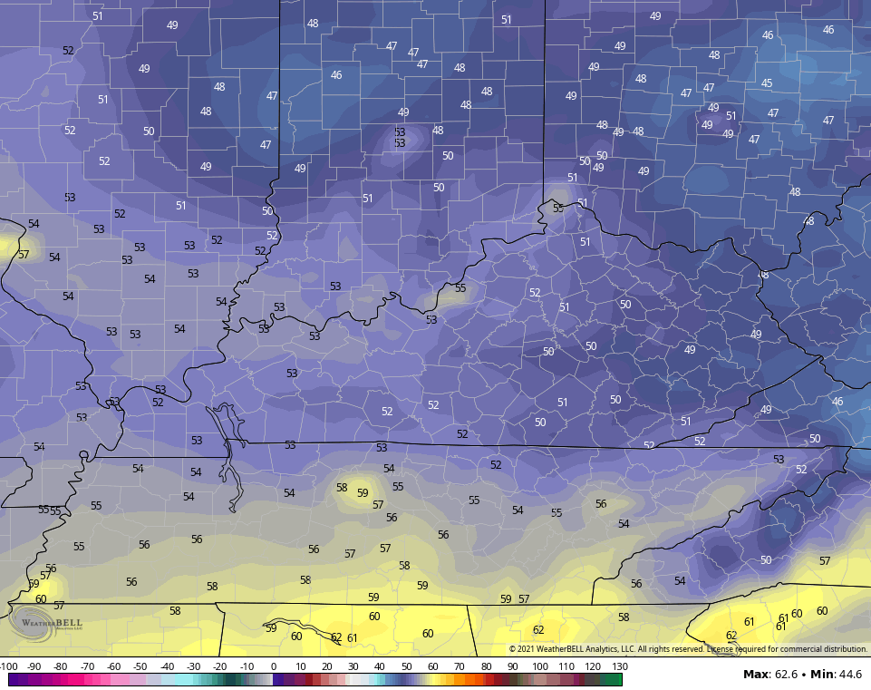
Much cooler air will come crashing in behind Ida for the end of next week. Some of the models are taking lows way down there…
I will have another update for you guys coming up this afternoon, so check back. Don’t you guys love when it gets close to multiple update days here on KWC? 😎
Make it a fantastic Friday and take care.

Thanks Chris, will look forward to your updates on Ida.
I will check back in this afternoon.
Looking forward to the fresh air once Ida is outa here.