Good afternoon, folks. It’s another steamy Friday with some storms going up, but the focus of this post is on Hurricane Ida and the impact it will likely have on our weather by early next week.
Ida is getting its act together as it approaches the western tip of Cuba…

Ida is now forecast to become a major hurricane as it heads toward Louisiana on Sunday. Here’s the latest info and track forecast from the National Hurricane Center…

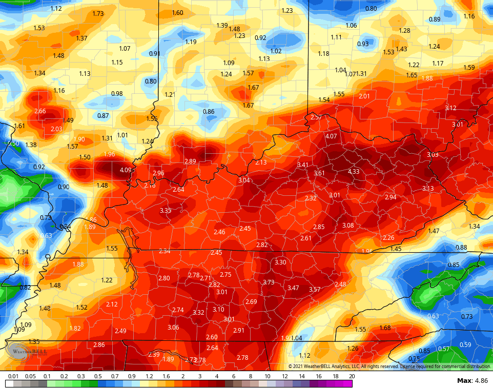
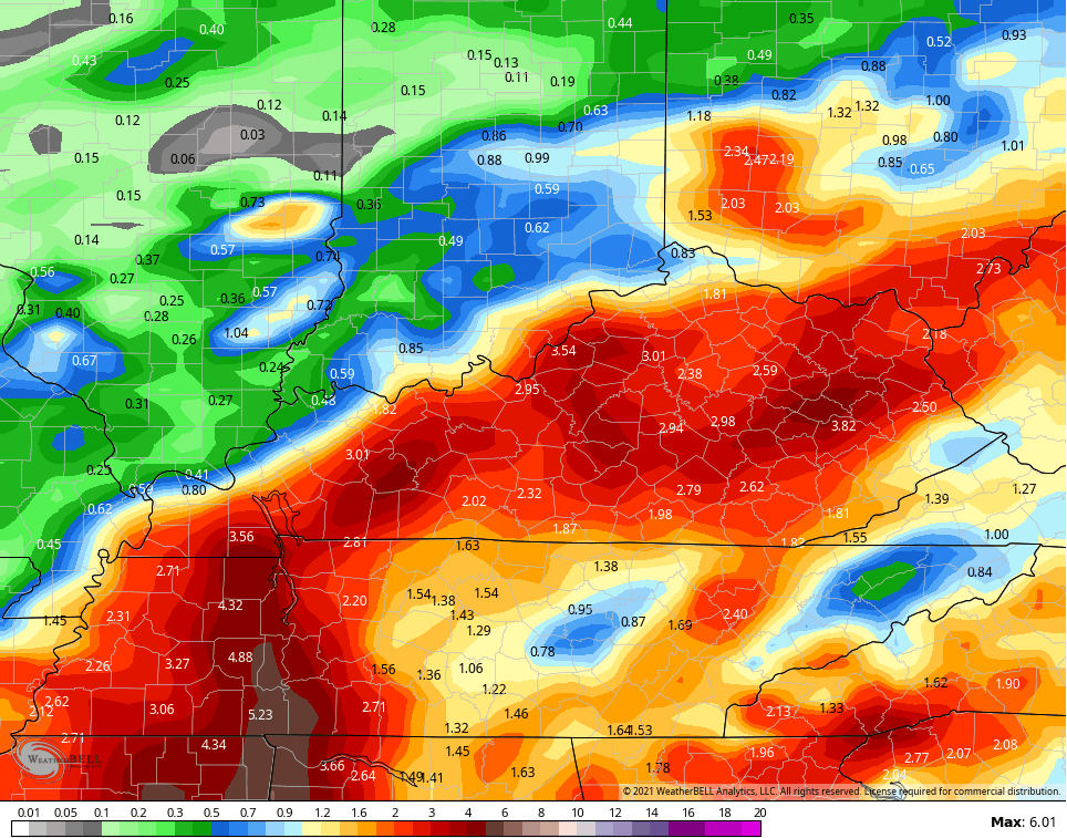
This system has a better than even chance to roll right up the Mississippi Valley and into Kentucky, bringing the heavy rain and gusty winds. The models are much more in line with one another on the potential for enough rain to cause flooding issues…
EURO

GFS
CANADIAN
ICON
![]()
![]()
I will have the latest on what Ida can bring our way coming up on WKYT-TV starting at 4pm.
In the short-term, storms are rumbling across the region and bringing torrential rains to many. Here are your radars to follow along…

Have a great rest of the day and take care.

I am surrounded by rain.
I have had only a few sprinkles so far.
Another hot an d steamy day in Central Warren County, which saw a line of potent storms develop just north of Bowling Green. We saw nary a drop of rain south BG, until small cell popped up around 4:00pm CDT and delivered a quick ¼” of rain before it dissipated.
We’re getting to that time of year when the Euro forecast becomes more reliable in these parts, and if Ida takes the indicated path, it could quickly put an end to the dry spell in this area.