Good Wednesday and welcome to the month of September. This is the first day of meteorological fall and it’s actually going to feel more like the start of actual fall. This is a much cooler than normal pattern that’s locked and loaded for the next few weeks.
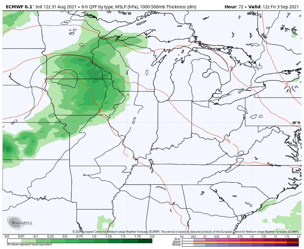
Before we get to all that, let’s get track the remaining rains from Ida out of town. This storm delivered the soaking rainfall, but it spread things out enough to keep any high water issues at a minimum. Still, some local issues may be noted across the east to start the day.
The steady rains pull away from the east this morning, with a stray shower or two lingering into the afternoon. Here are your radars…

Winds are very gusty today as highs reach the mid and upper 70s for many. The farther west you live, the better the chance for mostly sunny skies.
Temps stay VERY nice for Thursday and Friday with highs in the 70s and lows into the 50s.
As we head into Labor Day weekend, the focus of the forecast is on a system working in here for Saturday and Sunday. That will bring some showers with it and some of those showers may play a factor in the kickoff to the college football season on Saturday…
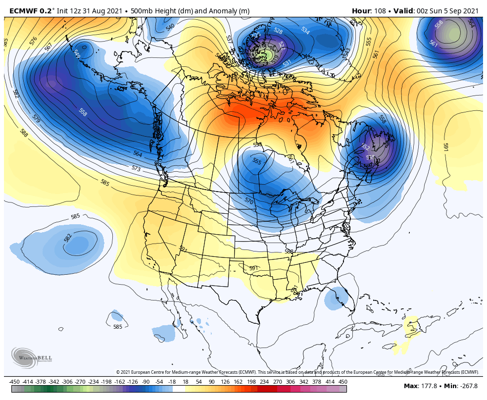
That gives us another round of pleasant early fall air, but another front looks to follow that up just after Labor Day. This one tries to dig out a much deeper trough in the eastern half of the country into next week…

Check out how deep those troughs are…
Have a wonderful Wednesday and take care.

Thanks Chris, According to the Kentucky Mesonet Ida gave us 2.22 inches of a good soaking rain.
Looking forward to the Autumn ahead.
I’m looking forward to the nice temps.
Recorded 2.16″ total rainfall from Ida, which currently sits over the SE corner of KY. Not bad. Rain started out like cat spit, and progressed to steady but never super heavy (peak rate was 0.60″/hr).
On another note, excited for the fall temps, timed perfectly for the start of football season!
The only rain that i got was when the front came through here and it was hit and misses though out the county were i live at.. Ida was to far east of us to effect us. The cool air will be a welcome to have. Have a good day!
Ready for the frost and cold temps, sick and tired of the rain. Early Fall, cold and limited snow for the winter.
oh come on Cruise lets have a lot of snow! LOL!