Good afternoon, everyone. What’s left of once powerful Hurricane Ida is now bringing torrential rains to much of the Bluegrass state. As the center of this system works across southeastern Kentucky, areas north and west of that are likely to see the greatest risk for flooding.
My time is short today, so let me go ahead and get into the area most at risk…
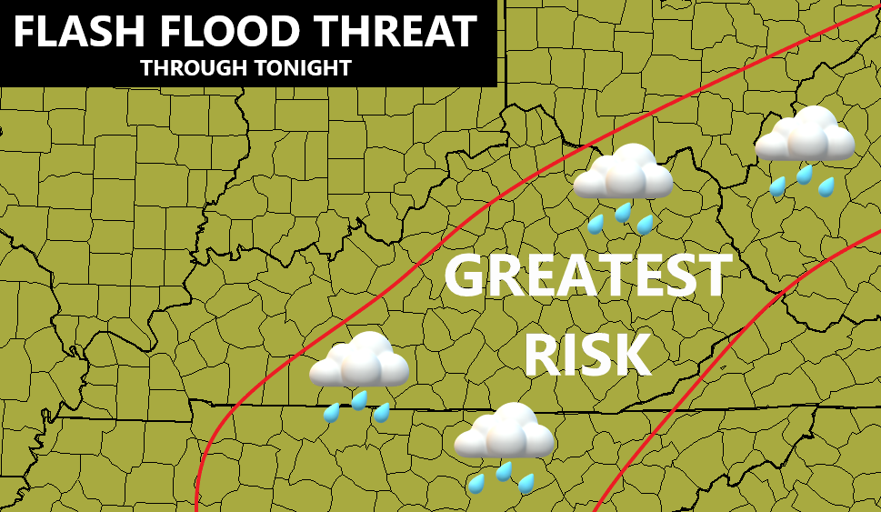
The lines are approximate, but should be pretty close to where the western edge of the heaviest rains setup. This action is working from southwest to northeast and may produce a swath of 2″-4″ rains for some. The Lexington metro and Bluegrass Region may see some enhanced rainfall and may become the bullseye of the flash flood potential.
Winds will be gusty tonight and Wednesday as Ida moves away from us. Much cooler air comes in behind this with highs in the 70s for the rest of the week. Lows are deep into the 50s and the NAM even has a few upper 40s by Friday morning…
Even cooler air comes in next week and I will talk about that in my overnight update.
I will have the latest on today’s flood threat on WKYT-TV starting at 4pm, so tune in.
I leave you with your radars to track the tropical rains across the region…

Have a great rest of the day and take care.

Rainfall in Central Warren County has been steady but not torrential, and winds have been relatively tame, with gusts in the 12-15 mph range.
I’ve recorded 3.40″ of rain so far, and with Ida’s center of circulation currently located on the Alabama/Tennessaa line, due south of Nashville, I anticipate South Central Kentucky will pick up another 1 to 2 inches before all is said and done.