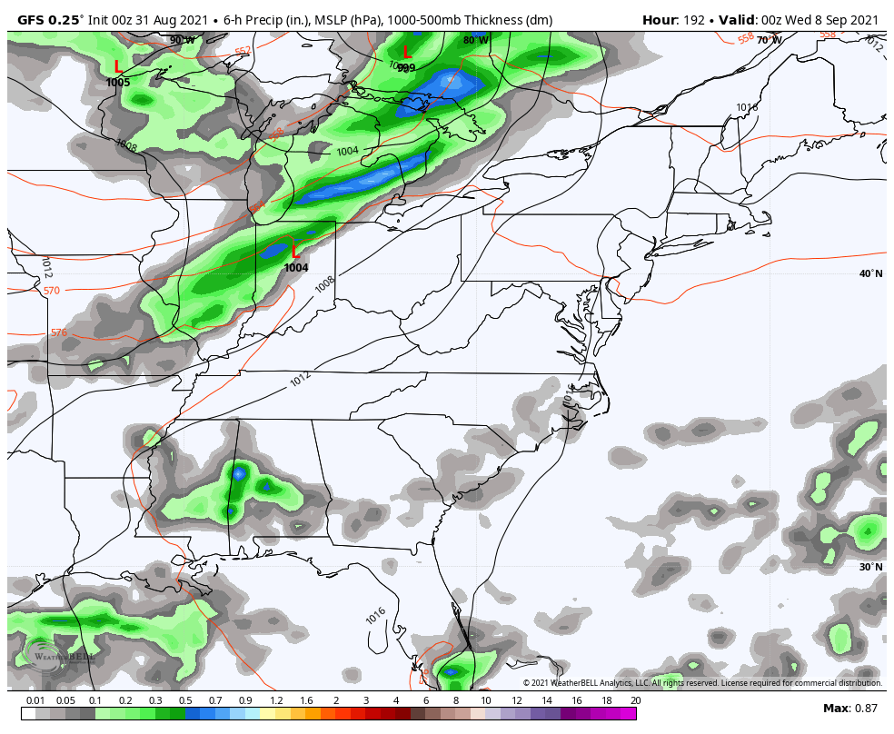
Good Tuesday, everyone. What’s left of Hurricane Ida is spinning into the region today and it’s bringing an increased threat for flooding and flash flooding. With much of the region already waterlogged from recent rains, it won’t take much to cause issues.
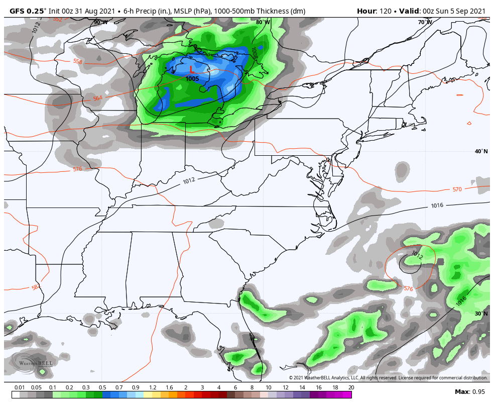
Spiraling bands of showers and storms will be spinning counterclockwise around the center of circulation working in from the southwest. This center moves across southeastern Kentucky this evening into the wee hours of Wednesday with the heaviest rain falling north and west of the track. That puts central and eastern Kentucky in the line of fire for some of the heavier rains and this may include the Lexington metro.
Here are your radars to follow along…

The heavy rains will pull away by early Wednesday with gusty winds continuing. Highs are in the 70s as cooler and drier winds blow in. This sets the stage for some great early fall weather through the end of the week. Check out the low temps…
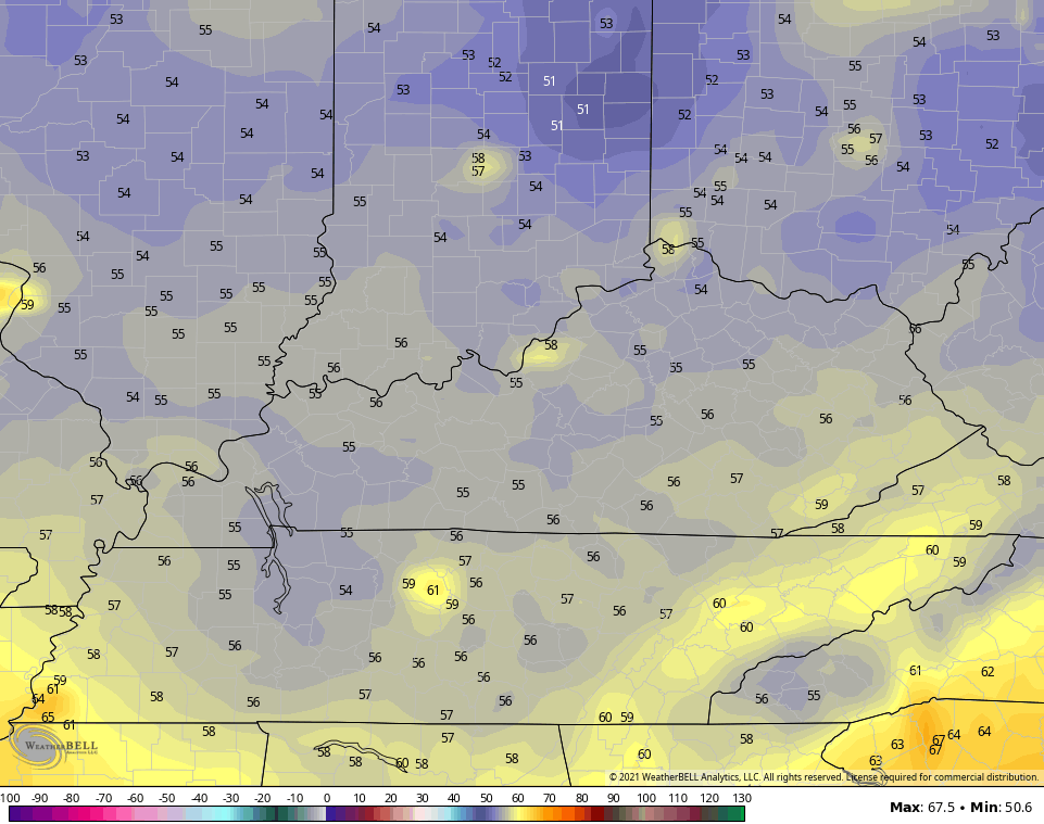
THURSDAY MORNING
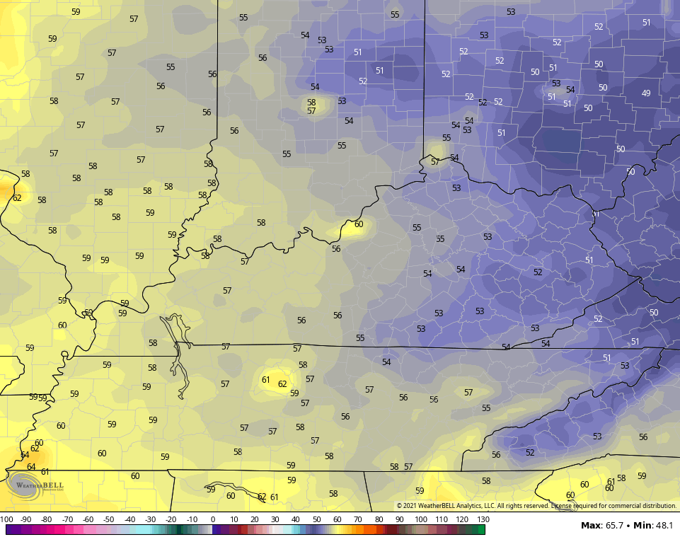
FRIDAY MORNING
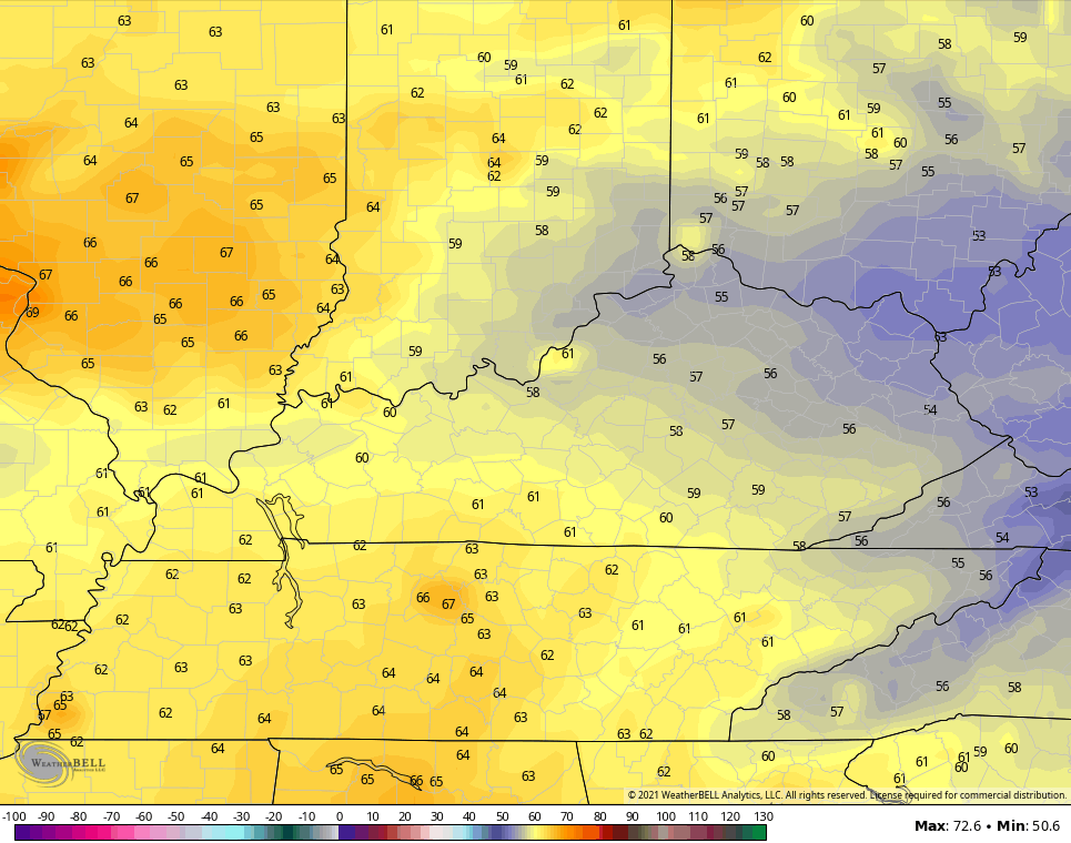
SATURDAY MORNING
Temps rebound closer to normal by Saturday, but a cold front looks to sweep in here behind that for Sunday and early Monday…
That brings another reinforcing shot of pleasant early fall air in here.
A stronger push of early fall air then shows up behind the next front arriving by the middle of next week…
Overall, the next few weeks are likely to feature some really nice weather that’s sure to get those fall juices flowing. 🍁🍂
I will have another update later today, so check back. Have a good one and take care.

hip boots are ready
Looking at various radars the heaviest rains are to my southwest with lighter rains extending northeastward towards my area of central Kentucky. It is difficult to determine where exactly the heaviest rains will fall the next twenty four hours. The main rivers in our area should be able to handle the run off, but creeks may not.
After this weather event is in the past the next few days are forecast to be very comfortable in my area with plenty of Sunshine and high temperatures between seventy five and eighty degrees and lows in the mid to upper fifties, but most importantly the dew points will be in the low fifties.
I wish I could say that this tropical storm season is over, but it looks now that it is going to continue into our Autumn months. UGH !!!
Thanks to that cold front it push Ida further east from western,ky no rain here. Looks like Bowling Green and east of it will get the heavy rain. Pray for them that it won’t causes any issues for them.
Only light rain here this morning so far, but it is a slow and steady rain. Heaviest rains in and around Bowling Green seem to be stationary with maybe a little progress to the northwest. looks like a dry slot forming in Tennessee. Can’t tell if it is moving north or east.