Good evening, folks. Torrential rain producing showers and storms have already caused flooding issues for several areas across the state and Ida isn’t even here yet. What’s left of this storm then rolls through here Tuesday through early Wednesday, bringing more flooding concerns.
Today’s rains are playing out, unfortunately, as we talked about for a while. Some areas have seen 3″+ of rain with a lot more to come. For that reason, a Flash Flood Watch is out for many…

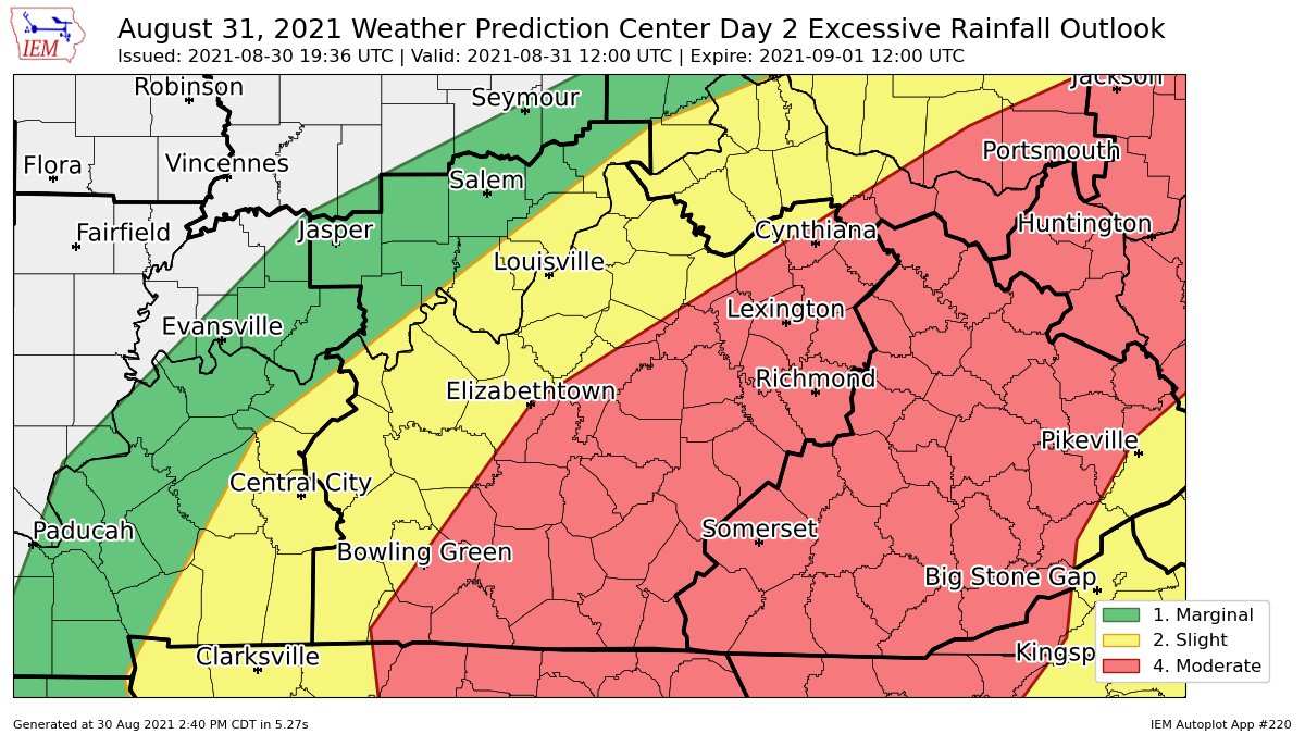
The WPC continues to highlight most of central and eastern Kentucky with the greatest risk for excessive rainfall on Tuesday…
That matches up well with the rainfall forecast I’ve had out since last night…

It’s interesting to watch how the various ensembles have been much more consistent than the operational models…
GFS ENSEMBLES

EURO ENSEMBLES

EURO ENSEMBLES CONTROL RUN

If you live in a low-lying or flood prone area, be alert to rising waters through early Wednesday.
Here are your radars to follow along…

Have a great rest of the day and take care.

We have had tropical downpours every afternoon for a week now. Looking at the radar, it looks like it may rain all night ? I don’t live in an area that’s prone to flooding, but those that do as Chris says “be alert to rising waters.” Good work Chris on your forecasts.
#teamautumnweather
We’ve already picked up slightly over 1″ of rain at my observation location just south of Bowling Green.
I remain concerned by Ida’s slow forward speed and its projected path, where South Central Kentucky will be positioned slightly to the north and west of the center of circulation. For many hurricanes that have weakened to the tropical depression stage, that area frequently produces heavier precipitation. Hopefully not…
Regardless, the onset of some cooler and hopefully drier air in the days that follow will be a welcome relief.