Good Monday, everybody. We have a very busy few days ahead of us as what’s left of Hurricane Ida moves into the region, bringing the potential for torrential rain and flash flooding. We have a lot to talk about, so buckle up and settle in.
Let’s hit the bullet points right out of the gate:
- Tropical moisture is steaming well out ahead of Ida today and it’s meeting up with a slow-moving front dropping into the region. This will cause showers and storms to go up and we have the risk for flash flooding from these storms. The greatest risk is across the northern half of the state.
- Ida continues to slowly weaken as it works toward the north and northeast across Mississippi today.
- The center of what’s left of Ida is likely to move from the Nashville area into southeastern Kentucky Tuesday into Tuesday night. Winds may reach 30mph at times in gusts.
- Spiraling bands of rain and some storms will be spinning around Ida as it moves through.
- The heaviest rains will likely fall just west and north of the track of the remnant low, which still may be classified as a Tropical Depression as it enters Kentucky.
- Much of central and eastern Kentucky is in the line of fire for a 1″-4″ rainfall from Ida. There may be a stripe of 4″+ of rain setting up from southwest to northeast.
- With much of that rain falling in a 12-24 hour window, flash flooding and general flooding will be possible.
- The exact track and speed of the low are the main determining factors with how much rain falls where you live.
Here is my current thinking on where this heavy rain falls…
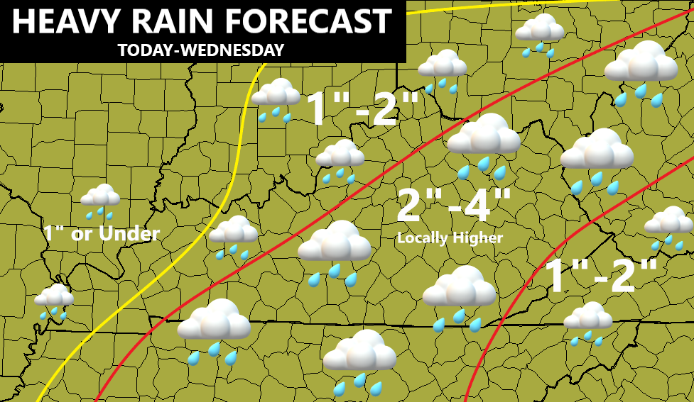
That map will likely change some later today as the exact track of Ida becomes more apparent. Kinda sounds like a winter storm setup, huh?
Ida continues to be a well organized storm that’s fanning out to cover a large part of the country…

The latest track from the National Hurricane Center continues to bring the remnant low right on top of eastern and southeastern Kentucky…

Here’s the latest Key Message from the National Hurricane Center…
![[Key Messages]](https://www.nhc.noaa.gov/storm_graphics/AT09/refresh/AL092021_key_messages+png/213152_key_messages_sm.png)
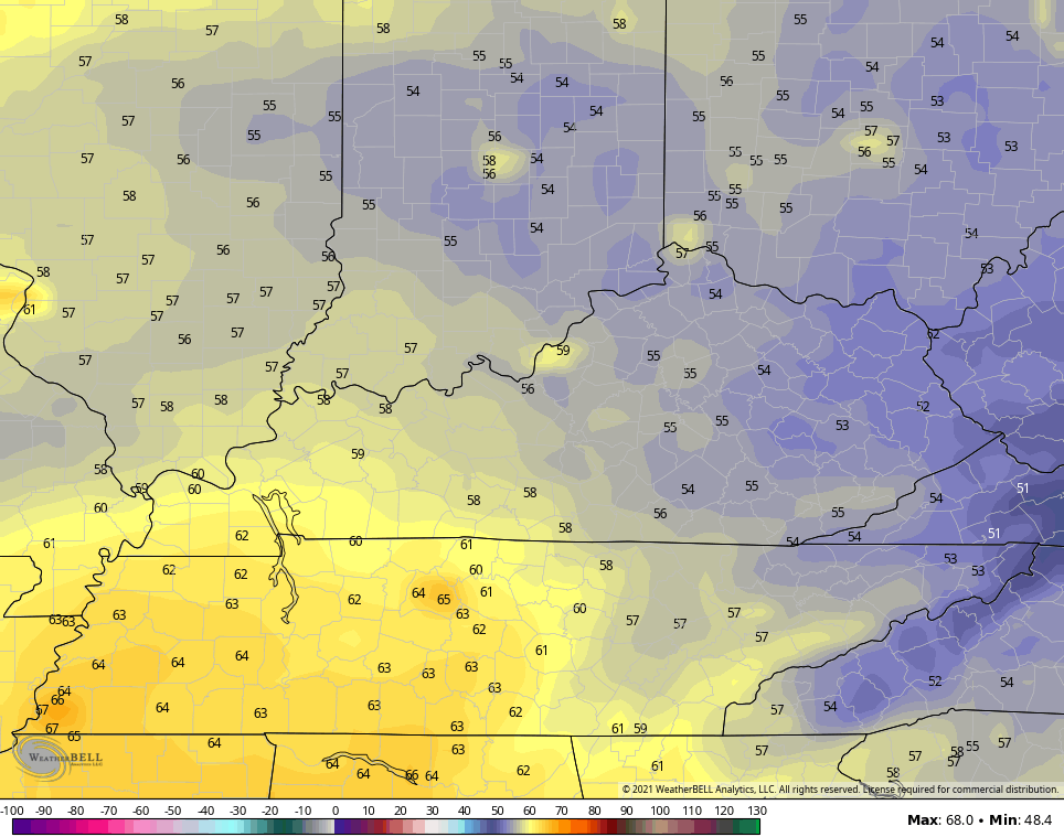
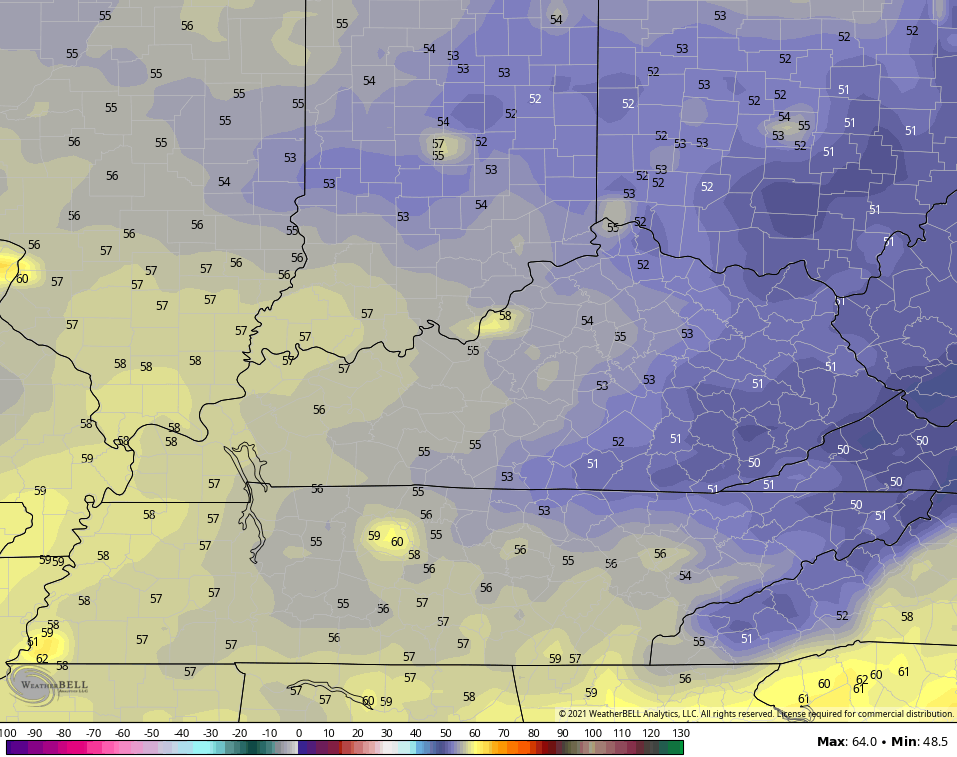
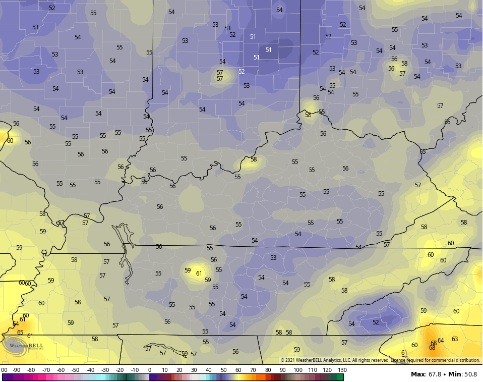
Behind all this comes a breath of early fall air as we kick off September. Check out the low temps…
THURSDAY MORNING
FRIDAY MORNING
SATURDAY MORNING
A bigger blast of early fall air is likely to sweep in later next week.
I will have updates later today and will have the latest on WKYT-TV starting at 4pm. Until then, here are your radars to track the torrential rain producing showers and storms going up over us today…

Make it a great Monday and take care.

Thanks Chris for all your hard work on keeping us informed on Ida. Here in Kentucky we should not complain.
In my local forecast for Tuesday, the NWS has issued a flash flood watch way ahead of the remnants of Ida. We shall wait and see for the rainfall totals.
Looking forward to the cooler days ahead, but it looks like Eastern Kentucky will feel more like Autumn than in my area of Kentucky, but that’s okay that’s just the way it is.
Ida remnants is a monster down south. Looking forward to the cool air.
Looking at that sat loop, Ida’s southernmost bands are halfway down in the Gulf. This storm is HUGE. The size reminds me of Hurricane Allen when it struck the southern TX coast in 1980…
This is SAD and these Folks need help NOW !!!
https://www.buzzfeednews.com/article/piapeterson/hurricane-ida-damage-destruction-louisiana-mississipi
Looks like the path of the center of the hurricane remnants is going to be somewhat further south and east than what was predicted a few days ago.
South Central Kentucky will likely come out near the top of current estimates, since that region is positioned to the north and west of the anticipated center of circulation, based on the storm’s path. More importantly, Ida is a relatively slow moving storm, which means that tropical rains could persist across a longer time frame.
Not a pretty picture, at all.