Good evening, folks. I wanted to drop by for a quick update on how things are looking over the next few days as Ida slowly turns in our direction. This will bring heavy rain and the potential for flash flooding for parts of Kentucky.
Hurricane Ida made landfall earlier today, but the storm is still looking amazing on Satellite…

Here’s the Interactive Radar to take track the storm…
The latest track forecast from the National Hurricane Center continues to bring Ida into Kentucky by Tuesday night…

The latest rainfall forecast from the HPC continues to show the potential for excessive rains across much of central and eastern Kentucky…
![[Image of WPC QPF U.S. rainfall potential]](https://www.nhc.noaa.gov/storm_graphics/AT09/refresh/AL0921WPCQPF+gif/211519WPCQPF_sm.gif)
Here are the updated Key Messages for Hurricane Ida…
![[Key Messages]](https://www.nhc.noaa.gov/storm_graphics/AT09/refresh/AL092021_key_messages+png/213152_key_messages_sm.png)
The WPC has upgraded the northern half of the state into the Slight Risk area for excessive rains with our front and tropical moisture hook up on Monday…
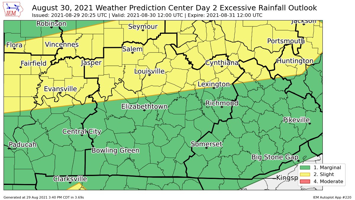
That’s the setup I’ve been talking about and it’s one that can cause flash flooding issues for some Monday afternoon.
The Tuesday Excessive Rainfall Outlook as pushed the Moderate Risk area a bit east and this now includes most of central and eastern Kentucky…
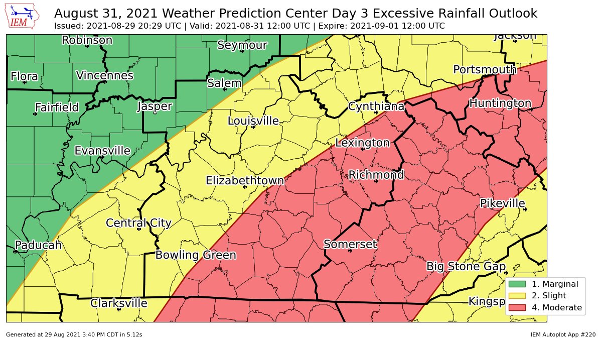
I agree with that placement as the heaviest rain from Ida will fall just west and north of the track of the storm. That track looks to be across southeastern Kentucky.
A full update with my rainfall forecast comes your way with the normal update later tonight. Enjoy the rest of your evening and take care.

Thanks Chris for your continuing updates on Ida. Reports are beginning to filter in and it looks bad unfortunately. I just pray and hope those that are affected receive the help they need. May God bless them all through all these hard times we have had in our Great Country.
Thanks Chris