Good Thursday, folks. Stop me if you’ve heard this one before… It’s another much colder than normal day here in the bluegrass state. Temps continue to run well below normal through the weekend before bouncing back early next week. That’s ahead of another pattern change that may very well get winter off and running during the second half of November.
Before we get to that, here are some headlines about the current pattern:
- Temps are in the 20s for the next several mornings and those cold valleys may make a run at 20.
- Highs range from the upper 40s to middle 50s today and Friday.
- Temps this weekend hit the 50s and may reach 60 as early as Sunday.
- It stays dry through this time.
The pattern next week starts mild with temps hitting the low and middle 60s. This is ahead of the chance for a few showers and storms arriving as early as Wednesday. That main show comes after that in the form of a deep trough in our region. The models continue to indicate this trough likely becoming another massive cutoff system late next week into next weekend. Here’s the GFS…
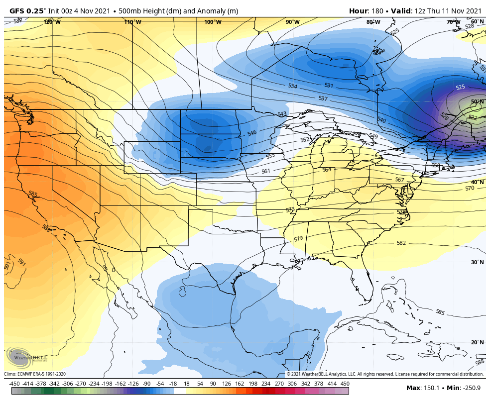
The GFS continues to show the fantasyland snowstorm…
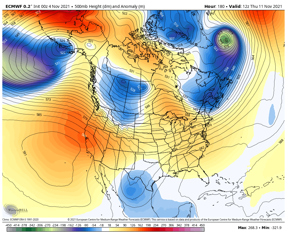
The EURO isn’t digging this system quite as much, but it’s still very deep…
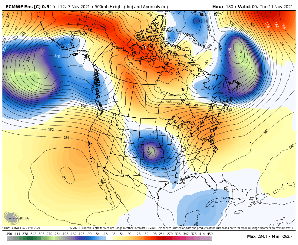
The average of the 51 member EURO Ensembles show the trough becoming established across the east during this time…
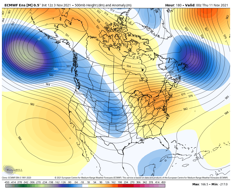
That’s a classic look for cold around here with a trough near the Aleutian Islands and a ridge up the west coast, and a ridge going up into Greenland.
The actual control run of the Euro Ensembles shows the potential magnitude of these troughs…
Before I go, this is just too cute not to share…
Hey Trey who is that? “The Winter man” @Kentuckyweather pic.twitter.com/62tvCk4DfJ
— Mikie Fyffe (@fyffe555) November 3, 2021
The Winter Man has a nice ring to it! ❄🥶 Thanks, Trey!
I will have an update later today so check back. Have a good one and take care.

The ground was so white i thought it snow last night. LOL
Yeah, we had a good hard freeze at 27 degrees and it did look like it Snowed. Now we wait for Indian Summer next week.
How cute is that little fella? So adorable. Thanks for posting winterman.