Good afternoon, weather weenies. Our frigid start to November continues through the rest of the week as we start to focus on a more interesting setup later next week and beyond. That’s one featuring a cold look that can give us a true start to wintertime if everything works out perfectly.
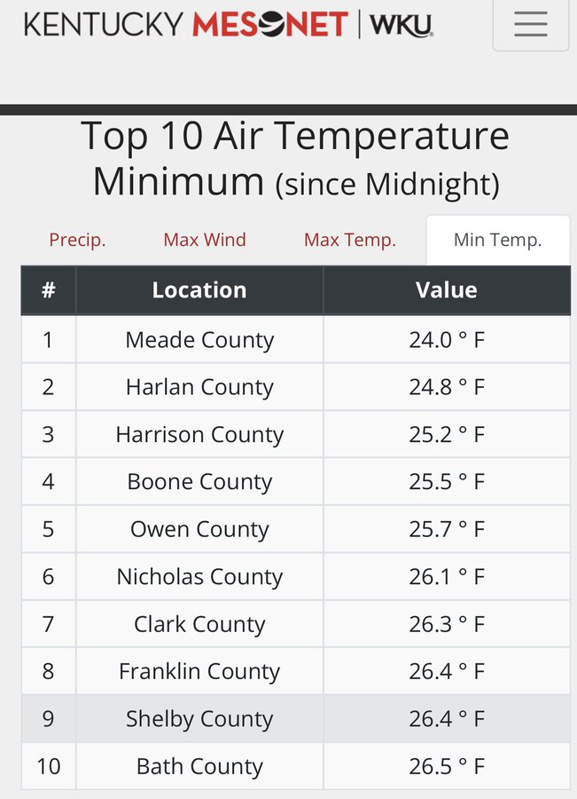
Let’s start things out with the current cold spell. Temps are well below normal and the lows this morning were deep into the 20s. Check out the top 10 coldest readings from the Kentucky Mesonet…
Temps over the next few mornings will be even colder with low and middle 20s showing up in more locations. The coldest valleys may make a run at the 20 degree mark before all is said and done. Highs will continue to struggle to get out of the 40s through Friday. Again, these temps are WAY below normal.
The weekend is seasonably chilly with temps back into the 50s for highs with lows upper 20s to middle 30s with dry skies. This looks like a good weekend to enjoy some outside action.
By the way, there’s still the chance for some rain or wet snows to get close to far southeastern Kentucky later today and tonight. Here are your radars to track the close call…

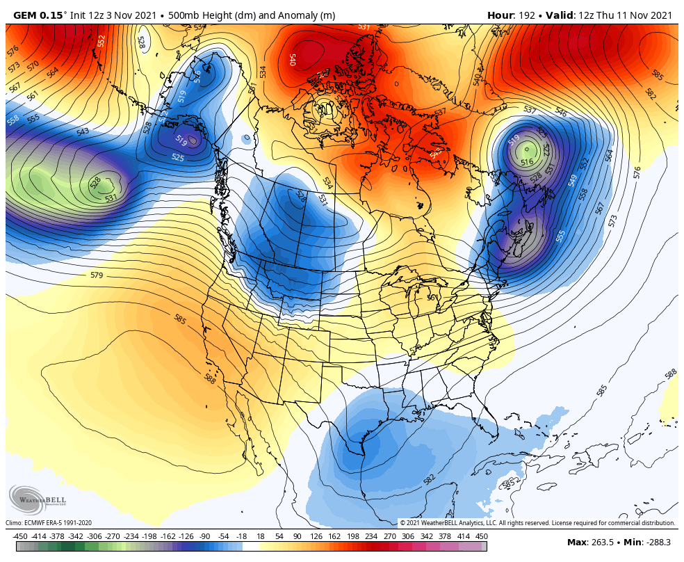
The setup for next week continues to be on that features a significant pattern change. A ridge builds in for the first half of the week, then winter crashes in late next week and tries to lock in from there. Watch how the individual models handle this at 500mb…
Canadian
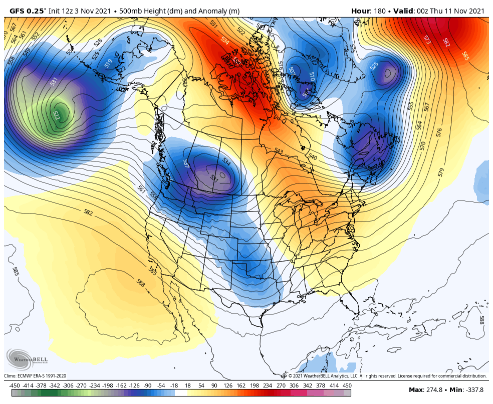
That only goes through day 10. The GFS goes through 16 days. Watch how the troughs dive in…
The GFS Ensembles goes through the same time period…
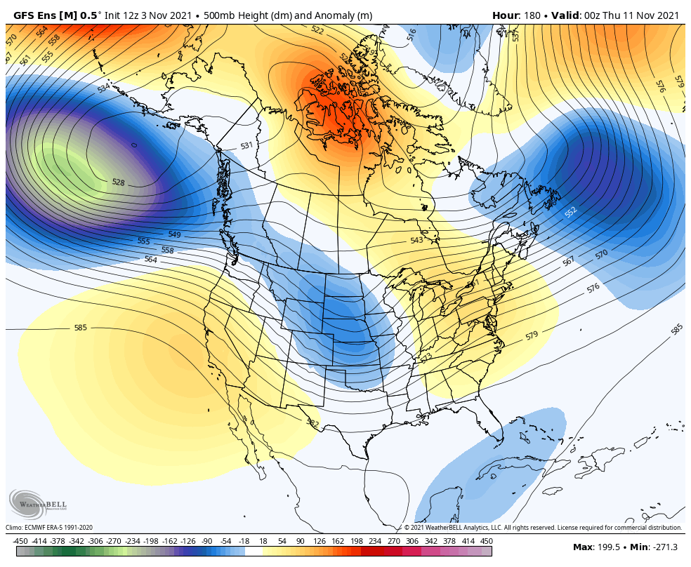
That’s a cold pattern taking shape and one that’s likely to feature a big time storm later next week. The models continue to try to figure it out, but they’re all sniffing the storm out…
GFS
Canadian
EURO
Some fun times are likely ahead of us before the month is over.
Enjoy the rest of the day and take care.

Opening day for modern gun deer season opens Saturday. I think only the deer will like this weather forecast.
Referring to Saturday the 13th.