Good Wednesday, everybody. Our cold opening week of November rolls on with temps averaging well below normal. I continue to maintain this is a sign of things to come and the pattern toward an even colder setup (relative to normal) is already on my radar by the middle of the month.
Let’s start with what’s happening out there today. Temps are into the 20s to start the day and will only recover into the 45-50 degree range for many. A system skirts by well to our south as this high pressure flexes some muscle on the storm track. It will get close enough to throw some clouds in here, but the precipitation looks to stay just to our south and southeast.
Here are the radars to see just how close it gets…

Temps continue to run cold over the next several days. Highs Thursday and Friday range from the upper 40s to low 50s for most with overnight lows dropping into the 20s. As a matter of fact, some of the coldest valleys may hit the low 20s. A little bit of a breeze should add an extra chill to the already cold air.
The weekend looks nice and crisp. Highs are in the 50s for the most part with lows from the high 20s to middle 30s.
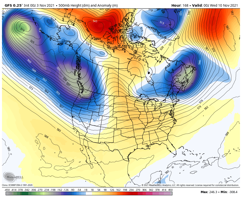
Temps do moderate late weekend into the first half of next week, but the potential for some showers will creep into the picture. That’s ahead of another deep trough likely to dig through the plains and into our region late next week into the following weekend.
The latest GFS shows that trough going crazy…
That leads to the first of many GFS fantasy snowstorms…
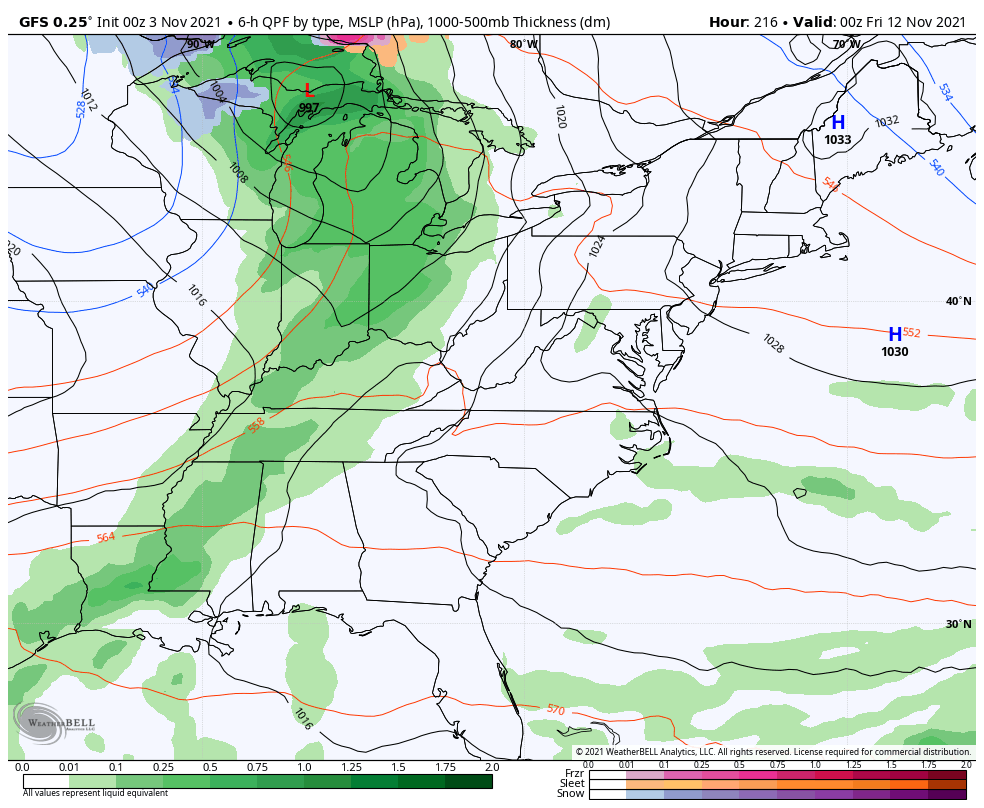
Lock that up, right? I mean… What could go wrong with a GFS solution from 10 days out? 😜
In all honesty, the pattern is likely to produce another massive cutoff storm system around that time frame. Have I mentioned there would be a lot of massive cutoff lows this fall and winter? 😏
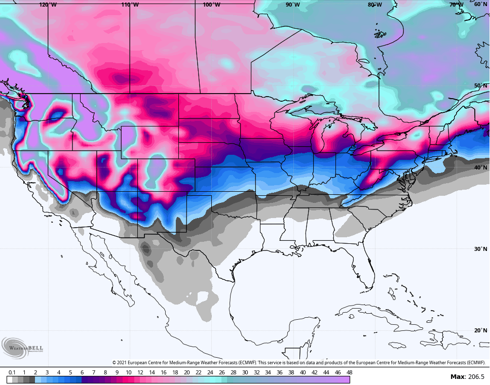
The new run of the EURO Weeklies goes through the middle of December and continues to indicate a colder than normal pattern through. The 51 member average for snowfall shows our region in the game for several snow chances…
The single run of the EURO Weeklies Control shows individual storm tracks…
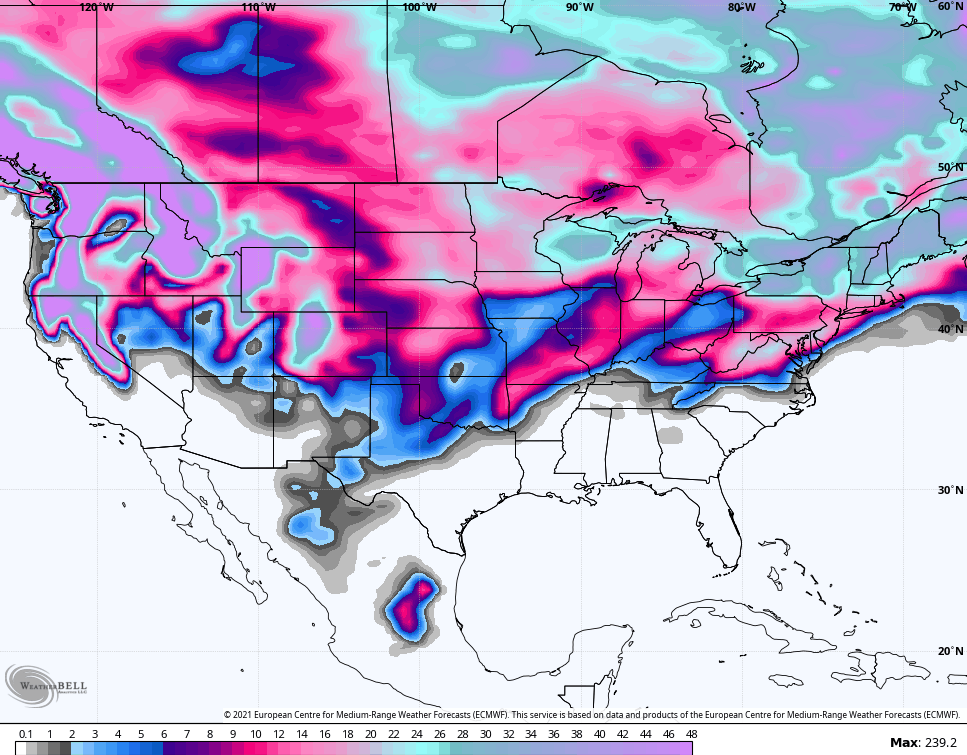
Again, those are for trends and not to be taken verbatim.
I will have another update later today. Until then, have a good one and take care.

Here is the link for the climate summary for October for Chicago: https://weather.gov/lot/October2021
The average temperature at Chicago’s O’Hare Airport for October was 59.7 degrees, which is 5.7 degrees above normal and tied for the ninth warmest October ever.
The 5.77 inches of rain for the month was also well above normal. The NWS Office in the SW suburbs received 7.55 inches of rain.
Thanks Chris, I take those Snowfall maps very seriously correct especially for the Mountain states and the North Central plains and the lee side of the Great Lakes. In my opinion I think here in the Ohio Valley except for the Appalachian Mountains areas we have a long wait to receive a major Snowstorm here in Western and Central Kentucky.
Current temperature here in Maple is 34 degrees with a light Northeast breeze. I don’t know if we will have the freeze that was predicted as the temperature is still falling. Won’t know until after 9:00 AM.
The October Summary has been posted by the NWS :https://www.weather.gov/lmk/october_2021_summary
Got our first heavy frost of the fall season this morning which is about 8 days behind of our normal date of getting frost. Have a great day!!
Here in Maple we had a light freeze and now the temperature has risen to 34 degrees with our first light frost scattered across my front field. Seems like most is running late this year.
I had to go outside last night around 11:00pm.
My trash cans were already covered with frost.